
Third-Party Thermal Data, Certified Level 3 Reporting
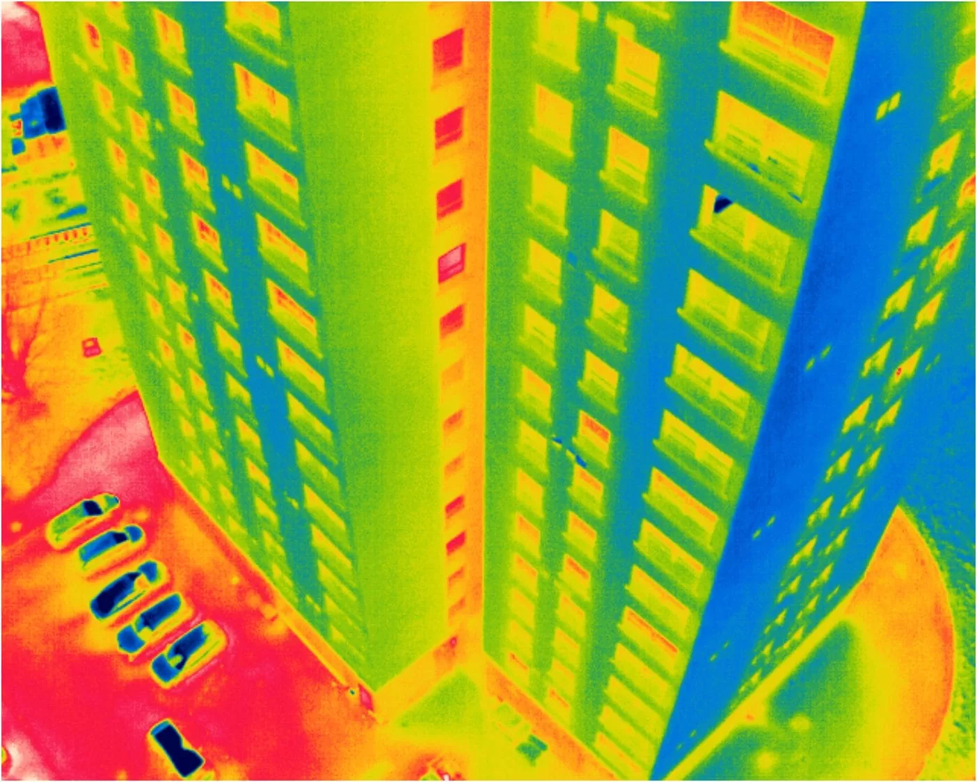
A drone operator in Scotland came to us in the spring of 2025 with three multi-storey residential blocks to survey. They had the aircraft, the thermal payload, the access and the flying skill. What they did not have was anyone able to sign the resulting report as a certified thermographic inspection.
That is a common position, and it is not a shortfall in their operation. Flying a thermal camera and reading a thermogram are two different disciplines, and the second one carries a certification requirement the first does not. So they flew it and we wrote it, working from a capture protocol we produced for their team before anybody left the ground.
The arrangement suits both sides. The operator keeps the client relationship, the site knowledge and the flying, and does not have to buy a qualification to service one job. We do the part that needs the qualification, without a day of travel on the invoice.
It also has real limits, and those are worth setting out honestly rather than glossing, because the analyst was not on site and cannot pretend otherwise. This piece covers why the protocol comes before the flight, what the analysis established across the three blocks, and what remote reporting genuinely cannot settle.
Blog Content TL;DR...
A drone operator flew three residential blocks in Scotland. We wrote the protocol and the certified report.
- Flying a thermal camera and reading one are different disciplines. Only the second carries a certification requirement, which is why operators bring the data to us rather than buying a qualification for one job.
- The protocol is written before the flight, not after. Camera parameters, reflected apparent temperature method, standoff, angle to the facade and an environmental record on every elevation.
- Depart from it and the report changes status. A declared deviation may invalidate the certified inspection, leaving only a professional opinion.
- Two of the largest anomalies were not defects. Unheated stairwells read as strong vertical signatures, and explaining why something is expected is a finding in its own right.
- The analyst was not there. The environmental log is not administration on a remote job, it is the evidence.
You keep the client and the flying. We do the part that needs the certificate.
The Protocol Comes Before the Flight
Data captured without one cannot be certified afterwards, however good the pilot
Why we write it first
A thermogram is a measurement, and a measurement is only worth something if the conditions it was taken under are known. That is why the first deliverable on this job was not a report but a written data acquisition protocol, issued to the operator’s team before the survey and specific to those three buildings.
It set the radiometric parameters to be entered into the camera, the method for establishing the reflected apparent temperature on the night, the standoff distance to hold, the angle to the facade to stay within, and the environmental readings to record before every flight, on every elevation. It also specified the flight pattern and the overlap, so that no part of a facade was quietly missed between passes.
The part that surprises people
None of that is about the aircraft. It is about making the resulting images comparable to one another and interpretable by somebody who was not there. A pilot working without it can produce a technically excellent set of pictures that cannot be certified, because nothing records what the camera was told to assume or what the weather was doing at the time.
The protocol also states plainly what happens if it is departed from, and this is the part worth quoting to anyone considering the arrangement. A declared deviation may invalidate the inspection as a certified report, in which case the document can only be issued as a professional opinion. That is not a threat, it is the boundary of what certification means, and saying so up front is what keeps everybody honest.
who can certify my thermal survey report, thermal data analysis for drone operators, what a drone thermal capture protocol specifieswho can certify my thermal survey report, thermal data analysis for drone operators, what a drone thermal capture protocol specifies
What the Analysis Found Across Three Blocks
Reading the fabric
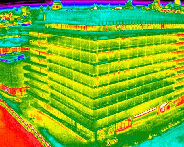
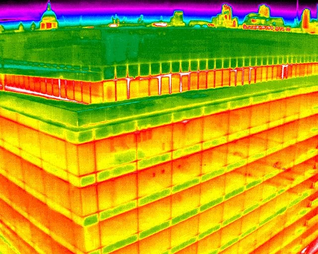
Across the three elevational surveys the imagery resolved into a small number of recurring patterns, which is what a well-captured set should do. Thermal bridging showed at the window mullions, consistently enough across all three blocks to read as a construction detail rather than a set of isolated faults. A handful of individual glazing units read differently from their neighbours in the same elevation, which is the signature that prompts a closer look at seal condition rather than a conclusion about it.
On the roofs, diffuse areas of retained warmth appeared under the covering, of the shape and softness associated with moisture held beneath a membrane. That is a suspicion worth acting on and it is not a finding of water, because a thermogram shows a thermal effect and not its cause.
The anomalies that were not defects
Two of the largest thermal features on the buildings were not faults at all. Unheated stairwell and circulation zones read very differently from the heated flats either side of them, and on a facade that presents as a strong vertical signature running the full height of the block.
An analyst who did not know the building would report that as a serious fault. Knowing the internal arrangement turns it into expected behaviour, which is why the building information gathered before the survey does as much work as the imagery. Explaining why something is not a defect is a finding in its own right, and it is usually the one that saves the client money.
Everything else was recorded as areas warranting further investigation by a suitably qualified contractor, with the environmental context that supports each observation.
What Remote Reporting Cannot Settle
The analyst was not there, and the report says so
An analyst working from delivered data cannot walk round the back of the building, cannot put a hand on a wall, and cannot go up a floor to see what is behind an anomaly. Everything that would ordinarily be settled by looking has to be settled by the record instead, which is precisely why the protocol asks for so much of it.
So the environmental log is not administration. On a remote job it is the evidence. If the differential was marginal, or the wind got up between the second and third elevation, that belongs in the report next to the findings it affects, because the reader is entitled to know how much weight each observation carries.
Where it works, and where it does not
The arrangement works well where the operator is competent, the buildings are straightforward to fly, and the question is a fabric-performance one that imagery can genuinely answer. It works less well where the site is complicated, where access is contested, or where the client is likely to want somebody to interpret something on the spot.
It is also not a route to a cheap certificate. The analysis takes as long as it takes whoever flew it, and a data set that arrives outside the protocol takes longer, because the first job is then establishing what can still be relied upon.
Where that suits, it is an efficient way to serve a client neither party could serve alone. Our own drone thermography work runs on the same standards, whoever holds the controls.
Radiometric parameters. Emissivity, reflected apparent temperature, ambient temperature, relative humidity and distance to subject are set in the camera before capture and recorded, because a thermogram carries its assumptions with it and cannot be re-derived afterwards without them.
Reflected apparent temperature. Established on site by a stated method rather than assumed, and repeated if the sky state changes materially during the survey.
Geometry. A standoff range and a maximum angle to the surface, because emissivity holds near perpendicular and falls away at glancing angles, so an oblique frame is not comparable to a square one.
Environmental record. Air temperature, relative humidity, wind speed and direction, and sky state, taken at the base of each elevation before each flight rather than once for the site.
Coverage. A stated flight pattern and overlap so that continuity across a facade can be demonstrated rather than assumed.
Deviation. Any departure is declared. Where it affects validity the report is issued as a professional opinion rather than as a certified inspection.
Governing Standards
- EN 13187:1999 is the methodology this building envelope work is aligned with, for the thermographic detection of thermal irregularities.
- ISO 6781-3 covers the detection of heat, air and moisture irregularities in buildings by infrared methods, and informs how the imagery is interpreted.
- This is qualitative detection, not measurement of energy loss. The survey identifies where the fabric behaves differently. It produces no quantified heat loss figure, no building survey and no condition grading, and findings are reported as areas warranting further investigation by a suitably qualified contractor.
- Data collected by a third party is analysed against the issued protocol. Any declared deviation is recorded, and where it affects validity the report is issued as a professional opinion rather than as a certified inspection.
- Analysis, certification and reporting are conducted by Steve Fisher, ITC Level III Certified Master Thermographer (Infrared Training Centre; Certification #205722059), practising in accordance with the frameworks of ISO 18436-7:2014, ASNT SNT-TC-1A and ANSI/ASNT CP-105, and BINDT CMGEN Appendix B as UK training governance.
Send Us Your Thermal Data
If you fly a thermal payload and your client wants a certified report, tell us the building, the question being asked and when you expect to fly. We will write the capture protocol for your team first, then analyse and certify what you bring back.
Talk to us before the flight, not after. Data captured without a protocol can usually still be interpreted, but it cannot always be certified, and that is a difficult conversation to have with a client after the invoice.
We work across Sussex, Hampshire, Kent and Surrey, and travel throughout the United Kingdom, Ireland and Europe. Remote reporting has no geography at all.
related posts
An inspection happens on one morning, but its photographs are usually needed months later by somebody who was not there. What makes them usable then is not the drama of the aerial view. It is whether each observation is marked where it sits, whether close detail is paired with a frame that places it, whether coverage is systematic enough that absence means something, and whether the set can be navigated at all.
Booking a drone operator means checking paperwork, and the names have changed since most checklists were written. This piece sets out the three families of document a client should ask for, registration, authorisation and insurance, what each proves, and the pairs most often confused: an Operator ID against a Flyer ID, an Operational Authorisation against the retired PfCO, a GVC against an A2 CofC. It closes with the paperwork that belongs to your job rather than the operator.
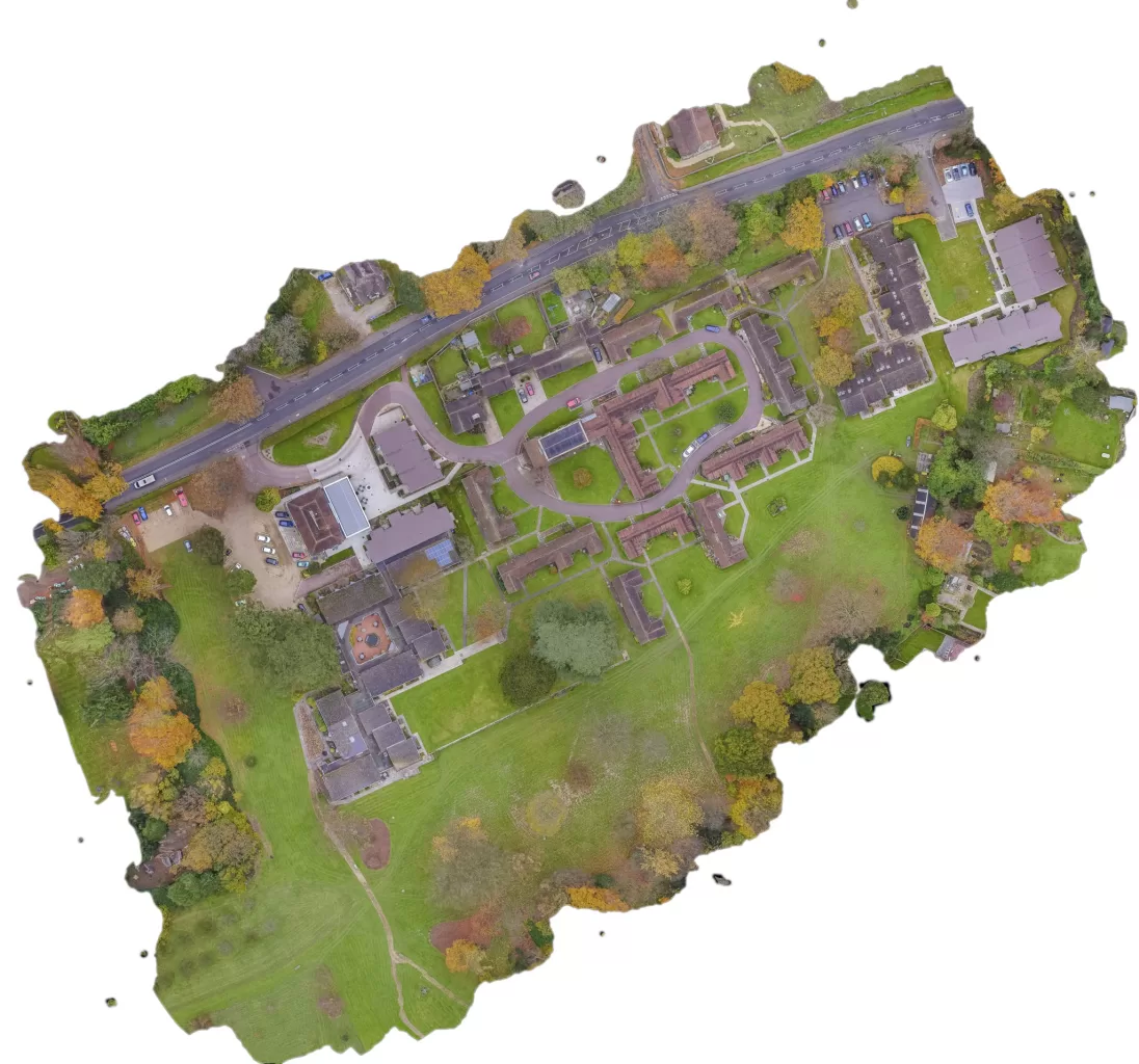
A rural holding is usually recorded in fragments: an old drainage plan, a track that has moved, a boundary everyone agrees on until it is questioned. An aerial survey replaces that with one dated record of the whole site. The decision that matters is whether you need a high quality visual record or positionally accurate survey data, because they look identical on screen, cost differently, and only one of them can be defended. Here is how the two differ, and what the method cannot do.



