
Drone Mapping and Surveys
Orthomosaics, Site Models and Aerial Data You Can Measure
Drone mapping turns a few thousand overlapping aerial photographs into something you can measure: one corrected image of your whole site, and the height models that go with it. This page explains what those products are and what the terms mean, then sets out how Drone Media Imaging runs the work, and why the difference between a good-looking map and a provable one is worth understanding before you commission either.
Orthomosaics, Site Models and Aerial Data You Can Measure
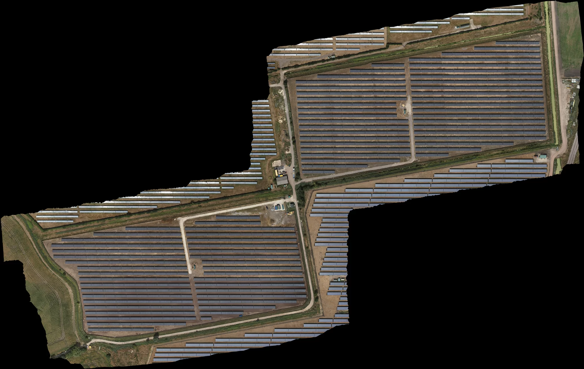
A drone mapping survey produces an orthomosaic: hundreds or thousands of overlapping photographs stitched into a single image and geometrically corrected, so that every part of it is viewed as if from overhead. That correction is what makes it measurable, unlike an ordinary aerial photograph where everything away from the centre leans outwards. In addition, height models of the surface, and of the bare ground beneath where the ground can actually be seen.
The technique is photogrammetry, and it is well established. Any competent operator can fly a grid and produce something that looks impressive on screen. What separates one survey from another is not the flying: it is whether the finished map is where it says it is, whether that can be demonstrated rather than asserted, and whether the file you are handed is one you can open and work with. Those three things are what the rest of this page is about.
What a Drone Survey Actually Produces
The deliverables, and the words used for them
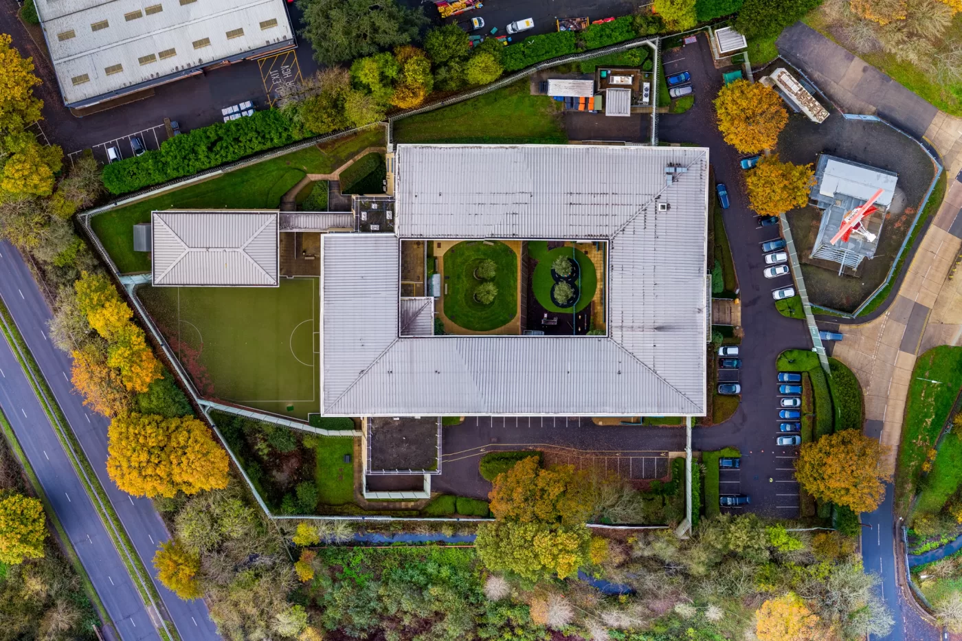
The orthomosaic is what most clients are really buying. One image of the entire site, corrected so that distances and areas measured on it are true. It is the thing that gets dropped into a planning drawing, sent to a contractor, used to count and locate assets, or laid underneath a design.
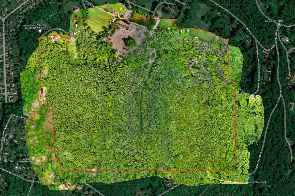
Two height products come from the same flight. A digital surface model is a height map of everything the camera can see, including buildings, plant, panels and vegetation. A digital terrain model is a height map of the bare ground with all of that stripped away. The distinction matters more than it sounds: photogrammetry can only model what it can see, so a terrain model is straightforward on open ground and impossible under closed woodland canopy, where a different technology is required. From those models come contours and volume calculations, which is how stockpiles, excavations and material movements get measured.
Underneath all of it sits the point cloud, the raw three-dimensional reconstruction of the site, and above it the Ground Sample Distance, or GSD, which is simply how much ground a single pixel covers. A survey flown at 0.8 cm GSD has pixels eight millimetres across. Smaller GSD means finer detail, more images, a longer flight and a very much larger file, so it is chosen from a real requirement rather than maximised for its own sake. The right question is not what resolution you want, it is what is the smallest thing you need to be able to identify, because a feature needs several pixels across it to be recognisable and roughly ten to be measurable.
One point of vocabulary that avoids disappointment later. A drone survey produces raster and point-cloud data, not drawings. Where an as-built record is asked for, what that means here is a georeferenced orthomosaic rather than vectorised linework or CAD, and the phrase is used the same way at enquiry, at quotation and at delivery so that it cannot be read two ways.
At a glance
What drone mapping delivers, what the words mean, and what to ask any operator before you commission a survey.
- An orthomosaic is the core deliverable: one geometrically corrected image of the whole site, measurable because every part of it is viewed as if from directly overhead.
- Surface and terrain models, point clouds, contours and volume calculations come from the same flight, so the survey is usually specified once and used many times.
- Ground Sample Distance is how much ground one pixel covers, and it is chosen from the smallest feature you need to identify, not picked as a round number.
- Work is quoted as one of two things. An Ortho is a good, usable map of a site. A Survey is one whose position is measured, evidenced and stated.
- The difference is provability, not sharpness. Ground control and independently withheld points are what turn a picture into evidence, and they change the day, the cost and the deliverable.
- Deliverables are supplied in the coordinate system you actually work in, with a lightweight working copy alongside the full-resolution master, so the file opens on an ordinary machine.
Drone Media Imaging has been flying photogrammetry since 2016, and every survey is run to a written, gated method rather than to habit.
Mapping Surveys We Are Asked For Most
Two Kinds of Survey, and Why the Difference Is Provability
The decision that shapes the day, the deliverable and the price
Nearly every mapping enquiry is really one of two jobs, and being honest about which one it is at the start is the single thing that most often goes wrong elsewhere. We give them two plain names so that what is being bought is never in doubt.
An Ortho is a good, usable map of a site. You want to see the whole thing at once, measure across it sensibly, share it, plan from it, compare it with last month. It does not need to sit on the national grid to the centimetre. This is the majority of mapping work and there is nothing second-rate about it.
A Survey is a job whose position has to be right and has to be demonstrable, because it will be tied to a design, handed to a third party, used to set something out, or relied on later. That means measured ground control on the day, independent points held back from the calculation, and a stated, measured result at the end.
The difference between them is not quality. It is provability. An Ortho can be every bit as sharp as a Survey, flown at the same resolution, showing exactly the same detail. What it cannot do is prove where it is. Ground control is what converts a picture into evidence, and where that evidence is not being sold and does not have to be produced, the sensible answer is not to spend the day collecting it.
Where the two cannot be cleanly separated at enquiry, that ambiguity is itself the answer and the job is planned as a Survey. It is far cheaper to collect control that turns out not to have been needed than to be asked, six months later, to prove where something was.
Construction Progress Mapping Beside Gatwick Airport
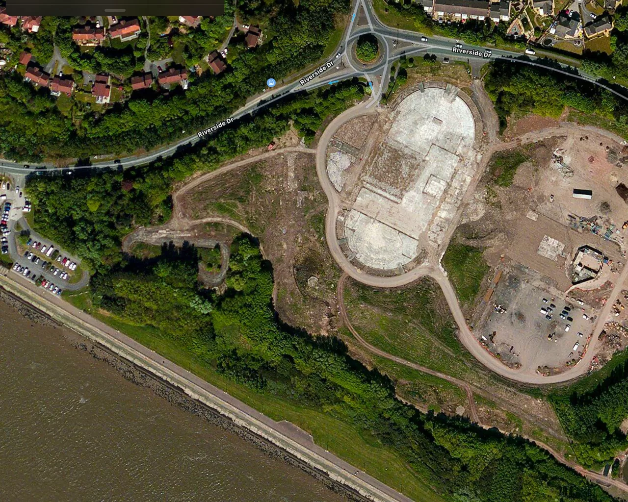
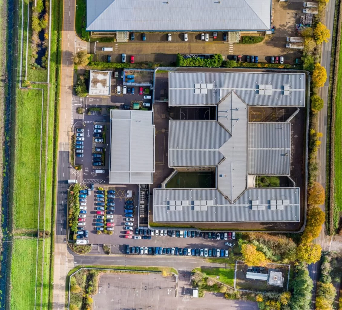
A programme of repeat mapping surveys across a major redevelopment site in Crawley, flown inside controlled airspace close to Gatwick. Every mission held identical altitude, overlap and imaging parameters, which is what gave the site team a consistent baseline rather than a series of unrelated maps. The orthomosaics were used to track excavation, building footprints, plant movement and site logistics between visits.
How Drone Media Imaging Runs a Mapping Survey
The photogrammetry itself is the same photogrammetry everyone runs, and it would be dishonest to claim otherwise. What differs is the method around it, which is written down, gated, and followed the same way on every job rather than reconstructed from memory each time.
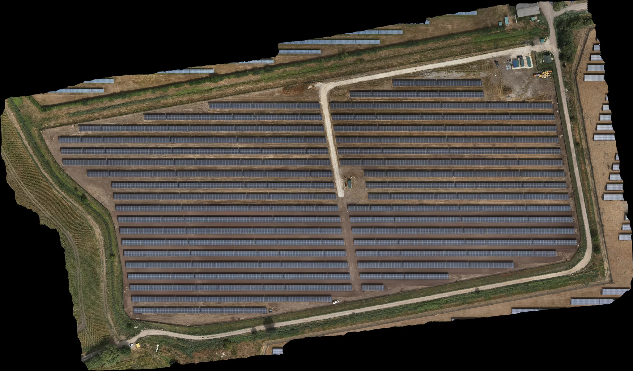
The scope is settled before a price is given. The first question is what kind of site it is, because a solar farm, a woodland, a construction site, open land and a roof each behave differently, need control in different places and have different things the method simply cannot deliver. The second is whether the job needs proof of position or a good map. From those two answers come the resolution, the coordinate system, the flight design and what is written into the quotation, in plain words rather than buried in a specification table. Nothing is quoted until the scope is defined, and what the survey cannot do is said at that point rather than at handover.
The flight is designed at a desk, not worked out in a field. Every parameter comes from a stated requirement and can be shown afterwards. Contingencies are decided in advance and written down, because a decision taken standing in a wet field with a client watching is a worse decision. The site executes what the office designed.
Positioning runs on a belt and braces. Corrections are applied in flight so the aircraft holds its lines, and a full raw satellite log is recorded on the ground throughout, without exception, so that every camera position can be recomputed afterwards from first principles. That is what makes the positioning survive a dropped radio link, a lost internet connection or a site with no mobile signal at all, and it means a survey can be reprocessed later if anything is ever questioned.
Nothing is processed before the data is proved. Image counts are reconciled against camera events, satellite logs against flight times, control against the register. A dataset that cannot support the claim being sold is identified on day one at the desk, not after a week of processing.
Accuracy is measured, not asserted. On a survey-grade job, a proportion of the measured ground points are deliberately withheld and never shown to the software. The model is built without them, and only then compared against them. A control point steers the model, so of course the model agrees with it. Only a point the model never saw can tell you the truth. The result is reported as a measured figure for that job, with the resolution and the number of check points beside it, which is a far more useful thing than a capability claim on a website.
What arrives is what was contracted. Products are exported in the coordinate system you actually work in, each full-resolution master paired with a lightweight working copy so it opens on an ordinary machine, named so the file describes itself, and load-tested from cold exactly as a client would open it. The deliverables clause of the agreement is re-read line by line against the folder before anything is sent.
Centimetre-grade drone positioning works by comparison. A receiver sits still on the ground while the aircraft flies nearby, both watching the same satellites through the same patch of sky, so the errors they share cancel out when one is subtracted from the other. It is an elegant piece of physics and it is why a drone can know where its camera was to within a couple of centimetres.
It carries one trap, and it is the reason ground control exists.
The comparison only ever tells you where the aircraft was relative to the receiver on the ground. It has no idea where that receiver actually was. It uses whatever coordinate it is given. If that coordinate is wrong, every single photograph moves by exactly the same amount, in the same direction, and the entire survey shifts as one rigid block.
Nothing in the imagery reveals it. The map is just as sharp. The stitch is just as clean. Every internal quality figure the processing software produces still passes, because the model is perfectly consistent with itself. It is simply in the wrong place.
That is exactly why the ground receiver’s own position is established and cross-checked against an independent solution rather than accepted from a default, and why a set of measured points is held back from the calculation on every survey-grade job. A rigid shift is invisible to the imagery and invisible to the software. The only thing that can see it is a measurement the model was never shown. It costs a little time on the day, and it closes the one failure that cannot be found afterwards.
The most dangerous error is the consistent one, where everything agrees and everything is wrong. It is worth asking any operator how they would know.
- Horizontal positions are delivered on British National Grid (EPSG:27700) using the Ordnance Survey OSTN15 transformation, which is the official conversion between satellite coordinates and the national grid, and heights on Ordnance Datum Newlyn using the OSGM15 geoid model. The coordinate system is declared at import, at control and at export, and is demonstrated against an independent source before delivery.
- Where positional accuracy is sold, it is evidenced by independently measured check points withheld from the adjustment, and reported as a measured result for that survey with its resolution and check point count stated alongside it.
- Flight operations are conducted under a Civil Aviation Authority Operational Authorisation held against the PDRA-01 standard scenario, with a General VLOS Certificate (GVC) and an A2 Certificate of Competency.
- Drone Media Imaging provides survey, mapping and reporting services. No chartered surveying designation is held or implied, and legal boundary determination remains the province of a chartered land surveyor.
Tell Us What the Map Is For
We do not publish a rate card, because a map cannot honestly be priced from one. What drives the day is the area, the resolution the job actually needs, and whether the position has to be proved. So we have made the quote quick instead. Send the site location, roughly the area, and what the map has to help you decide, and you will get a fixed price back with the deliverables and the claim written into it in plain words. If a simple site map is all you need, we will say so rather than sell you a survey.



