
Roof Maps for Solar Installers
Design the Array From the Desk, Not From the Roof
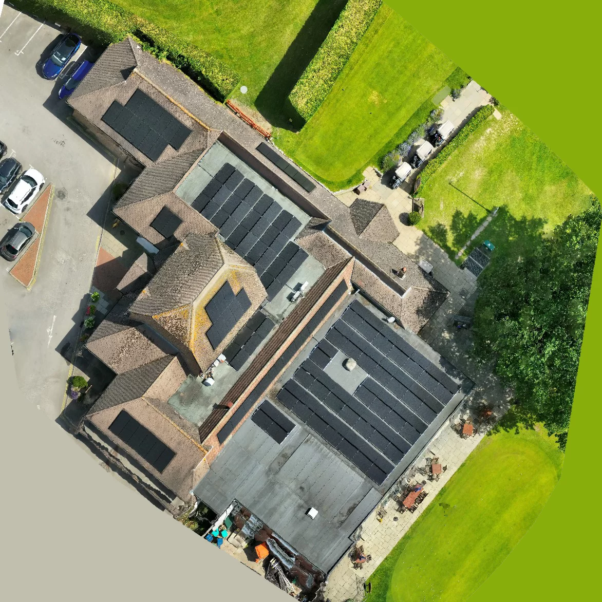
A measured aerial map of the roof, flown in a single visit, showing the usable area and everything that gets in the way of it. Ridges, plant, vents, rooflights, upstands and existing penetrations, all located and measurable, so panel layout, string routing and access can be worked out at a desk rather than argued about on site. No scaffold, no ladder, no roof access, no disruption to whoever is below.
Design the Array From the Desk, Not From the Roof
Most rooftop solar designs start from whatever is available: an old set of drawings that no longer matches the building, a satellite image taken years ago at the wrong angle, or somebody’s phone photographs from the top of a ladder. Then the installation team arrives and finds a run of plant, a rooflight or a recent repair that nobody had allowed for, and the layout changes on the day.
A drone roof map replaces all of that with one measured image of the roof as it is now. Every part of it is viewed as though from directly overhead, so distances and areas taken off it are true, and everything on the surface is where it really is rather than where a drawing says it should be. The array can then be laid out, checked and costed before anyone quotes for it, which is usually the difference between a job that runs to plan and one that is redesigned in a car park.
What You Get, and What You Do With It
One flight, and everyone downstream works from the same picture
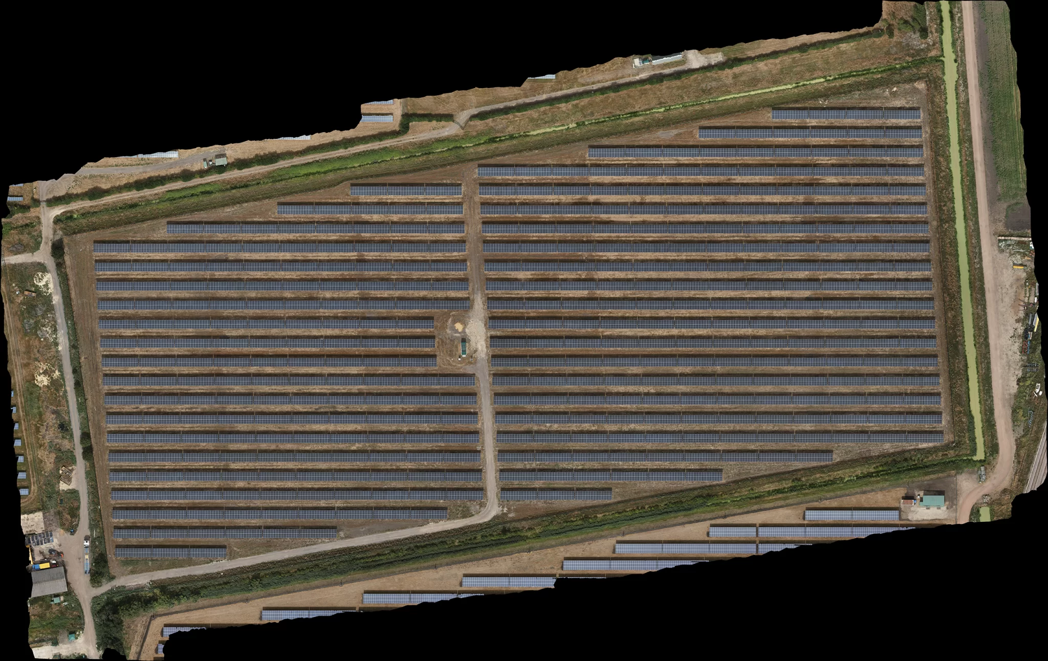
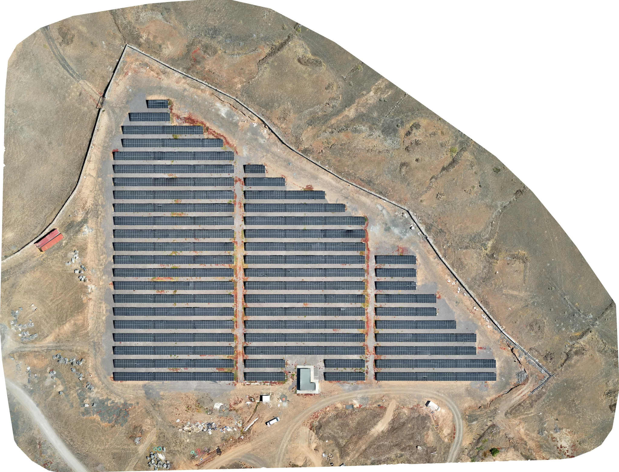
The deliverable is a georeferenced orthomosaic of the roof: one corrected, measurable image at a resolution fine enough that the things which matter to a layout are not just visible but identifiable. Fixings, upstand edges, vent positions, the run of a cable tray, the line where one roof sheet meets another.
Where the design needs heights as well as plan, a surface model comes from the same flight. That gives parapet and plant heights, which is what shading studies and walkway planning actually turn on, and it settles arguments about whether a run of air handling units will shade the row behind it in December.
The practical value is that one flight serves four jobs. Design lays out the array on a true picture. Procurement counts real quantities from real dimensions instead of an allowance. The installation team arrives already knowing where the obstructions are and how it gets accessed. And afterwards, the map is a dated record of the roof’s condition before anybody set foot on it.
Files are supplied so that they open. Each full-resolution master comes with a lightweight working copy alongside it, because a design office needs something it can drop into a drawing without waiting three minutes for it to load. Both carry the coordinate system with them, so the map lands in the right place in whatever software you already use.
At a glance
What a roof map gives a solar installer, and why it is usually the cheapest hour of the whole job.
- One measured image of the roof as it is today, not as the drawings say it was, with true distances and areas taken straight off it.
- Everything in the way is located: plant, vents, rooflights, upstands, ridges, existing penetrations and recent repairs.
- No roof access, no scaffold, no ladder, and no interruption to the business underneath.
- Panel layout, string routing, walkway and access planning can all be done from the desk, and the same map can be sent to whoever is quoting.
- Usually flown as an Ortho, because a layout needs accurate dimensions rather than a national grid position. Where the design has to tie into a wider site model, it is flown as a Survey instead.
- The same flight leaves you with a dated record of the roof before any work starts, which is worth having if the condition of it is ever questioned afterwards.
The roof is surveyed once and the map is used by design, procurement, installation and, later, by whoever inspects it.
Before, During and After the Install
An Ortho Is Almost Always the Right Answer Here
And we will tell you when it is not
A panel layout is a question about the roof, not about the country. You need to know that a clear run is 18.4 metres and not 17, that the vent sits 900 mm off the ridge, and that the parapet is high enough to matter. What you do not need is for the roof to be tied to the national grid to the centimetre, because nothing in the design depends on it.
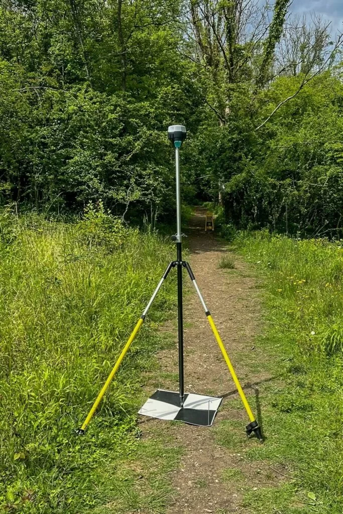
That is an Ortho, and it is what almost every rooftop solar job should be quoted as. It is flown in a single visit, it measures reliably across the roof, and it does not spend half a day placing and measuring ground control that the design will never use. Quoting it as anything more expensive would be selling you evidence you have no use for.
There are three occasions when the answer changes, and they are worth checking before you order:
The roof has to sit correctly inside a wider site model, because the solar scheme is part of a bigger development or a grid connection design. The output is going to a third party who will combine it with survey data of their own. Or the position may have to be defended later, because of a boundary, a wayleave or a planning condition.
In those cases the job is flown as a Survey, with measured ground control and independent points held back so the accuracy can be stated rather than assumed. It costs more and it takes longer, and on a straightforward rooftop it is usually unnecessary. We would rather say that at the enquiry than sell it to you.
Measured Orthomosaics, Flown Repeatedly to the Same Specification
A programme of repeat mapping surveys across a major redevelopment site in Crawley, flown inside controlled airspace close to Gatwick. Every mission held identical altitude, overlap and imaging parameters, so the maps could be compared against each other rather than simply looked at. It is the same discipline a roof map depends on: a specification decided once and then flown exactly, every time.
The Same Roof, Later: Commissioning and Inspection
Drone Media Imaging is unusual among mapping providers in that solar is the main business rather than a sideline. Most of the flying is thermographic inspection of commercial arrays, carried out to IEC 62446-3 by an ITC Level III Certified Master Thermographer. That matters to a roof map in three practical ways.
The map is designed by somebody who knows what an installed array has to survive. Access routes, walkway positions, plant shading, cable runs and the awkward corner where a row will never quite fit are the same things that come up later in inspection. They get looked for at the mapping stage because they are already familiar.
The pre-installation map becomes the baseline for everything afterwards. A dated, measured record of the roof before any panels were fixed to it is genuinely useful evidence if there is ever a question about the condition of the roof covering, a leak near a penetration, or what was already there before the installers arrived. It costs nothing extra because the flight has happened anyway.
And the same site can be flown again once the array is live. A post-installation commissioning inspection confirms that what was designed is what was built and that it is performing, and an as-built map of the finished array pairs naturally with it. Where both are wanted, they can often be flown together, which is one mobilisation rather than two.
That connection runs both ways. If you are a solar installer or EPC and the reason you are here is a layout, the mapping side is the right place to start. If the array is already up and the question is whether it is working properly, that is thermographic inspection, and it sits under Solar PV Surveys.
Resolution in mapping is described as Ground Sample Distance, which is simply how much ground a single pixel covers. A map flown at one centimetre GSD has pixels a centimetre across. Finer sounds better, and it is not free: halving the GSD means flying lower, which means far more images, a longer flight, more processing and a very much bigger file.
So the useful question is not what resolution you want. It is what is the smallest thing you need to be able to see.
The reason is that a feature needs several pixels across it before the eye can reliably identify it, and roughly ten before you can measure it confidently. A one-metre rooflight is obvious at almost any sensible resolution. A 50 mm vent pipe, a fixing head, or the exact edge of an upstand is not, and if the layout turns on those, the flight has to be designed for them.
So the specification comes out of the design, backwards. Tell us what has to be identifiable and what has to be measurable, and the resolution, the flying height and the flight pattern follow from that. It is a two-minute conversation at enquiry and it is the difference between a map that answers your questions and one that is either short of detail or four times the size it needed to be.
- Mapping deliverables are supplied georeferenced, on British National Grid (EPSG:27700) using the Ordnance Survey OSTN15 transformation where a national grid position is required, or in a stated local system where it is not.
- Where positional accuracy is sold, it is evidenced by independently measured check points withheld from the adjustment and reported as a measured result for that survey. Where it is not sold, no absolute position is claimed and the deliverable is stated as a relative measurement product.
- Flight operations are conducted under a Civil Aviation Authority Operational Authorisation held against the PDRA-01 standard scenario, with a General VLOS Certificate (GVC) and an A2 Certificate of Competency.
- Drone Media Imaging provides survey, mapping and reporting services. No chartered surveying designation is held or implied, and no structural or roofing opinion is offered on the condition of a roof covering.
Send Us the Address and What You Need to See
A roof map is quick to scope. Tell us the site address, roughly what area is involved, and the smallest thing the design needs you to be able to identify, and you will get a quotation that says plainly what is being flown and what you will be able to do with it. If you are also going to want the array inspected once it is generating, say so at the enquiry, because the two are often better flown as one mobilisation than two.



