
Building Heat Loss Surveys
See the Whole Building Losing Heat at Once
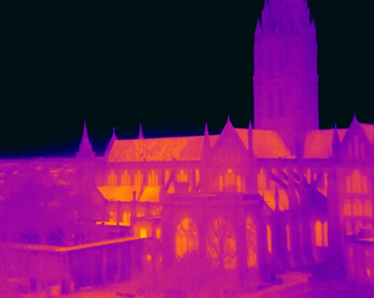
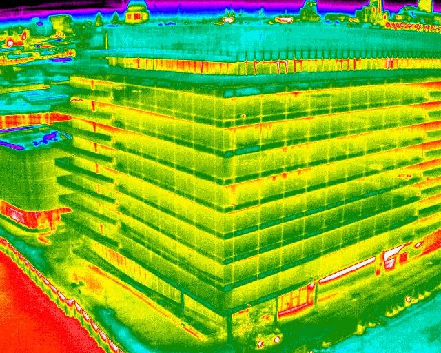
Thermal survey of a building envelope flown from the air, covering every elevation and the roof inside a single window of conditions. Used where a building is too tall, too large or too hemmed in to be surveyed properly from ground level: housing blocks, commercial and industrial buildings, estates and heritage structures. Shows insulation gaps, thermal bridging, air leakage and wet fabric, reported by an ITC Level III Certified Master Thermographer.
See the Whole Building Losing Heat at Once
A heat loss survey carried out from the ground is a series of separate views, taken from wherever there happens to be room to stand, across the course of an evening. The upper floors are seen at a steep angle or not at all. The elevation facing the next building is barely seen. The first image and the last were captured several hours and several degrees apart, which quietly weakens every comparison drawn between them.
Flown, the same building becomes one survey. Every elevation and the roof are covered under a single set of conditions, square on to the surface, at a resolution that resolves individual panels, junctions and window reveals. The gain is not simply more coverage. It is that one part of the building can be compared against another and the comparison actually holds, which is the whole basis on which a qualitative thermal survey works.

What the Survey Actually Finds
Insulation, bridging, air movement and wet fabric
Heat leaving a building does not leave evenly, and the pattern of where it leaves is diagnostic. Four things show up repeatedly, and they look different from one another once the whole envelope can be seen at once.
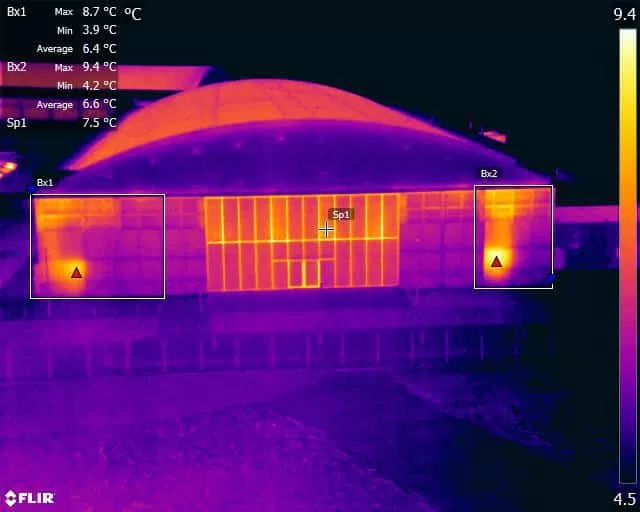
Insulation that is missing, slumped or was never continuous. Cavity fill that has settled leaves a warm band along the top of a wall. Boards fitted with gaps between them read as a grid. Areas that were never treated at all stand out immediately against neighbouring bays that were, and on a repeated facade that contrast is unmistakable.
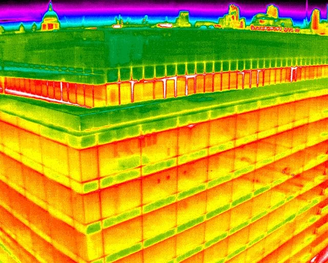
Thermal bridging. Slab edges, balcony connections, structural frames, lintels and window reveals conduct heat around the insulation rather than through it. These read as sharp, geometric warm lines that follow the structure, and they are the reason a building can be well insulated on paper and still lose heat in a regular pattern.
Air leakage. Warm air escaping around openings, service penetrations, roof junctions and panel joints produces a plume rather than a clean edge, and it is the shape that distinguishes it from conduction. On a windy night it is unreliable, which is one of the reasons the survey is stood down in wind.
Wet or failed fabric. Saturated insulation, water tracking behind cladding and failed sealing behave differently from dry material because water changes how quickly a surface gives up heat. On a building that is also a roof problem, the same flight covers both.
Each finding is located on the elevation, described, and graded so the report can be worked through in order rather than read as a wall of anomalies.
At a glance
What an aerial heat loss survey shows, when it is worth flying, and what it needs in order to work.
- The whole envelope in one survey. Every elevation and the roof, under one set of conditions, viewed square on rather than at a steep angle from the pavement.
- Finds missing, slumped or bridged insulation, thermal bridging at slab edges and junctions, air leakage around openings and service penetrations, and areas of saturated or failed fabric.
- Qualitative by design, in line with EN 13187:1999, the standard covering the detection of thermal irregularities in building envelopes.
- Needs the heating season and a real temperature difference across the fabric. Flown in winter, after dark or before dawn, and stood down for wind, rain or a day of strong sun on the elevations.
- Worth flying where a handheld camera is defeated: tall blocks, large footprints, restricted or dangerous access, or a portfolio of buildings that needs triaging before money is committed.
- Analysed and reported by an ITC Level III Certified Master Thermographer, with findings graded so that repair and retrofit can be put in a sensible order.
Ground-level thermography is the right tool on a small building. This is for the ones where it is not.
Often Flown on the Same Building
When It Is Worth Flying
Height, footprint, access, and a portfolio to prioritise
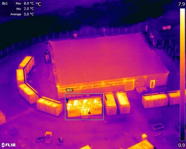
Flying is not automatically the right answer, and the sensible test is whether the building defeats a camera held at ground level. Four situations usually mean it does.
Height. Above two or three storeys the geometry works against you. A camera angled steeply upwards sees the surface obliquely, reflection increases with that angle, and the top of the building, which is frequently where the worst of the loss is, is the part seen worst. Flying puts the camera level with each floor in turn.
Footprint. On a large building or a terrace of them, a ground survey takes long enough that conditions shift materially between the first image and the last. Since the survey works by comparison, drift in the baseline is a real problem rather than a technicality.
Access. Elevations facing a railway, a river, a live yard, a neighbouring property or a locked service area are often the ones nobody has looked at in years. Aerial survey reaches them without scaffold, a platform or a negotiation with the neighbour.
A portfolio to triage. Where there are twenty buildings and a budget for three, flying the estate in a single season produces a consistent comparison across all of them. That is a different and usually more valuable question than a detailed survey of one building, and it is the one asset managers most often need answered first.
Where the building is small, low and accessible, a ground-based survey is better and cheaper, and it can go inside, which an aerial survey cannot. That work is carried out by our sister brand, Thermography Services (UK), and we will say so at the enquiry rather than sell you a flight you do not need.
Heat Loss and Heritage Diagnostics on Grade I and II Listed Buildings
Thermal imaging applied to Grade I and Grade II listed buildings, where the fabric cannot be opened up to find out what is happening inside it. The survey identified heat loss patterns and fabric condition without intervention, which on a protected structure is frequently the only investigation permitted at all.
What It Can Tell You, and What It Cannot
Being clear about the limits is more useful than a longer capability list, because in building thermography the limits are what get misunderstood at the point of ordering.
It does not measure U-values, and no thermal survey does. A U-value is a rate of heat transfer through a construction, established by calculation from the build-up or by in-situ heat flux measurement over a period of days. A thermal image is a picture of surface temperature at one moment. It will show you convincingly that this bay performs worse than the one beside it, and it will not tell you either bay’s U-value. Anybody offering U-values from a thermal camera is selling something the instrument cannot do.
It shows the effect, not always the cause. A warm patch is heat arriving at the surface. Whether that is missing insulation, a bridge, a leak, a pipe run in the wall or damp fabric is an interpretation, drawn from the shape, the context, the construction and the conditions. Where the evidence supports one cause it is stated plainly; where two remain possible the report says so rather than picking the more impressive.
It does not quantify air leakage. The survey shows where air is moving through the envelope, which is genuinely difficult to find any other way. How much air, across the whole building, is a blower door test, and the two work well together: thermography locates, pressure testing quantifies.
It cannot see inside. An aerial survey covers the outside of the envelope. Internal surveys of individual dwellings, cold spots in a specific flat, condensation risk and internal condition are ground-based work and are carried out by Thermography Services (UK).
What it does exceptionally well is coverage and comparison. A whole building, or a whole estate, seen under one set of conditions, at an angle the measurement supports, with every elevation treated the same way. On buildings where the alternative is a partial survey drawn from wherever there was room to stand, that difference decides whether the findings are worth acting on.
Clients occasionally ask why a heat loss survey cannot be done next week in April. The answer is that outside a fairly narrow set of conditions the survey does not fail loudly, it fails quietly, and produces a report that looks perfectly convincing and means very little.
There has to be heat trying to get out. Thermography reads surface temperature, so if the inside and the outside of the building are at similar temperatures, there is nothing driving a difference and nothing to see. That is why envelope surveys belong in the heating season, with the building heated and holding a real difference across the fabric. A mild spring evening is not a difficult survey, it is an invalid one.
The sun has to have been off the building for long enough. Masonry, concrete and cladding store heat and give it back for hours. An elevation that had sun on it during the afternoon will still be releasing that heat well into the evening, in a pattern that follows where the sun fell rather than where the insulation failed. Flying after dark, with enough hours since sunset for the fabric to have settled, is what removes it. On a heavy structure that can mean flying well into the night.
Wind takes the signal away. Air moving across a surface strips the thin warm layer that the camera is reading, flattening genuine differences and making leakage plumes unreadable. Rain and heavy damp do the same by wetting the surface and changing how it emits.
Which is why these surveys are booked to a window and not to a date. The right night sometimes arrives a fortnight after the enquiry. That is inconvenient, and it is the difference between findings you can act on and an expensive set of pictures.
- Thermographic inspection, analysis and reporting are conducted by Steve Fisher, ITC Level III Certified Master Thermographer (Infrared Training Centre; Certification #205722059), practising in accordance with the frameworks of ISO 18436-7:2014, ASNT SNT-TC-1A and ANSI/ASNT CP-105, and BINDT CMGEN Appendix B (UK training governance).
- Survey methodology is aligned with EN 13187:1999, the qualitative detection of thermal irregularities in building envelopes. Findings are reported as located and graded thermal anomalies, not as calculated thermal performance.
- No U-value, heat loss rate or energy performance figure is derived from thermographic data, and none is implied. Those require calculation from the construction or in-situ heat flux measurement.
- Emissivity and reflected apparent temperature are established on site against the actual surfaces surveyed and recorded with the data, together with the environmental conditions at the time of the flight.
- Flight operations are conducted under a Civil Aviation Authority Operational Authorisation held against the PDRA-01 standard scenario, with a General VLOS Certificate (GVC) and an A2 Certificate of Competency.
- Drone Media Imaging provides survey, analysis and reporting. No remedial work, retrofit design or specification is offered or implied.
Tell Us About the Building and What You Need to Decide
Send us the address, the height and rough footprint, and what the survey has to help you settle: a retrofit business case, a defect you cannot locate, a tenant complaint you cannot reproduce, or which buildings in a portfolio to spend on first. You will get a fixed price back with the deliverables in plain words, and an honest view on whether the building is better surveyed from the ground. Book early in the season if you can, because the survey depends on winter conditions and the good nights are finite.



