
Water Leak Detection
Dig in Three Places, Not Thirty
Aerial thermal survey along buried water mains, district heating networks and site distribution runs, narrowing a long corridor to a short, ranked list of candidate locations worth excavating. Flown at the times of day when the ground gives the strongest contrast, with each candidate classified by confidence rather than presented as a certainty. Delivered in the UK and internationally, under a written protocol developed and proven in some of the most difficult ground the method faces.
Dig in Three Places, Not Thirty
A leak on a buried run is rarely a mystery in principle. The pressure is dropping, or the make-up water is climbing, or the heat losses on a network have quietly got worse. The difficulty is location, because the pipe may be two kilometres long, under a road, a yard or a field, and excavation is the single most expensive way to ask a question.
A thermal survey works on the ground above the pipe rather than the pipe itself. Water escaping into the surrounding material changes how that material holds and releases heat, and on a district heating network the escaping water is hot to begin with. Flown along the corridor at the right time of day, that difference shows at the surface, and a long run becomes a short list of places worth opening up.
Candidates, Ranked by Confidence
A graded list, with the evidence attached to each one
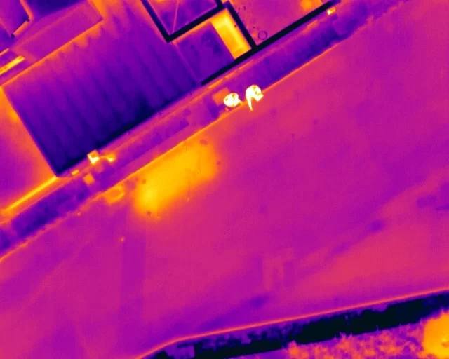
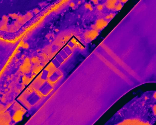
The deliverable is a list of candidate locations along the surveyed corridor, each one positioned, described, and graded by how much confidence the evidence supports. That grading is the point of the exercise, because a survey that returns thirty equally weighted anomalies has not actually narrowed anything.
Grading is done against stated temperature thresholds, fixed before the analysis begins. Rather than comparing everything with the road surface, the reference is built around the pipe itself: a local baseline is established on a stable section of the buried run in each zone of the corridor, because pipe temperature changes along a route as hydraulic load changes. An anomaly must exceed that local baseline by 0.3°C to be entered for review at all, and by 0.5°C to be classified as a confirmed candidate. Because the rule is fixed and published, a strong candidate on your survey means the same thing as a strong candidate on anybody else’s, and the classification can be checked by a third party rather than taken on trust.
Passing the temperature test is only the first stage. Every flagged location is then assessed against a further set of criteria in a defined order: the magnitude of the departure, the shape of the anomaly across the pipe and along it, whether the warm zone has broadened beyond the normal pipe corridor, whether it runs downslope in the way escaping water would, what the visible imagery shows at the same spot, and what infrastructure is known to be there. A candidate supported by three or more of those independently is a different proposition from one that is merely warm.
Corroboration in the visible imagery raises confidence further. Cracking in a road surface, ground that is damp or unusually green, or vegetation growing where it should not, all strengthen a thermal finding. So does the reverse: on one corridor, road reinstatement patches were measured and found to read slightly cooler than the aged asphalt around them, which eliminated the patch material itself as a heat source and meant any warmth over a patch required an explanation from underneath it. That is the kind of reasoning a Level 3 analysis is for, and it is what separates a defensible candidate list from a list of warm spots.
At a glance
What a thermal leak survey does, the thresholds it works to, and what it will not tell you.
- Surveys the corridor, not the pipe. Escaping water changes how the ground above holds heat, and that is what the camera reads.
- Flown twice in a day where conditions allow, before dawn and in the late afternoon, because wet ground reads warm in one window and cool in the other. Appearing correctly in both is the strongest evidence available.
- Graded against fixed thresholds, not impressions. Against a local baseline set on the pipe run itself, an anomaly enters review at 0.3°C and is classified a confirmed candidate at 0.5°C, then tested against seven further criteria before it is reported.
- Effective depth is shallow. The signature comes from moisture in roughly the top 30 to 50cm of ground. The survey does not image the pipe, and a deep main under heavy construction may show nothing at the surface.
- Surface type governs it. Paved and made-up surfaces read reliably. Vegetated and uneven open ground frequently does not.
- Strongest on district heating, where the leaking fluid carries its own heat and the contrast is large rather than marginal.
- Available internationally. The protocol was written to be executed by a trained local operator with the certified analysis carried out against their dataset, so a survey overseas does not depend on flying a specialist to the site.
- Conditions are enforced. Capture is postponed above 75% relative humidity or 8m/s wind, and for rain, fog or haze, rather than flown and then qualified in the report.
The survey tells you where to excavate. It does not tell you the leak rate, the pipe condition or the flow direction.
Related Thermal Work
Where It Earns Its Keep
District heating, long rural runs, and networks beyond the UK
This is not the right tool for every leak. On a short run in an accessible location, acoustic survey and correlation are quicker, cheaper and more precise, and any competent leak detection contractor will find it faster than a drone will. The aerial survey earns its place in a narrower set of situations, and in one of them it has very little competition at all.
District heating and hot water networks are where it works best by a considerable margin. The escaping fluid is hot, so the contrast at the surface is large and unambiguous rather than marginal, and it does not depend on the subtle differences in thermal behaviour a cold water leak relies on. On a campus, hospital, housing scheme or industrial site network, one visit covers the whole distribution layout.
Long runs across open ground are the second case. Where a main crosses fields, verges or estate land for a kilometre or more, walking it with acoustic equipment is slow and repeated speculative excavation is expensive. Flying the corridor and returning a handful of ranked candidates changes the economics of the investigation rather than just the method. The third case is ground you cannot open speculatively: a live yard, a service road, a car park, a listed setting, or anywhere reinstatement costs more than the excavation.
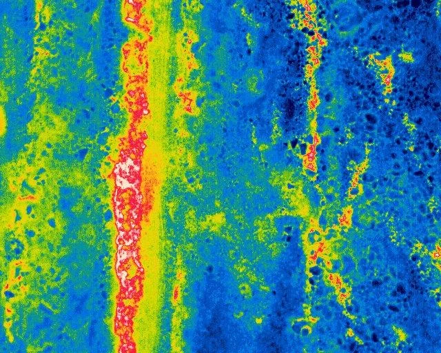
The fourth is international, and it is the one this service was actually built for. The protocol behind these surveys was developed and proven overseas, in arid volcanic ground that drains away the very moisture the method depends on, which is close to the hardest condition thermographic leak detection faces. It was written from the outset to travel: the document fixes the altitudes, the radiometric parameters, the environmental limits at which capture is postponed and the two survey windows, so that a trained local operator can capture to it in their own territory while the certified Level 3 analysis and reporting is carried out against their dataset. The practical consequence is that a survey can be delivered in a country without flying a specialist to the site, and the cost of working in a new territory is a trained operator rather than an air fare.
That matters most where water is scarce and losses are political rather than merely expensive. Across southern Europe, the Atlantic islands and much of Africa, distribution networks run through exactly the difficult ground this method was calibrated against, and the case for finding losses without excavating is correspondingly stronger. If you are a network operator, a utility or an aid or development programme working in those conditions, the protocol already exists and has been tested against a known answer.
Proving the Method in Ground That Works Against It
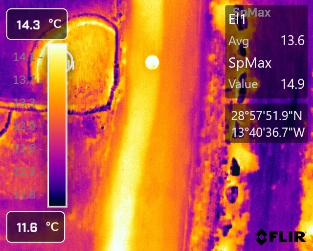
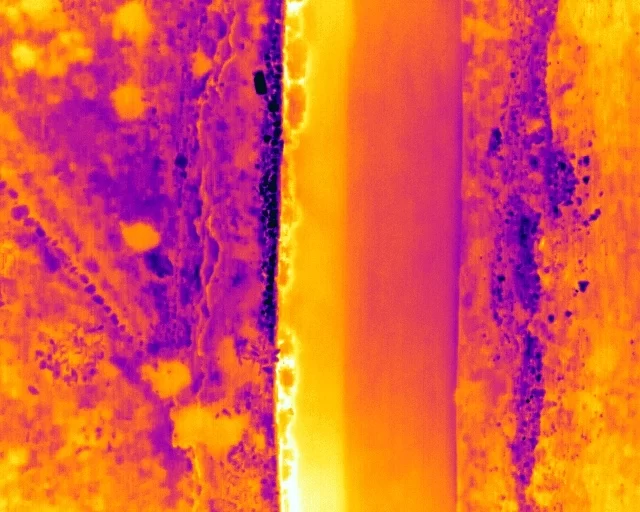
Before this method was trusted on unknown ground, it was flown over a confirmed leak in arid volcanic terrain, where high-porosity soil drains away the very moisture the technique depends on. Six flights across two thermal windows established what a real leak looks like in the hardest conditions the method faces, and produced the written protocol that governs the survey work described on this page.
The Limits, Stated Before You Book Rather Than After
Thermography is an indirect technique. It measures the temperature of a surface, and everything about a buried pipe is inferred from that. Being precise about where the inference runs out is what makes the candidates worth acting on.
Depth is the hard limit. The effect being read is a change in the ground within roughly the top few hundred millimetres. A leak deeper than that has to warm or wet a considerable volume of material before anything reaches the surface, and on a deep main under a constructed road it may never produce a readable signature. Depth is therefore the first question at the enquiry, and where the pipe is deep the honest answer is that this is the wrong survey.
Surface type decides reliability. Paved, tarmac and made-up surfaces behave consistently and give the cleanest results. Open, vegetated and uneven ground is considerably less reliable: plant structure, shading, varying soil and different materials produce their own patterns, and a genuine signature can be lost inside them. Where a route crosses both, the paved sections will carry higher confidence than the grass, and the report reflects that rather than averaging it away.
It does not confirm a leak, and it says nothing about the pipe. A candidate is a place where the ground is behaving as it would above a leak. It does not establish leak rate, flow direction, pipe integrity or remaining life, and it cannot distinguish a leak from every other thing that wets or warms ground: a land drain, a previous repair, a void, a change of material, or a different service running alongside.
Conditions rule the survey. High humidity, wind, rain, fog and haze all degrade or prevent it, and a surface still radiating stored heat after sunset will mask what is being looked for. Surveys are postponed on those grounds rather than flown and caveated.
What it does exceptionally well is cover distance. Kilometres of corridor, in a single visit, without traffic management, without excavation, and without anybody walking a live carriageway, reduced to a ranked handful of places worth the cost of opening the ground.
Wet ground and dry ground respond to the day differently, and a survey that only looks once sees only half of that. Where the site and the conditions allow, the same corridor is flown at two points in the cycle, because each one produces a different signature and a candidate that appears in both is considerably stronger than one that appears in either.
Before dawn, wet ground reads warm. Through the night the surface radiates heat away to the sky and cools. Saturated material holds far more energy than dry material and gives it up more slowly, so by the end of the night it is lagging behind everything around it. The pre-dawn pass is looking for that: a warm line or patch where the ground has failed to cool at the same rate as its surroundings. It is the cleanest signature available, and it is why this work involves getting up early rather than fitting into a working day.
In the late afternoon, wet ground reads cool. With the sun on it all day, dry ground warms quickly. Wet ground both takes longer to warm and is actively cooled by evaporation at the surface, so it lags the other way and appears as a cool region against warm surroundings. That pass also carries a risk, because shadows do the same thing, which is why it is read alongside the visible imagery rather than on its own.
The two together are the check. Something that reads warm before dawn and cool in the afternoon is behaving exactly as wet ground should. Something that reads cool in the afternoon only is quite likely to be a shadow. Getting both is not always possible, and where only one pass can be flown the report says which, and grades the findings accordingly.
- Thermographic inspection, analysis and reporting are conducted by Steve Fisher, ITC Level III Certified Master Thermographer (Infrared Training Centre; Certification #205722059), practising in accordance with the frameworks of ISO 18436-7:2014, ASNT SNT-TC-1A and ANSI/ASNT CP-105, and BINDT CMGEN Appendix B (UK training governance).
- Thermography is an indirect, qualitative technique. It measures surface temperature distribution, not the presence of water. Findings are reported as graded candidate locations with the supporting evidence stated, never as confirmed leaks.
- No statement is made about leak rate, flow direction, pipe integrity, remaining life or hydraulic performance, and none is implied. The survey is decision support for where to investigate.
- Candidates are classified against defined temperature-difference thresholds fixed before analysis, so that classification is reproducible and can be independently checked.
- Environmental conditions and the times of the survey passes are recorded and reported. Surveys are postponed where humidity, wind, precipitation or residual surface heat would compromise detection.
- Flight operations are conducted under a Civil Aviation Authority Operational Authorisation held against the PDRA-01 standard scenario, with a General VLOS Certificate (GVC) and an A2 Certificate of Competency.
- Drone Media Imaging provides survey, analysis and reporting. Excavation, acoustic correlation, pipe repair and network design are not offered and remain with your own contractors.
Tell Us the Route, the Depth and the Surface
Three things decide whether this survey is worth doing on your network: how deep the pipe is, what the ground above it is made of, and whether the fluid is hot or cold. Send us those, along with the route and the length to be covered, and we will tell you honestly whether an aerial survey is the right instrument or whether you would be better served by an acoustic team. You will get a fixed price with the deliverables in plain words. Where the pipe is deep, or the route is mostly rough vegetated ground, we will say so before you commit, because a survey that was never going to work is worse than no survey at all.
Enquiries from outside the UK are welcome and are handled differently rather than declined. Tell us the territory and what capture capability exists locally, and we will set out how the survey would be run: whether an operator on the ground works to our protocol with the certified analysis carried out here, or whether the job warrants attending in person.



