
Detail Is a Flight Decision, Not a Processing Option
Most enquiries for an aerial survey arrive with a sentence like “we need it high resolution”, and that is a perfectly reasonable thing to ask for. The difficulty is that detail is not a setting applied afterwards, in the way a photograph can be sharpened or a video exported at a larger size. In a photogrammetric survey the level of detail is a consequence of how the aircraft was flown, and it is fixed the moment the last image is taken.
Two flight decisions do almost all of the work. The first is how high the aircraft flies above the surface, which sets how much ground each pixel covers. The second is how much each photograph overlaps the ones around it, which decides whether the software can reconstruct the geometry at all. Both are chosen before take-off, both have a direct cost in flying time, and neither can be improved once the aircraft has landed.
This piece explains what those two decisions actually control, in plain terms, so that a scoping conversation can be a short one. It is not a method document, and it does not set out how a mission is planned. It is here so that when you are asked how much detail you need, you can answer in terms of what you intend to do with the result.
Blog Content TL;DR...
The short version, for anyone being asked how much detail their survey needs.
- Detail is set by how high the aircraft flies, not by anything done in processing afterwards.
- Ground sample distance is the size of the patch of ground one pixel covers. Lower flying makes it smaller.
- A feature has to span several pixels before it can be identified confidently, so the working limit is always coarser than the headline figure.
- Overlap is what lets the software rebuild the geometry, and featureless surfaces such as fresh tarmac or still water need more of it.
- Fine detail with heavy overlap can multiply the image count many times over, and with it the batteries, the daylight and the processing.
Bring an intention rather than a number, because a coarse dataset cannot be sharpened later and a fine one costs the day.
Height Is the Detail Setting
What one pixel covers, and why the number on the quotation is not the number you work to

One pixel, one patch of ground
Ground sample distance is the only measure of detail that means anything in a survey, and it describes a simple thing: the size of the patch of ground represented by a single pixel in the imagery. A survey flown at a ground sample distance of one centimetre means each pixel covers a one centimetre square of the site. Flying lower makes that patch smaller and the detail finer. Flying higher makes it larger and the detail coarser. Nothing else in the process changes it, because it is set by the geometry of the camera and its distance from the ground.
Why the headline figure flatters
A feature does not become identifiable the moment it is the same size as one pixel. It needs to span several pixels before anyone can say with confidence what it is and where its edges are, which is why the practical limit of a dataset is always coarser than the pixel size suggests. The same applies to anything that must be located precisely rather than merely seen. Treat the figure as the finest thing the data could possibly contain, not as the smallest thing you will be able to work with.
The ceiling the law puts on it
Flight above the surface is limited to 120 metres in UK airspace, and that limit sets the coarsest detail a given camera can produce in a single pass. Everything finer than that is obtained by flying lower, and flying lower narrows the strip of ground each pass covers. A site that takes one set of flight lines at the ceiling may take several times that number at half the height, which is where the cost of detail actually appears.
what ground sample distance actually means, how much overlap a drone survey needs, why survey detail is decided before the flightwhat ground sample distance actually means, how much overlap a drone survey needs, why survey detail is decided before the flight
Overlap Is What Makes It Solvable
The software matches what it can recognise
A photogrammetric model is built by finding the same physical point in several different photographs and working backwards to where the camera must have been. That only works if each point appears in enough frames, and if the surface carries enough visual variation for the point to be recognised at all. Overlap is the deliberate repetition that guarantees it: every image is captured so that a large proportion of what it shows also appears in its neighbours.
Featureless ground is the hard case
Surfaces that look easy to a person are often the difficult ones. Fresh tarmac, uniform gravel, sand, still water margins and dense uniform canopy all give the software very little to lock onto, because one patch looks like every other patch. The answer is more overlap rather than better software, and the need for it is judged from the ground conditions before the flight is planned. A site visited in different conditions, wet, dry, mown or overgrown, can behave quite differently.
Front is cheap, sideways is expensive
Overlap along the direction of travel is bought by triggering the camera more often, which costs very little. Overlap between adjacent passes is bought by flying more passes, which costs flight lines, batteries and daylight. That asymmetry is why a survey is usually generous with the first and disciplined with the second, and why any saving that has to be found comes out of the sideways figure. It is also the reason two sites of identical size can take very different amounts of time.
What It Costs, and What Cannot Be Undone
Detail multiplies the day
The two decisions compound. Taking a site from the coarsest workable detail and modest overlap down to fine detail with heavy overlap can multiply the number of images by roughly eight, and that multiplies the batteries, the time on site and the processing that follows. None of that is wasted if the job needs it. All of it is wasted if the finished product was only ever going to be looked at on a screen.
Ground that rises and falls
Height is measured above the surface being photographed, not above the point the aircraft took off from. On a site with real changes in level, a flight held at a constant altitude produces finer detail over the high ground and coarser detail over the low, with the overlap varying in step. The lower the flight, the more pronounced that effect becomes, which is one of the reasons low flying over uneven ground is a slower and more deliberate business.
The decision has one direction
A dataset captured finely can always be presented more coarsely, and a dataset captured coarsely cannot be improved afterwards by any amount of processing. That makes this a scoping question rather than a production one. The useful thing to bring to that conversation is not a number but an intention: what has to be identified, what has to be measured, and what the result will be used to decide. The flight is then planned to answer it, and the quotation follows from the plan.
Survey planning works backwards from the required ground sample distance to the flight height, never the other way round, because the detail is the requirement and the height is only the means. Height is taken above the surface being photographed, so on undulating ground the plan either follows the terrain or accepts a varying result across the block.
Overlap is expressed as two separate figures, one along the direction of travel and one between adjacent passes. The first is delivered by the interval at which the camera is triggered, and it is constrained by how quickly the payload can record a frame in the file format actually in use. Exceed that and frames are silently missed, which shows up as gaps in the block long after the site visit. The second is delivered by the spacing of the flight lines.
Ground speed is limited by light before it is limited by the camera. Holding a shutter fast enough to stop motion in dull conditions raises noise, and a sharp noisy image is usable where a clean blurred one is not.
Not Sure What Detail Your Survey Needs?
Tell us what the survey has to help you decide and we will work back to the flight that answers it, rather than asking you to specify a figure. Drone Media Imaging provides aerial survey capture, processing and reporting across Sussex, Hampshire, Kent and Surrey, travelling throughout the UK, Ireland and Europe. Get in touch for a no obligation quotation or to talk a site through before you scope it.
related posts
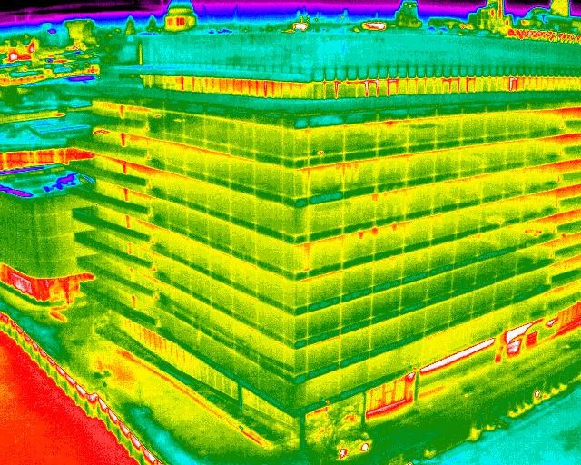
Discover how building thermography can significantly reduce energy costs by identifying heat loss areas in every snapshot.

Quantitative and qualitative thermography are two essential methods in thermal imaging analysis. Quantitative thermography measures exact temperature values, while qualitative thermography focuses on pattern recognition. Both play a crucial role in building inspections, electrical fault detection, and industrial diagnostics. Understanding their differences helps professionals choose the right approach for accurate thermal assessments. Drone Media Imaging provides expert thermographic services, ensuring precise, reliable results. Contact us today for professional thermal imaging analysis.
A quotation for aerial survey work arrives carrying an operating category, an authorisation reference, a competence certificate and a class mark, and it is tempting to skip past all of it to the price. Those terms are the part of the document that tells you what can actually be flown. This is the vocabulary you are likely to meet in a real quotation or a real conversation about permissions, in plain English, with the practical consequence of each attached.



