What a Thermal Survey Adds to a Building Survey
Both are called surveys, and that shared word causes more confusion than any technical point in this subject. A building survey is a qualified professional’s considered opinion on the condition of a structure, written by somebody whose training, institution and professional indemnity stand behind the judgement. A thermal survey is a different thing altogether. It is a record of how a building’s surfaces behaved on a particular day, under conditions written down at the time, and it offers no opinion on whether the building is sound.
Said like that the two sound unrelated, and in one sense they are. They answer different questions, they are produced by different disciplines, and neither replaces the other. What makes them worth discussing together is that the questions sit next to each other. A surveyor forms a view partly from what can be seen, reached and reasonably inferred, and a thermal survey widens what can be seen, across a whole elevation, without opening anything up.
Drone Media Imaging provides the second of the two. We hold no surveying qualification, we do not assess structures and we do not grade condition, and that is not a caveat buried at the foot of a report, it is the shape of the service. Knowing where the line runs is what makes the thermal evidence worth having to the person on the other side of it.
Blog Content TL;DR...
Two services that share a word, answer different questions, and work best when the difference is stated plainly.
- A building survey is a qualified professional’s opinion on the condition of a structure. A thermal survey is a dated record of how its surfaces behaved.
- The authority behind each is different: one rests on a surveying qualification and indemnity, the other on a declared method and conditions recorded at the time.
- Thermography contributes reach, showing where insulation stops, where air moves through the envelope and where fabric behaves as though it is holding moisture.
- It contributes nothing about cause. An anomaly is located and characterised, never diagnosed, and it goes to somebody qualified to say what it means.
- Drone Media Imaging holds no surveying qualification and offers no structural assessment or condition grading, which is what keeps the evidence clean.
One answers what the building is. The other answers what the building did, on a day, in conditions somebody wrote down.
Two Questions, Not One Question Asked Twice
What each survey is actually being asked to establish
What a building survey answers
A building survey, at whatever level it is commissioned, exists to produce a judgement. Somebody qualified inspects the property, applies training and experience to what they find, and tells the client what condition the building is in, what is likely to matter, and what it may cost to put right. The value of that document is inseparable from the person who signed it. Remove the qualification and the professional responsibility and what remains is a description of a house, which is not what the client paid for. It is a professional opinion, offered by somebody entitled to offer it.
What a thermal survey answers
A thermal survey answers something narrower and much more literal. It asks how the surfaces of a building behaved during a defined period, while heat was moving through the fabric, and it records the answer as radiometric imagery with the conditions of capture written down beside it. The questions it is set are specific: how the building is performing thermally as a whole, where heat is being lost, where insulation is absent or interrupted, where the structure bridges from inside to out, and where air is moving through the envelope. Air temperature, humidity, wind, cloud cover and the orientation of each elevation are logged as the work proceeds, because without them the imagery can be neither interpreted nor repeated. The output is an observation, dated and conditioned, rather than a verdict.
Why the difference is not a technicality
It would be easy to treat this as a distinction that matters only to the people producing the documents. It is not. The two carry different kinds of authority, and a client who mistakes one for the other will lean on it in the wrong place. A surveyor’s opinion is backed by qualification, institutional membership and indemnity, and it can properly be relied on as advice. A thermographic report is backed by a declared method and by conditions that were recorded rather than remembered, and it can properly be relied on as evidence. Advice and evidence are both valuable. They are not interchangeable, and a document that blurs them is weaker than either.
What a thermal survey answers that a building survey does not, How a thermographic survey supports a chartered surveyor, Where the thermal survey stops and professional judgement beginsWhat a thermal survey answers that a building survey does not, How a thermographic survey supports a chartered surveyor, Where the thermal survey stops and professional judgement begins
What Thermography Puts in Front of a Surveyor
Coverage without disturbance
The practical contribution is coverage. A person inspecting a building works from where they can stand, what they can reach and what they can open up, and every one of those is constrained by cost, by occupation and by the fabric itself. Thermal imaging reads a whole elevation at once, from the air where the elevation is tall, without contact, without access equipment and without disturbing a building that is still occupied. Nothing about it requires a decision in advance about where the interesting part is going to be.
Things that are genuinely hard to establish otherwise
Three kinds of finding come out of that coverage particularly well. Insulation that is missing, compressed, slumped or simply stopping short of a junction shows as a coherent area behaving differently from the fabric around it, and its outline frequently follows the boards or the bays rather than anything visible on the face. Air moving through the envelope leaves a characteristic plume around junctions, seals and service penetrations, which is difficult to pin down from inside without a pressure test. Fabric holding moisture responds to heating and cooling more slowly than the dry fabric beside it, so the two separate as conditions change through the survey.
And a record that holds its value
There is a fourth contribution that is easy to overlook. Because the conditions are recorded, the survey can be repeated later under comparable conditions and the two sets read against each other. A building that has been altered, repaired or insulated since the first visit can be shown to have changed, in a form that does not depend on anybody remembering what it looked like before. For a surveyor building a case about a defect, or an owner wanting to show that remedial work achieved something, that is a genuinely useful property, and it comes directly from the discipline of writing the conditions down.
Where the Line Runs, and Why It Is Drawn There
What a thermal survey does not do
A thermal anomaly is not a defect. It is a difference in surface temperature with a range of possible explanations, and the survey’s job is to locate it, describe it, and characterise its shape and behaviour so that somebody can act on it. Drone Media Imaging does not assess structures, does not grade condition and holds no surveying qualification of any kind. No building survey, structural assessment or professional opinion on the condition of a structure is offered or implied by anything we produce. Findings are recorded as areas warranting further investigation by a suitably qualified contractor or surveyor, and the decision about what they mean rests there.
Which is exactly what makes it useful
That sounds like a retreat and it is the opposite. A thermal report that has stayed inside its scope can be handed to a surveyor, a contractor, an insurer or an owner without any of them having to work out which parts to discount. One that strays into diagnosis invites the reader to question all of it, including the observations that were perfectly sound. The two services work best in sequence rather than in competition: the thermal survey establishes where the building is behaving oddly and under what conditions, and the qualified professional decides what that means for the structure and for the person who owns it.
In practice that usually means the thermal survey is commissioned by, or alongside, the professional who will use it, and that the scope is agreed before anyone attends, so the imagery answers the question actually being asked rather than a general one. Neither discipline is diminished by the other doing its own job properly.
A thermographic survey becomes usable evidence because of what is declared around the imagery. The work is carried out to a written data acquisition protocol that fixes the scope, the instrument settings and the capture geometry before anyone attends site. Object parameters are set deliberately, with emissivity chosen for the fabric, reflected apparent temperature determined on site rather than assumed, and distance, air temperature and relative humidity entered from measured values. Environmental readings are taken before each flight and logged against each elevation and its compass orientation, covering air temperature, humidity, wind speed and direction and cloud cover. Capture geometry is held as near perpendicular to the surface as conditions allow, because apparent emissivity degrades at glancing angles. Any departure from the protocol is declared, and a declared departure may invalidate certification, in which case the output is issued as an uncertified thermographic opinion rather than a certified report. That distinction is stated on the face of the document, not left for the reader to infer.
Governing Standards and Scope
- BS EN ISO 6781-1:2023, Performance of buildings. Detection of heat, air and moisture irregularities in buildings by infrared methods. General procedures. The building envelope methodology this work is aligned with, and the source of the conditions and reporting requirements described above.
- ISO 18434-1:2008, Condition monitoring and diagnostics of machines. Thermography. Part 1: General procedures. The basis for determining and compensating for reflected apparent temperature, emissivity and attenuating media.
- Governance statement. Thermographic inspection, analysis and reporting are conducted by a Drone Media Imaging ITC Level III Certified Master Thermographer (Infrared Training Centre; Certification #205722059), practising in accordance with the frameworks of ISO 18436-7:2014, ASNT SNT-TC-1A and ANSI/ASNT CP-105, and BINDT CMGEN Appendix B (UK training governance).
- Scope. Survey, analysis and reporting only. No building survey, structural assessment, condition grading or professional opinion on the condition of a structure is offered or implied, and no surveying qualification is held or claimed. Findings are recorded as areas warranting further investigation by a suitably qualified contractor or surveyor.
Need Thermal Evidence Alongside a Building Survey?
Drone Media Imaging carries out building envelope thermography as survey, analysis and reporting, at Level III, with the scope and the conditions agreed before anyone attends. If you are a surveyor, a managing agent or an owner who needs thermal evidence to sit alongside a professional judgement, tell us what that judgement has to cover and we will tell you plainly what infrared can contribute to it and what it cannot. Core coverage across Sussex, Hampshire, Kent and Surrey, travelling throughout the UK, Ireland and Europe.
related posts
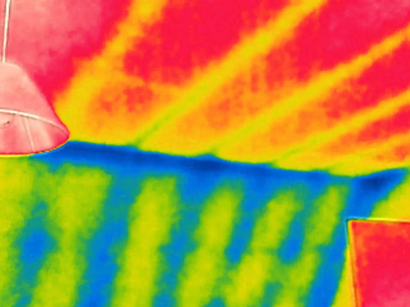
On most pitched roofs a ventilated loft sits between the tiles and the insulation, so an aerial thermal image of the roof is an indirect view of what lies beneath. This piece explains how cold and warm roofs read differently from the air, why the cold night sky is reflected by and draws heat from every roof surface, and which checks turn a warm patch on a roof into a finding worth investigating further inside the loft.

Every drone flight starts and ends on somebody's ground, and an aviation authorisation gives no right to it. This post explains the two separate permissions a professional flight needs, the air and the ground, what happens when the client controls a site but does not own it, why the best vantage point is often next door, why public land and roads are rarely the answer, and how Drone Media Imaging settles the take-off point during planning rather than on the day.
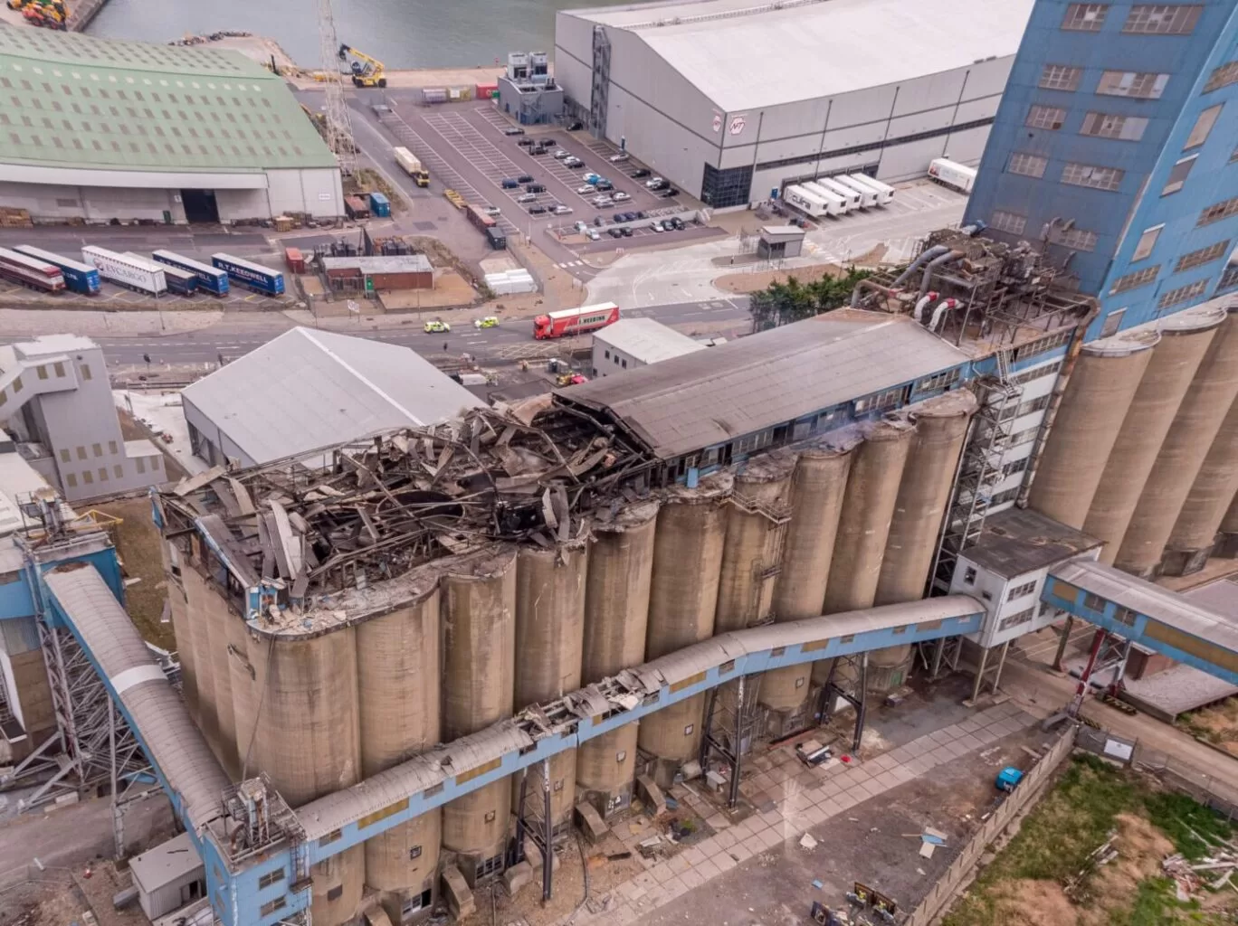
Thermal Fire Monitoring Following a Grain Store Terminal Explosion
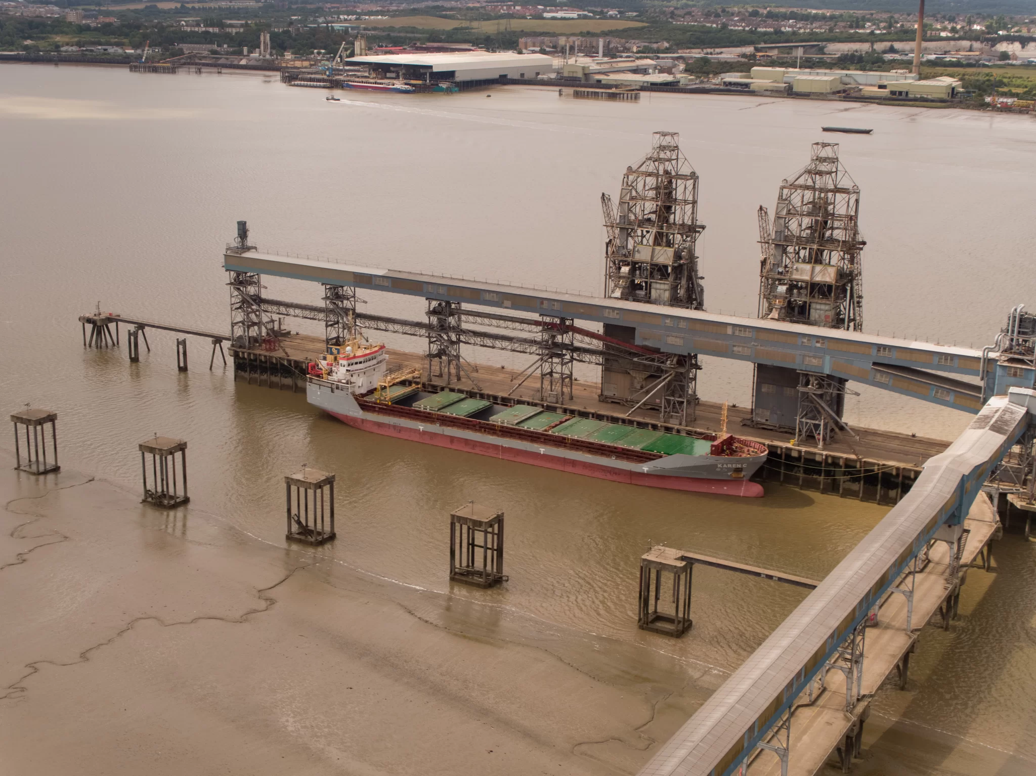
Grain Store Explosion and Year-Long Fire – July 5, 2020 – Tilbury Port, London On July 5, 2020, a series of events (possibly by a spark) triggered a large dust explosion and a subsequent fire at the Grain Store Terminal at the Port of Tilbury in London. This was a serious event that required the attention of a large-scale emergency response to get the subsequent grain fire under control and avoid additional explosions. No one was seriously hurt, which is nothing short of a miracle given the number of people on the scene and the amount of reinforced concrete and debris thrown high into the sky before raining down on the surrounding buildings.
Traditional firefighting methods and techniques are ineffective in the case of grain storage fires. Using water to extinguish the inferno is ineffective with grain and dust fires, and the added weight might have caused a catastrophic structural collapse, exacerbating an already challenging situation. As a result, London fire teams were on the scene for days while a proper fire strategy and plan was developed and implemented, with staff always remaining on-site to monitor the situation over the following weeks.
Throughout this early period, there was always the possibility of more explosions and the fire spreading since the grain stored in the linked silos generates dust that may ignite if the temperature is high enough. Drone Media Imaging was contracted to fly thermal imaging flights to collect temperature data to estimate fire spread and track fire management efforts over time. For instance, were the temperatures rising, falling, or remaining constant?
We began operations on July 7, 2020, flying three flights each day, seven days a week initially, to compare temperatures and report back to crisis management teams and emergency service gold commanders. We eventually completed our thermal imaging missions one year and a month after the initial Grain Store explosion in late August 2021! While not all of the silos were full with grain, many were, and several were burning at temperatures far beyond 800°C. Before the fire could be quenched, the building had to be entirely demolished. Temperatures more than 80°C were still being recorded in the grain that remained on the ground after demolition 13 months later.
Gaining safe access to the terminal to fly was not without difficulty, as emergency services had imposed a 50m exclusion zone surrounding the terminal due to the possibility of additional explosions. As a result, our risk assessments and method statements had to be developed specifically for this circumstance and rigorously tested to assure both safe drone flights and the most accurate thermal data gathering at this vital juncture.
We continued to provide the Port of Tilbury London and the accompanying emergency services with daily and weekly calibrated temperature measurements that documented the progress of the grain store fire over 13 months. As thermal infrared aerial specialists, we provided data in the form of detailed reports, thermal imaging, RGB photographic and video footage.