Drone Water Leak Detection Case Study: Volcanic Terrain and a Transportable Protocol
Why a Water Leak Detection Survey Starts With a Leak You Already Know About
This drone water leak detection case study in association with Skynox Drones of Lanzarote, records an international proof-of-concept survey flown over a confirmed underground leak in arid, volcanic terrain, carried out to establish whether aerial thermography could work in ground that actively defeats it. High-porosity volcanic soil drains away the moisture the method depends on, and at a pipe depth of around 0.9 metres the target sat close to the limit of surface detectability. Six flights were made in a single day, split between pre-dawn and sunset to capture opposing points of the thermal cycle, each at three altitudes. The low-altitude pre-dawn dataset proved the most informative, and the confirmed breach returned a coherent anomaly of two to three degrees above background. Buried service ducts were correctly classified as infrastructure rather than leakage. The real deliverable was a proprietary written protocol, calibrated to this class of ground and climate, separating local data capture from certified Level 3 analysis so that it can be adopted by operators in other territories, with further European and African markets the intended path.
Project Overview
Subject
drone water leak detection case study, leak detection in volcanic terrain, arid climate thermographic survey, international water network operators, ISO 18436-7
Skills Used
Subsurface Anomaly Detection, Delta-T Assessment, Qualitative Thermal Analysis
Portfolio Tags
Water Leak Detection, Volcanic Terrain, Arid Climate, Aerial Thermography, International Projects, Water Networks, Survey Protocol, How Is A Buried Leak Found
How Do You Find A Buried Water Leak In Volcanic Ground, Transportable Thermographic Survey Protocol, Aerial Leak Detection For International Water NetworksHow Do You Find A Buried Water Leak In Volcanic Ground, Transportable Thermographic Survey Protocol, Aerial Leak Detection For International Water Networks
Drone Water Leak Detection Case Study: Volcanic Terrain and a Transportable Protocol
~ Volcanic ground, a marginal signal, and a protocol written to travel ~
Validation before deployment, under Level 3 supervision
Why a Water Leak Detection Survey Starts With a Leak You Already Know About
Water networks lose a great deal of water to leaks that nobody can locate. The pipe is buried, the loss is gradual, and on a long distribution run the pressure data will confirm that something is wrong without indicating where. Excavating to find out is slow, disruptive and expensive, so any method that narrows the search before the ground is opened has obvious value to a network operator. In territories where water is genuinely scarce, that value stops being an efficiency and starts being a strategic problem.
This survey was commissioned by Skynox Drones SL to establish whether aerial thermography could take on that role, on behalf of a municipal water authority in the Canary Islands assessing it as a screening layer across its distribution network. The site was an urban residential road corridor with a buried potable water main at approximately 0.9 metres depth, and it was chosen for one specific reason: a leak at that location had already been confirmed, with visible surface water at a breach in the road. The survey was therefore not attempting to discover anything. It was establishing what a genuine leak looks like to a thermal camera in this ground, under these conditions, and what else in the same corridor produces a signature that could be mistaken for one.
The science is indirect and it is worth stating plainly, because it governs everything that follows. Thermography does not see water. It measures the temperature of a surface, and water changes how the material beneath that surface holds and releases heat. Saturated ground carries more thermal mass than dry ground, so it warms and cools more slowly, and at the right point in the daily cycle that lag becomes visible at the surface. Volcanic ground and an arid climate both work against that mechanism, which is precisely why the project was worth doing here rather than somewhere easier. Te project management, data collection protocols, unique methodology, analysis and certified reporting were delivered by Drone Media Imaging as level 3 thermographers, with the aerial data captured on site by a specialist operator Skynox Drones working to a written Level 1 protocol prepared under the supervision of our Level 3 Master Thermographer.
Governing Standards
- Thermographic analysis and reporting were carried out by Steve Fisher, ITC Level III Certified Master Thermographer (Infrared Training Centre; Certification #205722059), practising in accordance with the frameworks of ISO 18436-7:2014, ASNT SNT-TC-1A and ANSI/ASNT CP-105, and BINDT CMGEN Appendix B (UK training governance).
- ISO 18436-7:2014, the competency framework for thermographic condition monitoring personnel, applied here as the alignment framework governing the division of responsibility between Level 1 data collection and Level 3 interpretation.
- Written Level 1 data collection protocol, prepared under Level 3 supervision before any flight, fixing altitudes, radiometric parameters, environmental recording and the abort criteria under which capture would be postponed.
- Qualitative and indirect method. Thermography measures surface temperature distribution. It does not detect water, and it does not measure leak flow, pressure or volume. Findings are reported as candidate locations for ground investigation, never as confirmed leaks.
- Radiometric parameters, including emissivity and reflected apparent temperature, were fixed and applied consistently across the whole dataset, and recorded with the environmental conditions for every flight.
- Drone Media Imaging provides survey, analysis and reporting. Excavation, acoustic correlation and pipe repair are matters for a suitably qualified contractor.
The terrain was the problem the project existed to solve
How Do You Detect a Buried Leak in Arid, Volcanic Ground?
Most published guidance on thermal leak detection assumes a temperate climate and a retentive soil. Neither applies here, and the gap between the two is the reason this work had to be developed rather than simply applied.
Volcanic ground does not hold water in the way the method expects it to. The technique depends on escaping water saturating the material around the pipe and leaving it thermally heavier than the dry ground beside it. High-porosity volcanic soil with low organic content drains and disperses that water instead of holding it, so the saturated zone is smaller, shallower and shorter-lived, and the surface signature it produces is correspondingly weaker. At the pipe depth on this site, approximately 0.9 metres, that puts the target close to the upper limit of what is detectable at the surface in this ground at all. Getting a result was not a matter of flying carefully. It required the survey to be designed around a signal that was known in advance to be marginal.
The arid climate cuts both ways, and both had to be built into the method. Reliably clear night skies produce exceptionally strong radiative cooling, which is a genuine advantage: the effective sky temperature is very low, giving a reflected apparent temperature of around minus 20 degrees and the sharpest possible contrast between wet and dry ground before dawn. Against that, ground which has taken a full day of sun holds its heat for hours, so a flight made too soon after sunset reads stored solar energy rather than moisture. The protocol therefore carries a hard rule that capture is delayed where the surface is still re-radiating above 25 degrees two hours after sunset, which is a condition that simply does not arise on a British survey.
Some hazards are regional and have to be written in. Calima, the Saharan dust haze that periodically crosses the Canary Islands, degrades atmospheric transmission and is an abort condition in its own right, alongside the more familiar limits on humidity, wind and precipitation. A protocol written for northern Europe would not mention it, and a survey flown through it would return quietly unreliable data.
Scope, and what was deliberately excluded:
- Included: the paved road corridor above the known main, the confirmed breach, road crossings and buried service features, and adjacent open volcanic ground assessed for comparison.
- Included: comparison of all three altitudes and both time windows against one another, to establish what the method actually requires rather than what is convenient.
- Excluded: any determination of pipe condition, leak rate, flow direction or hydraulic performance, none of which thermography can establish.
- Excluded: excavation, acoustic correlation or intrusive confirmation, which remain matters for a suitably qualified contractor.
What Did the Thermal Survey Actually Find?
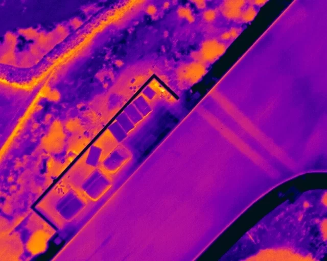
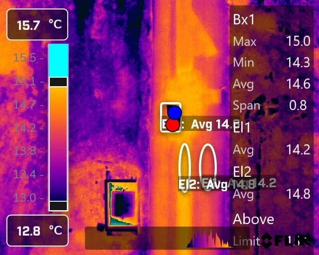
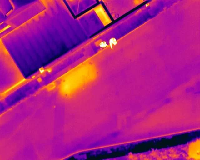
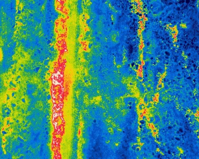
At the confirmed breach the method worked, and it worked clearly. The low-altitude pre-dawn dataset showed a well-defined localised warm anomaly at the breach location, exceeding background surface temperature by approximately two to three degrees under near-equilibrium conditions. The anomaly was spatially coherent, it appeared in multiple independent frames, and its shape followed the downslope direction in which surface water was visibly running. Line profiles taken across it showed a peak against a stable surrounding baseline rather than a general elevation of the whole road surface, which is the distinction that separates a discrete source from a warm section of carriageway.
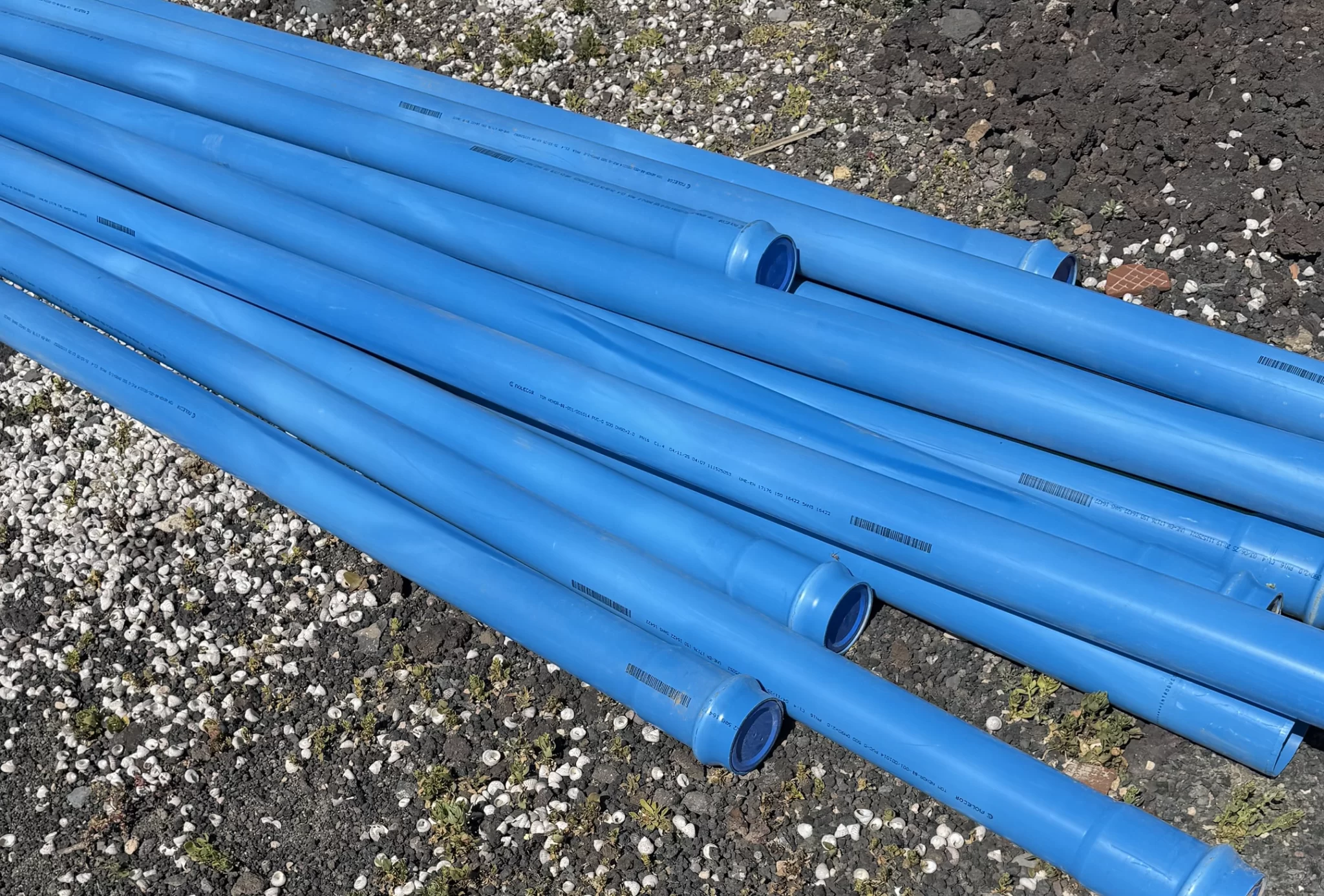
The more valuable finding was what the survey correctly rejected. Linear features crossing the carriageway, consistent with buried service ducts or trench backfill, produced their own repeatable thermal separation from the surrounding asphalt of roughly 0.7 to 0.8 degrees. They were measurable, consistent and entirely real, and they were not leaks. They were classified as infrastructure because they showed no plume and no migration, presenting instead as a straight bounded line consistent with a construction feature. Any method that flags those as candidates will drown a network operator in false positives, and the ability to set them aside on stated evidence is what makes the rest of the findings worth reading.
Adjacent open volcanic ground, with sparse vegetation and exposed lapilli, produced no pattern that could confidently be attributed to leakage. Rather than report that as a clear result, it was recorded as non-diagnostic for this application, because uneven natural ground of this kind carries too many competing thermal explanations to support a confident negative.
The Real Deliverable Was the Protocol, Not the Leak
The commissioning authority already knew where that leak was. What it did not have, and what the exercise was actually built to produce, was a written, proprietary survey protocol calibrated to this class of ground and climate, with its performance characterised and its failure modes documented.
That document fixes everything a repeatable survey depends on and leaves nothing to the judgement of whoever happens to be holding the controller: flight altitudes and the ground sample distance each one yields, overlap and gimbal angle, the emissivity and reflected apparent temperature to be applied and the method for establishing them on site, the palette and thermal span used during triage, the environmental limits at which capture is postponed, and the two-time-of-day strategy with the reasoning behind each window. The altitude comparison went into it as a finding: low altitude is the analytical dataset, medium altitude is context only, and the highest altitude was reported as not diagnostic for leak detection, which is exactly the sort of conclusion a proof of concept exists to produce.
It was written from the outset to be transportable. The structure separates data collection from interpretation, so a competent local operator captures to the protocol in their own territory while the certified Level 3 analysis and reporting is carried out against that dataset. The value of that split is practical rather than theoretical: it means a survey can be delivered in a country the thermographer has never stood in, without the certification integrity of the report depending on their physical presence, and it means the marginal cost of extending into a new territory is a trained operator rather than a travelling specialist.
The territories it was designed for are the ones where the conditions are hardest and the problem is largest. Arid and volcanic ground of this kind is common across southern Europe, the Atlantic islands and much of Africa, and those are also the regions where water scarcity makes losses from a distribution network economically and politically significant rather than merely inconvenient. A protocol proven in high-porosity volcanic soil under a strong solar load transfers to those conditions far better than anything written for a temperate climate. Adoption in further European and African markets is the intended path for this work, and the calibration exercise described here is what makes that a credible proposition rather than an ambition.
What the exercise established, in practical terms:
- That a leak at this depth in this ground produces a surface signature the method can resolve, and roughly how large that signature is.
- That low altitude is not optional, and that coverage gained by flying higher costs more than it returns.
- That the pre-dawn window carries the cleanest signal, with the afternoon pass valuable as a cross-check rather than a substitute.
- That buried services will be seen, will look convincing, and must be discriminated on shape and behaviour rather than temperature alone.
- That open, vegetated and uneven ground should be scoped out at the enquiry stage rather than surveyed and then caveated.
- That the conditions rules have to be enforced rather than noted, because in this climate the ground itself will produce a convincing false result.
Why Test a Method on a Leak You Have Already Found?
It is a fair question, and the answer is the whole point of the exercise. A survey flown over unknown ground that returns nothing tells you either that there is no leak or that the method cannot see it, and there is no way to tell those apart. Flown over a leak that is already confirmed, a null result would have been decisive, and a positive result establishes the size and shape of the signature to look for everywhere else. Characterising an instrument against a known answer before trusting it on an unknown one is ordinary measurement discipline, and on a technique as easy to over-read as thermography it is the difference between a screening tool and an expensive source of false confidence. The protocol written here has since governed leak detection work on ground where nothing had been confirmed in advance, which is the only real test of whether the exercise was worth carrying out.