
Drone Thermography
Flying the Camera Is the Easy Part
Thermal surveys flown from the air across building envelopes, flat roofs, industrial plant, landfill sites and buried services, wherever scale, height or access defeats a handheld camera. Every survey is planned, flown, analysed and reported by the same ITC Level III Certified Master Thermographer, so the person interpreting the data is the person who knows what the camera was told and what the conditions were. Survey, analysis and reporting, nationwide.
Flying the Camera Is the Easy Part
A thermal camera on a drone will produce an image of almost anything you point it at. Whether that image means what somebody says it means is a different question, and it is largely settled before the picture is taken: by the conditions on the day, by what the camera was told about the surface it was looking at, and by whether the person reading it can tell a real thermal anomaly from a reflection.
Drone Media Imaging flies thermal surveys where scale, height or access defeats a handheld camera, across building envelopes, flat roofs, industrial plant, landfill sites and buried services. The survey is planned, flown, analysed and reported by the same person, an ITC Level III Certified Master Thermographer, so the judgement applied to the data belongs to somebody qualified to apply it rather than to somebody who was hired to fly.
What the Air Gives You That the Ground Cannot
Coverage, height, and the whole asset in one set of conditions
Ground-based thermography is the right tool for a great many jobs, and where a surveyor can stand in front of the thing and get a clean, square view of it, that is what should happen. The case for flying is specific, and it comes down to three things.
Scale. A large distribution roof, a housing block, a process plant or a closed landfill cell cannot be covered on foot in any sensible time. A survey assembled from dozens of ground-level views taken across several hours is comparing surfaces that were at different temperatures when each image was captured, which quietly undermines the comparison the survey exists to make. From the air the whole asset is covered inside one window of conditions, and that is what allows one part of it to be read against another.
Height. Anything above the second floor is difficult to see properly from the ground and impossible to see square on. A camera pointed steeply upwards is reading the surface at an oblique angle, where reflection rises sharply and the measurement degrades with it. Flown level with the surface, the camera looks at it perpendicular, which is the condition the measurement assumes in the first place.
Access. Scaffold, mobile platforms, rope access and shutdowns are slow to arrange and are frequently the largest single line in the cost of a survey. Flying removes most of that, and on a live site it removes the need to stop the process simply to look at it.
What comes back is the whole asset, surveyed under one set of conditions, at a viewing angle the physics actually supports.
At a glance
What drone thermography is for, and what decides whether the survey is worth having.
- Airborne thermal survey where the ground is the wrong place to stand: large roofs, tall elevations, live industrial plant, landfill cells and long runs of buried service.
- Flown, analysed and reported by an ITC Level III Certified Master Thermographer. Capture and interpretation are not split between two people.
- Radiometric, not merely thermal. Emissivity and reflected apparent temperature are set on site against the real surfaces and recorded, so the temperatures in the report can be traced to the assumptions behind them.
- Conditions decide validity. Each application has a window it must be flown in, frequently after dark or before dawn, and the window is not negotiable because the diary is.
- Survey, analysis and reporting only. Findings carry a severity and a consequence; the remedial work stays with your own contractors.
- Applications: building heat loss, flat roof moisture, landfill subsurface fire, buried pipe and district heating leaks, industrial condition monitoring and ongoing fire observation.
The camera records surface temperature. Everything useful comes from knowing what that means.
What We Survey From the Air
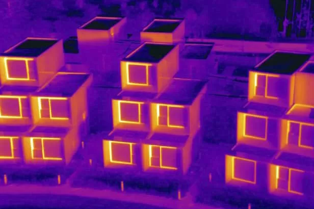
The Survey Is Only Worth What the Analysis Is Worth
Capture is a flying skill, interpretation is a certification
There is an awkward gap in the thermal imaging market. Flying a drone with a thermal camera is a licensed and learnable skill, and there are many operators who do it competently. Reading what the resulting radiometric data actually means is a separate discipline with its own certification structure, and the two are often not held by the same person.
That matters because thermal images are easy to misread. A cool patch on a roof can be wet insulation or it can be a puddle. A warm band on an elevation can be a thermal bridge or it can be the sun that was on it two hours ago. A hot component can be a developing fault or it can be a polished surface reflecting something else in the yard. Telling those pairs apart is not a matter of looking harder at the picture. It depends on knowing what the camera was told, what the conditions were doing, and how the material behaves.
At Drone Media Imaging the same person plans the survey, flies it, analyses the data and writes the report. That person is Steve Fisher, an ITC Level III Certified Master Thermographer, the senior of the three thermographic levels and the one that carries responsibility for procedure and interpretation rather than for data collection alone.
The practical consequence is that the decisions which govern the result are made by somebody who understands their effect, on site, while there is still time to act on them. A survey flown in the wrong conditions cannot be repaired in the office afterwards, and the most expensive version of this problem is the one nobody notices until the findings are challenged.
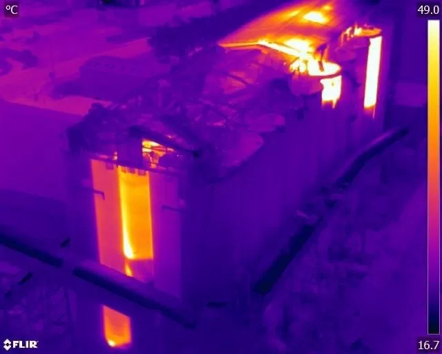
Thirteen Months of Thermal Monitoring After a Grain Terminal Explosion
A dust explosion and fire at a port grain terminal left burning material inside silos that nobody could approach. Thermal monitoring began two days later and ran for thirteen months, at first three flights a day, seven days a week, from outside a fifty metre exclusion zone. Calibrated temperature data went to the crisis management team throughout the response.
What Decides Whether a Thermal Survey Is Valid
Almost everything that separates a defensible thermal survey from a folder of colourful pictures is decided before and during the flight, not afterwards.
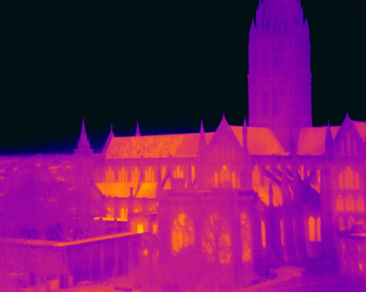
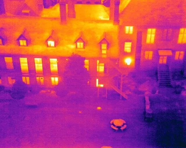
Conditions. Thermography detects differences in surface temperature, so something has to be driving a difference. On a building envelope that is a meaningful temperature difference between inside and outside, which is why envelope surveys belong in the heating season rather than in June. On a flat roof it is the heat the roof took in during the day escaping again after sunset, which is why those surveys are flown after dark. On buried services it is the contrast between the ground and whatever is moving through the pipe. Wind strips the surface signal away, rain and standing water mask it, and direct sun loads surfaces unevenly and produces convincing anomalies that have gone by the next morning. Every application has a window, and the window does not move because the diary would prefer it to.
Radiometric setup. A thermal camera does not measure temperature. It measures radiation arriving at the sensor and converts that into a temperature using values it has been given, principally the emissivity of the surface and the reflected apparent temperature of everything around it. Get those wrong and the numbers come out wrong, confidently and to one decimal place. They are established on site against the actual materials being surveyed and recorded alongside the data, so any figure in the report can be traced back to the assumptions that produced it.
What the survey is being asked to do. Some questions need only a reliable yes or no about whether an anomaly exists and where it is. Others need a defensible number attached to it. Those are different jobs with different evidence requirements, and the difference is settled at the enquiry rather than discovered in the report.
Reporting. Findings are described with a severity and a consequence, so a reader can separate what needs attention this week from what needs watching over a season. Drone Media Imaging provides survey, analysis and reporting. The remedial work stays with your own contractors, which is the correct separation and part of why the findings can be relied upon.
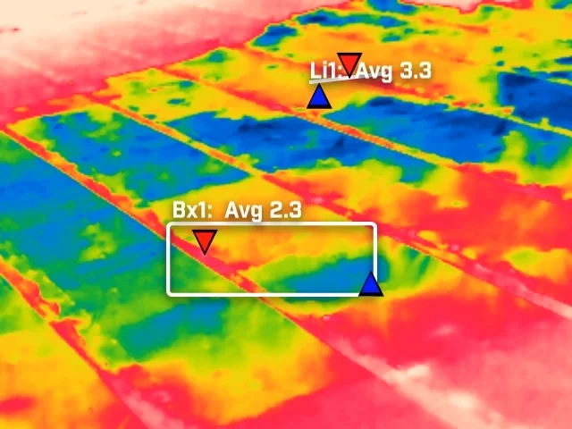
Thermographic work divides into two kinds, and knowing which one a job actually needs prevents most of the disappointment in this field.
Qualitative thermography compares one part of a surface with another and reports the difference. It answers where, and it answers whether: where the insulation is missing, whether this section of roof is behaving differently from the rest, where the pattern of loss sits across an elevation. It does not depend on the absolute temperature being exactly right, because the comparison is internal to the image. This is the basis of building envelope survey work, and it is what EN 13187:1999 addresses, the qualitative detection of thermal irregularities in building envelopes.
Quantitative thermography attaches a defensible number to a surface: this connection is running at this temperature and the one beside it at that. It is what condition monitoring and severity classification rest on, and it is considerably more demanding, because every error in emissivity, reflected temperature, distance, atmosphere and viewing angle now lands directly inside the figure being reported.
Most surveys are a mixture of the two. The sweep across a large asset is qualitative and finds the candidates. The specific measurement of those candidates is quantitative and grades them. Trouble arrives when a survey is sold as one and read as the other, most commonly when a qualitative image is used to argue about a precise temperature it was never set up to support.
- Thermographic inspection, analysis and reporting are conducted by Steve Fisher, ITC Level III Certified Master Thermographer (Infrared Training Centre; Certification #205722059), practising in accordance with the frameworks of ISO 18436-7:2014, ASNT SNT-TC-1A and ANSI/ASNT CP-105, and BINDT CMGEN Appendix B (UK training governance).
- Inspection methodology is aligned with EN 13187:1999 for building envelopes and IEC 62446-3:2017 for solar photovoltaic installations, as applicable to the survey being carried out.
- Emissivity and reflected apparent temperature are established on site against the actual surfaces surveyed and recorded with the data, so that any reported temperature can be traced to the parameters behind it.
- Flight operations are conducted under a Civil Aviation Authority Operational Authorisation held against the PDRA-01 standard scenario, with a General VLOS Certificate (GVC) and an A2 Certificate of Competency.
- Drone Media Imaging provides survey, analysis and reporting. No remedial, corrective or installation work is offered or implied.
Tell Us What Needs Surveying, and What You Need to Settle
Send us the site, the asset and the question the survey has to answer, whether that is heat loss across a housing block, water somewhere in a flat roof, a hot spot on a landfill cell or plant you cannot shut down in order to inspect. You will get a fixed price back with the deliverables set out in plain words, an honest answer about anything thermography cannot tell you, and the conditions window the survey needs to be flown in. If the matter is time-critical, say so at the enquiry, because on this work the window usually matters more than the diary.



