
Drone Photogrammetry
How a Set of Photographs Becomes Something You Can Measure
Photogrammetry is the technique behind every drone map: thousands of overlapping photographs reconstructed into a three-dimensional model of a site, from which a corrected, measurable image is produced. This page explains how it actually works, what separates a survey-grade result from a merely sharp one, and where the method stops being able to help. Flown across the South East and nationally since 2016.
How a Set of Photographs Becomes Something You Can Measure
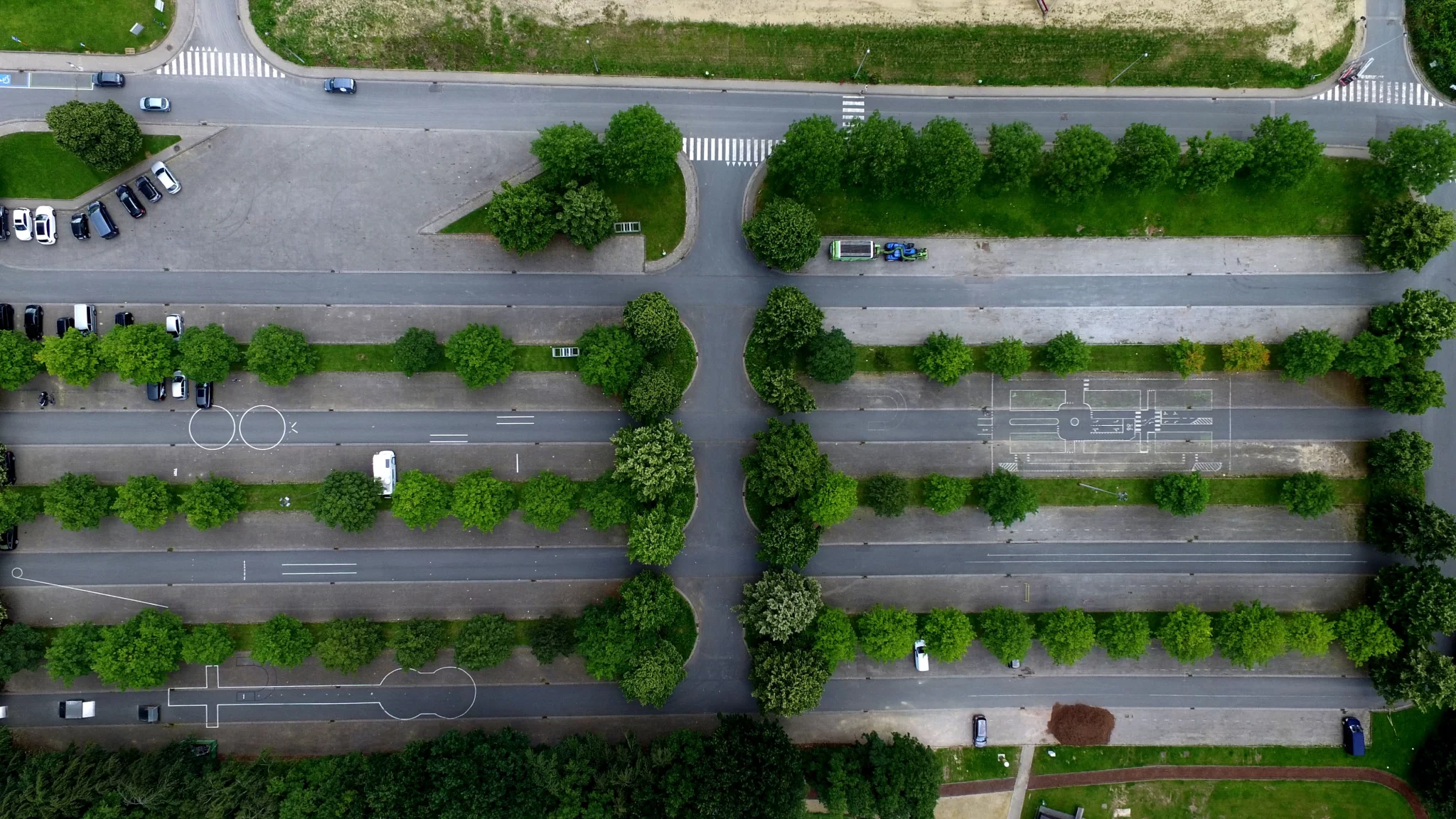
Photogrammetry is measurement from photographs. Fly a site so that every point on the ground appears in a large number of overlapping images taken from different positions, and the geometry of where those images were taken can be recovered, along with the three-dimensional shape of everything they saw. From that model comes the orthomosaic: a single image of the site, corrected so that every part of it is viewed as though from directly overhead, and therefore measurable.
It is an old technique that became cheap. The mathematics predates aviation, the aerial version was flown from aircraft for most of the twentieth century, and what changed is that a drone can now do at small scale, in an afternoon, what used to need a survey aircraft and a fortnight. What has not changed is that the quality of the answer depends far more on how the flight was designed and controlled than on the camera, which is the part most buyers are never told.
What Happens Between the Flight and the Map
Four stages, and each one can quietly spoil the answer
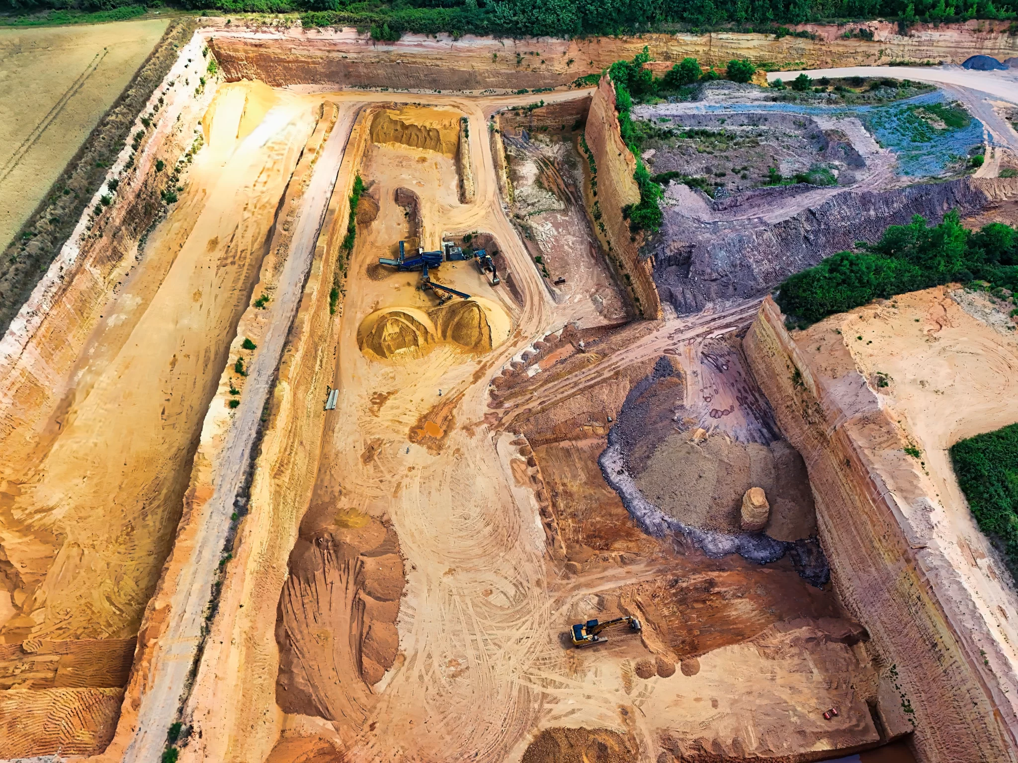
Capture. The aircraft flies a planned grid at a fixed height, taking an image every few metres so that each point on the ground appears in a great many photographs from different positions. Height sets the resolution, overlap sets whether the reconstruction will work at all, and both are derived from what the client actually needs to see rather than from a default. A modest site routinely produces a few thousand images.
Matching. The software finds features that appear in more than one photograph, thousands of them per image, and works out which are the same physical point seen from different angles. From those correspondences it solves, simultaneously, where every camera was when it fired and where every matched point sits in three dimensions. This is the bundle adjustment, and it is the heart of the technique.
Densification and surface. That sparse skeleton is then filled in to a dense point cloud, millions of measured points describing the surface, from which the height models are built. Where the ground is visible the terrain can be separated from what is standing on it; where it is not, it cannot.
Orthorectification. Finally the original photographs are reprojected onto that surface, which removes the lean that makes an ordinary aerial photograph unmeasurable, and blended into one continuous image. That reprojection is why an orthomosaic is a measurement and a photograph is not, and it is only as good as the surface model underneath it.
At a glance
What photogrammetry is, what it produces, and what decides whether the result is any good.
- Measurement from photographs. Overlapping images from many positions are used to reconstruct the three-dimensional shape of a site, and the products come from that model.
- The outputs are the orthomosaic, surface and terrain models, dense point clouds, contours and volumes, all from a single flight.
- Overlap is the specification that matters most. Every point needs to appear in many images from different angles, which is why a small site still runs to thousands of photographs.
- Survey grade is not a camera setting. It comes from corrected positioning, measured ground control and independently withheld check points, and without those the result is a picture rather than evidence.
- The method models only what it can see. No bare ground under closed canopy, nothing underground, nothing under cover.
- Flown across Sussex, Surrey, Kent and Hampshire and nationally, and practised here since 2016.
The flight design and the control decide the answer. The camera is the least interesting part of it.
What the Technique Gets Used For
What Makes Photogrammetry Survey Grade
Nothing to do with the camera, everything to do with the control
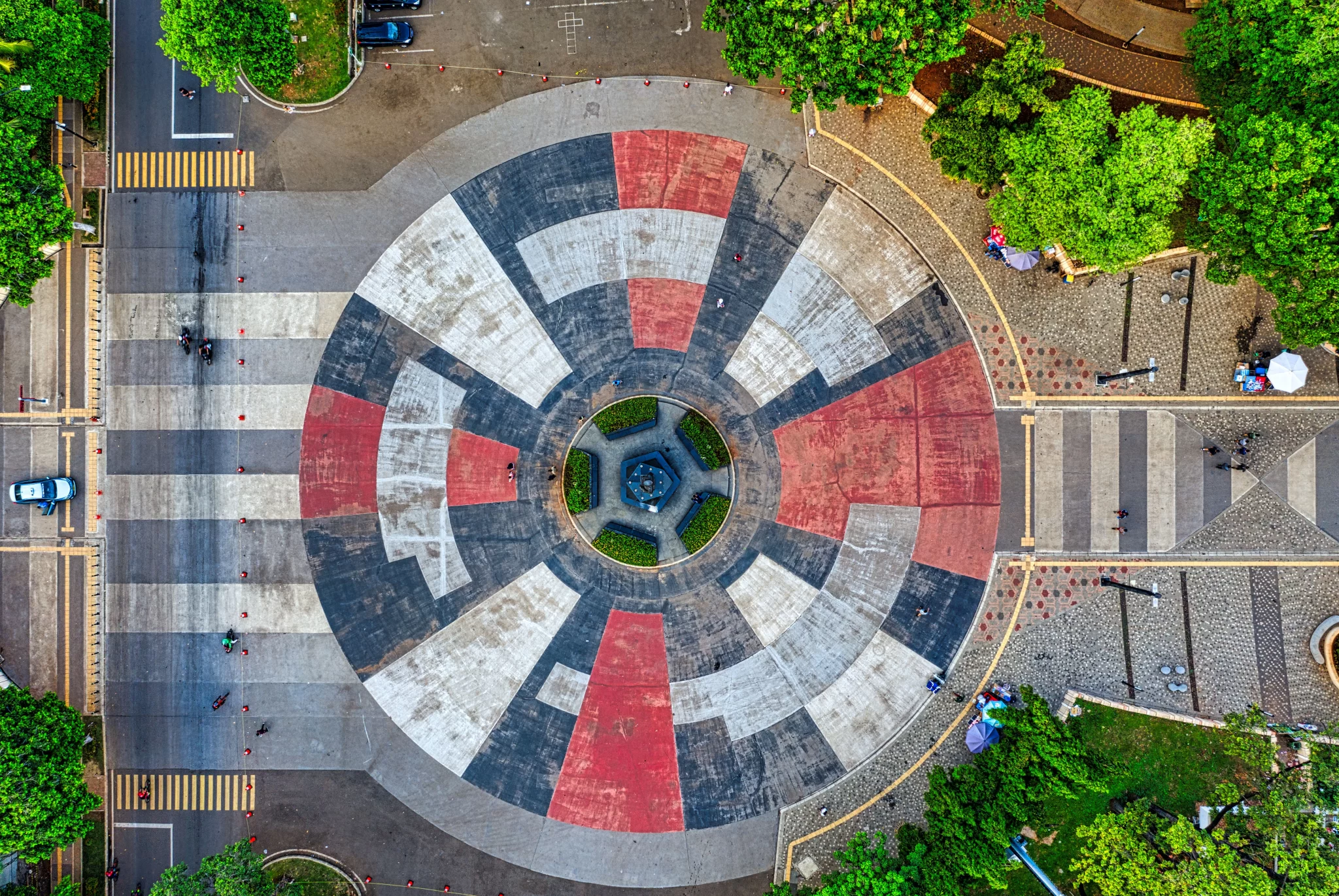
“Survey grade” is used loosely enough to be nearly meaningless, so it is worth saying what actually produces it. It is not resolution, and it is not the aircraft.
Corrected positioning. A satellite position on its own is good to a few metres. Comparing the aircraft’s observations against a receiver sitting still on the ground removes most of the shared error and brings each camera position to within a couple of centimetres, either live during the flight or by recomputing afterwards from the raw logs. Recomputing afterwards is the more robust of the two, because it survives a lost radio link and can be re-run if anything is ever questioned.
Measured ground control. Points on the ground whose coordinates are surveyed independently and which can be identified in the imagery. They anchor the model to the real world and carry it onto the delivery datum by measurement rather than by trusting a transformation.
Independently withheld check points. Measured the same way, then deliberately kept out of the calculation. The model is built without them and only then compared against them. Control points steer the model, so of course the model agrees with them. Only a point the model never saw can tell you the truth, and the difference between the two is the accuracy figure.
Without those three, photogrammetry still produces a perfectly good picture. What it cannot produce is evidence, and the distinction is the whole of the Ortho against Survey decision described on the mapping pillar.
A Hundred Acres Reconstructed From the Air, Twice
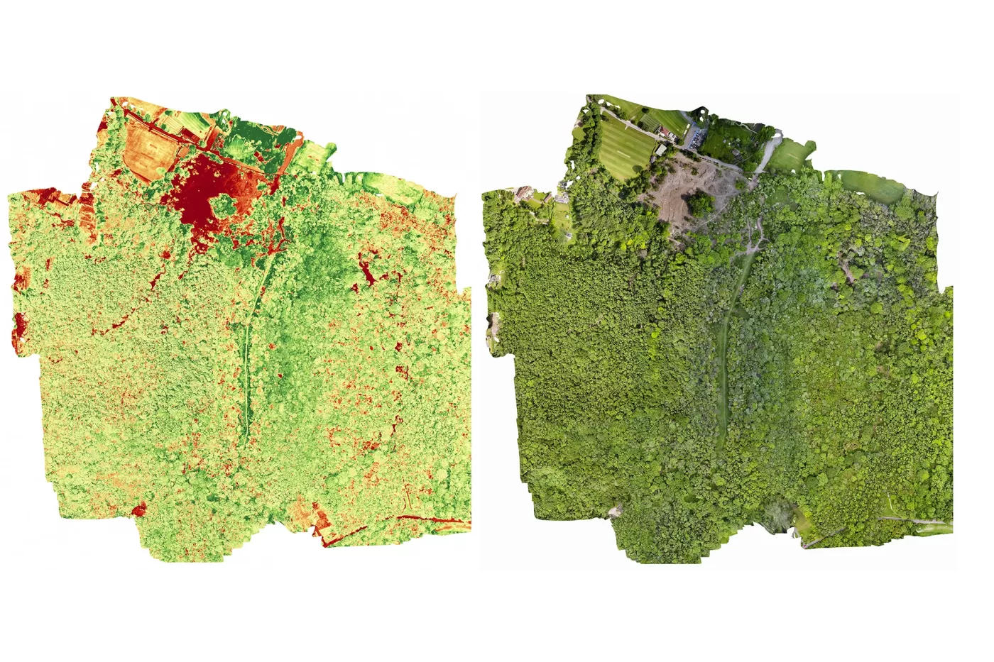
A hundred acres of woodland captured with structured flight planning under controlled imaging conditions, producing an orthomosaic, a surface model and a canopy dataset from several thousand images. The block was then flown a second time after a major felling operation, to the same specification, so the two reconstructions could be compared directly rather than merely looked at side by side.
Where We Fly It, and How Long We Have Been Doing It
Drone Media Imaging has been flying photogrammetry since 2016, which is long enough to predate most of the industry as it now exists and long enough to have made the mistakes on our own time rather than on a client’s.
The base is in the South East, and a large share of the work is within reasonable reach of it: Sussex, Surrey, Kent and Hampshire, where a site can usually be flown without an overnight and without travel appearing as a line on the quotation. Beyond that the work is national, and international for the thermographic side of the business, so distance changes the logistics rather than the answer.
What experience actually buys on a photogrammetry job is not better flying, it is better decisions before the flight. Knowing that a site with a live access road needs its control placed where a lorry will not flatten it. Knowing which sites will not hold a correction signal and planning to log raw throughout instead of hoping. Knowing when a client asking for a topographic survey actually wants a picture, and when a client asking for a picture is going to need to prove where it was.
The method is written down rather than remembered. Every job runs to the same documented sequence, with recorded stops before flying, before leaving site, before processing and before delivery. That is unusual for a single-operator business and it is the reason the same site flown a year apart produces two surveys that can be subtracted from one another rather than two that merely look similar.
The instinct is that a map needs enough photographs to cover the site once. In photogrammetry it needs enough that every point on the ground is seen many times over, from meaningfully different positions, and that is a completely different quantity.
The reason is that depth comes from parallax. A single photograph cannot tell you how far away anything is. Two photographs of the same point taken from different places can, because the point shifts against its background by an amount that depends on its distance. More views of the same point, from more angles, mean a better-conditioned solution and a more reliable position for it.
So a survey flies with the images heavily overlapping both along each line and between adjacent lines, and the aircraft ends up photographing every part of the site many times over. That is why an area you could walk across in two minutes still generates thousands of frames, and why flying lower for finer resolution multiplies the count rather than merely increasing it.
When overlap is inadequate, the failure is rarely obvious. The model still builds. What happens instead is that thin areas reconstruct weakly, the surface goes soft or develops gentle warps, and the errors are largest exactly where the coverage was thinnest, which is usually the edges of the site. It looks like a map, and parts of it are quietly unreliable.
Which is why overlap is set from the ground type and the site rather than from a default, and why the image count is reconciled against the camera’s own event log before any processing begins. A shortfall found at the desk on the day of the flight is a return visit. The same shortfall found after delivery is an argument.
- Flight parameters, including height, resolution and overlap, are derived from a stated requirement for the job rather than from a default, and are recorded so they can be reproduced on a later visit.
- Image counts are reconciled against the camera’s own event log, and satellite logs against flight times, before any processing is carried out.
- Where positional accuracy is sold, it is evidenced by independently measured check points withheld from the adjustment and reported as a measured result for that survey. Where it is not sold, no absolute position is claimed.
- Deliverables are supplied on British National Grid (EPSG:27700) via the Ordnance Survey OSTN15 transformation, with heights on Ordnance Datum Newlyn via OSGM15 where orthometric heights are required, or in a stated local system.
- Flight operations are conducted under a Civil Aviation Authority Operational Authorisation held against the PDRA-01 standard scenario, with a General VLOS Certificate (GVC) and an A2 Certificate of Competency.
- Drone Media Imaging provides survey, mapping and reporting services. No chartered surveying designation is held or implied, and vectorised linework, CAD and BIM deliverables are not offered.
Tell Us the Site and What It Has to Prove
Send us the site location, roughly the area, and the smallest feature that has to be identifiable in the result. If the position has to be defensible, say so, because that decides whether the day includes ground control. You will get a fixed price back with the deliverables and the claim written into it in plain words, and a straight answer if photogrammetry is the wrong tool for what you are actually trying to find out.



