Drone solar panel inspection
Using Drone Thermography for Building Surveys

Thermal imaging cameras can turn the infrared radiation reflected off by all objects into a picture which presents this information visually. This can have so many applications.

  • Insulation Inspection
  • Solar Panel Inspection – either domestic or commercial
  • Identifying Heat Loss and Thermal Bridging
  • Roof Inspections
  • HVAC Inspections
  • Search and Rescue
  • Electrical Equipment Assessment

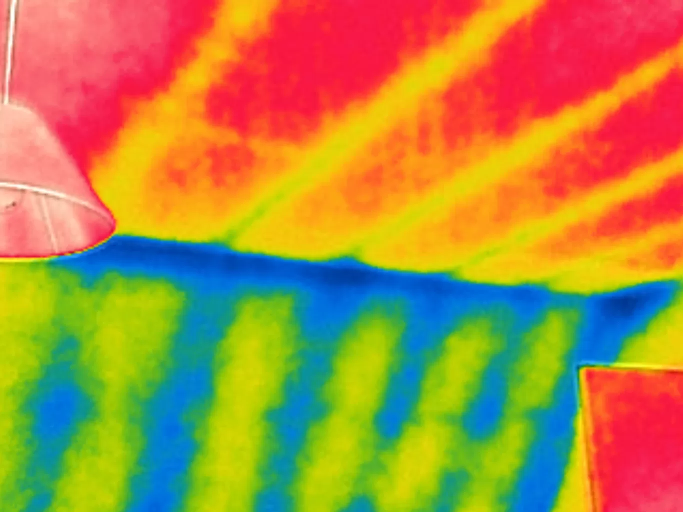
Contrary to many movies, a thermal camera can’t be used to see through walls which means they are of no use in spying on your neighbours (and we only mention this because have been asked for this in the past!).  In fact, a thermal imaging camera captures the heat or infrared signature that is reflected from a surface.

While anyone is capable of taking a picture with an infrared camera, the skill is in doing so under the right conditions in order to obtain an accurate picture and results as desired.

For example, an image designed to assess insulation efficiency must be taken under the right conditions – after dark, with heating inside the building creating a difference in temperature of at least 10°C with dry conditions and low wind.  An image designed to examine a solar panel must be taken when it is operating at its maximum, on a clear day with the sun at its height.  Attempting to capture a thermal image under the wrong conditions can lead to misleading results and potentially unnecessary remedial works.

Drone Media Imaging are qualified thermographers which means that we have undergone the necessary training to understand both the required conditions to capture the image and how to interpret the resulting data to give you a complete and accurate picture.

On top of this, we have invested in the highest specification thermal camera to provide the very best quality in terms of image capture.   We are CAA accredited and fully insured commercial drone pilots to allow us to put our cameras in the sky to carry out inspection work without the necessity or expense of scaffolding or elevated platforms.

Drone Thermography allows use to create an infrared image map of areas of any size – from smaller domestic properties through to solar farms covering acres.

Just contact us to discuss your requirements and we are happy to help with your thermal imaging needs across the UK.

Drone Media Imaging

CAA Certified with Enhanced OSC Permissions

Blog Subject

UK Thermography Association Member Near Me?
Approved and Certified Thermographer
blog tags
Get a Quote First

Expert Infrared Inspections for Accurate Thermal Assessments

Need professional thermographic analysis for your project? Our certified experts use the latest infrared technology to deliver precise results. Contact Drone Media Imaging today for expert thermal imaging services.

Get a Quote First

related posts

  • © 2019 - 13 Months of Grain Store Fire Monitoring

    Thermal Fire Monitoring Following a Grain Store Terminal Explosion

    Grain Store Explosion and Year-Long Fire – July 5, 2020 – Tilbury Port, London On July 5, 2020, a series of events (possibly by a spark) triggered a large dust explosion and a subsequent fire at the Grain Store Terminal at the Port of Tilbury in London. This was a serious event that required the attention of a large-scale emergency response to get the subsequent grain fire under control and avoid additional explosions. No one was seriously hurt, which is nothing short of a miracle given the number of people on the scene and the amount of reinforced concrete and debris thrown high into the sky before raining down on the surrounding buildings.

    Traditional firefighting methods and techniques are ineffective in the case of grain storage fires. Using water to extinguish the inferno is ineffective with grain and dust fires, and the added weight might have caused a catastrophic structural collapse, exacerbating an already challenging situation. As a result, London fire teams were on the scene for days while a proper fire strategy and plan was developed and implemented, with staff always remaining on-site to monitor the situation over the following weeks.

    Throughout this early period, there was always the possibility of more explosions and the fire spreading since the grain stored in the linked silos generates dust that may ignite if the temperature is high enough. Drone Media Imaging was contracted to fly thermal imaging flights to collect temperature data to estimate fire spread and track fire management efforts over time. For instance, were the temperatures rising, falling, or remaining constant?

    We began operations on July 7, 2020, flying three flights each day, seven days a week initially, to compare temperatures and report back to crisis management teams and emergency service gold commanders. We eventually completed our thermal imaging missions one year and a month after the initial Grain Store explosion in late August 2021! While not all of the silos were full with grain, many were, and several were burning at temperatures far beyond 800°C. Before the fire could be quenched, the building had to be entirely demolished. Temperatures more than 80°C were still being recorded in the grain that remained on the ground after demolition 13 months later.

    Gaining safe access to the terminal to fly was not without difficulty, as emergency services had imposed a 50m exclusion zone surrounding the terminal due to the possibility of additional explosions. As a result, our risk assessments and method statements had to be developed specifically for this circumstance and rigorously tested to assure both safe drone flights and the most accurate thermal data gathering at this vital juncture.

    We continued to provide the Port of Tilbury London and the accompanying emergency services with daily and weekly calibrated temperature measurements that documented the progress of the grain store fire over 13 months. As thermal infrared aerial specialists, we provided data in the form of detailed reports, thermal imaging, RGB photographic and video footage.