
Caterham School Photogrammetry of Forest Trees
Surveying for Chalara Fraxinea – Ash Dieback
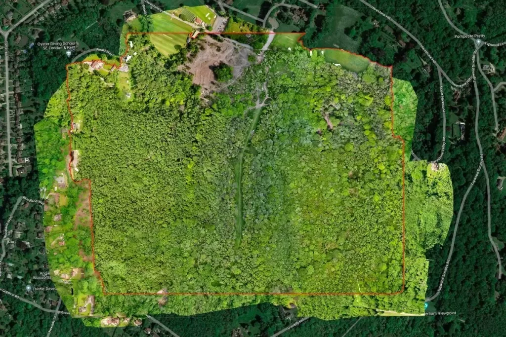
Last year, we were asked by Caterham School to survey and map their school forest known as Old Parks Wood. Ash trees within the wood were suffering from Chalara Fraxinea (Ash Dieback) a disease which has the potential to kill off 80% of the ash trees in the 45-acre wood and once dead, would quickly become dangerous to wildlife and other users of the woods, including the school pupils.
The mission was to map the forest canopy by drone using photogrammetry survey techniques so that the school could get a full understanding of the degree of diseased trees that were present, and then subsequently put in place a management plan in conjunction with the Forestry Commission, Natural England and the local council.


Project Background
In 2014 the school had bought approximately 140 acres of Old Park Wood – partly to protect it from the threat of development but also to secure its long-term future as a biodiverse environment and a resource to be enjoyed by all of the community. The school itself uses the woodland extensively to enhance the education of its pupils in terms of providing additional academic activities and skill enhancement programmes and they also open the area up to other clubs and societies to do the same.
Photogrammetry Surveying
So, the forest is a really important area for them but one that was under threat after years problems and by the prevalence of the ash dieback. The school have a dedicated forestry team who decided that action was necessary to secure this valuable area’s future and so their first step was to invite the Forestry Commission to get involved. This is where Drone Media Imaging came in, as we provided a detailed and calibrated Digital Surface Models (DSM) and Digital Terrain Models (DTM) as well as an orthomosaic map of the area from the sky to give the team in charge the data that they needed to create a package of solutions that was both successful and cost effective.

What is an Orthomosaic Map?
An orthomosaic map is a photogrammetrically orthorectified image mosaicked created from a structured nadir image collection, where the geometric distortion has been corrected to produce a seamless mosaic dataset or map.
What are Digital Surface Models (DSM)?
A Digital Surface Model, or DSM captures a surface—including natural and human-made structure such as vegetation and buildings. They illustrate reflective surfaces of all features elevated above the ‘bare earth’.
What are digital terrain models (DTM)?
Digital Terrain Models (DTM) sometimes called Digital Elevation Models (DEM) is a topographic model of the bare Earth that can be manipulated by computer programs. The data files contain the elevation data of the terrain in a digital format which relates to a rectangular grid. Vegetation, buildings and other cultural features are removed digitally – leaving just the underlying terrain. DTMs are used especially in civil engineering, geodesy & surveying, geophysics, geography and remote sensing, in short, DSMs represent the Earth’s surface and all objects on it.
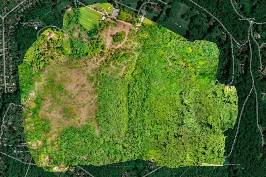
Armed with the collected photogrammetry data and the specialist knowledge of the team in charge, a plan was created to attack the worst affected areas and save the woodland. A felling licence was granted, and extensive works were then carried out.
Felling is paused during nesting season and so, a year later, we were invited back to repeat the process to create an updated DSM/DTM and Orthomosiac maps, to capture the progress made. This will assist the team in planning and carrying out the next phase of the project which is replanting 70,000 new oak, birch, hazel, beech and wild cherry saplings to establish the restoration process.
As well as helping to create a detailed and accurate plan of some inaccessible areas, the detailed mapping service that we provided has helped the management team stay on track with their target of keeping the project carbon neutral.
The head groundskeeper John Dodwell said, “The felled lumber wood is turned into logs and charcoal, which we sell to the community, while the diseased and unusable wood is chipped and sent to a renewable energy biomass power station in Kent, where it’s used to generate electricity. Our felling licence was issued to us on condition that we replace the trees that have been removed, and the new ones will be absorbing carbon throughout their lifetime.”
This focus on the long term doesn’t stop there, with 20% of the replanted trees being grown for logs ensuring the sustained financial viability of the woodland and ensuring that it can be maintained well into the future.


Drone Media Imaging aerial photogrammetry services are designed to provide detailed mapping of large areas of land in a way that would be virtually impossible from ground level or at the very least an extremely time consuming and expensive process.
Using our drone fleet, surveying equipment, qualified operators, and specialist training, we are able to provide 2D and 3D models of areas to assist you in many planning and project management exercises. Just get in touch to discuss your project and how drone mapping can assist you.


Aerial Photogrammetry
We are certified and approved drone pilots and work throughout the UK to provide both aerial and ground based photography, video/filming, photogrammetry and thermography services. Fully insured and certified by the CAA with enhanced permissions for day and night time flights.