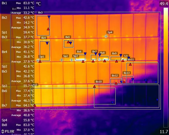
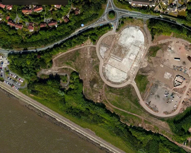
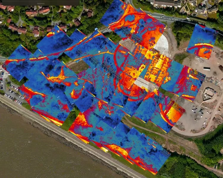
Old 1950 Landfill Site Thermal Imaging Inspection
The build-up of gases such as methane in landfill sites is a common problem for councils & landowners, particularly if the land is identified for development.
Drilling boreholes to relieve the gas build-up, along with ‘flash burning’ the methane is a significant undertaking, so the identification of the heat spots and potential underground fires is critical.
The use of drones to complete the survey and land inspection using thermal imaging payloads is a new technological development and access to all through Drone Media Imaging. Using the latest in drone thermal imaging camera sensors such as the Zenmuse XTr radiometric, we are ready to deploy anywhere in the UK to carry out ground inspections, like the one recently completed at the Festival Gardens in Liverpool.
Below is some of the resulting imagery.


Drone Services Enquiry
Thermography | Inspections | Solar | Photogrammetry
Discover how drone technology can enhance your operations with a free quotation from our experts. Get a Free Quote or Make an Enquiry Today!
related posts
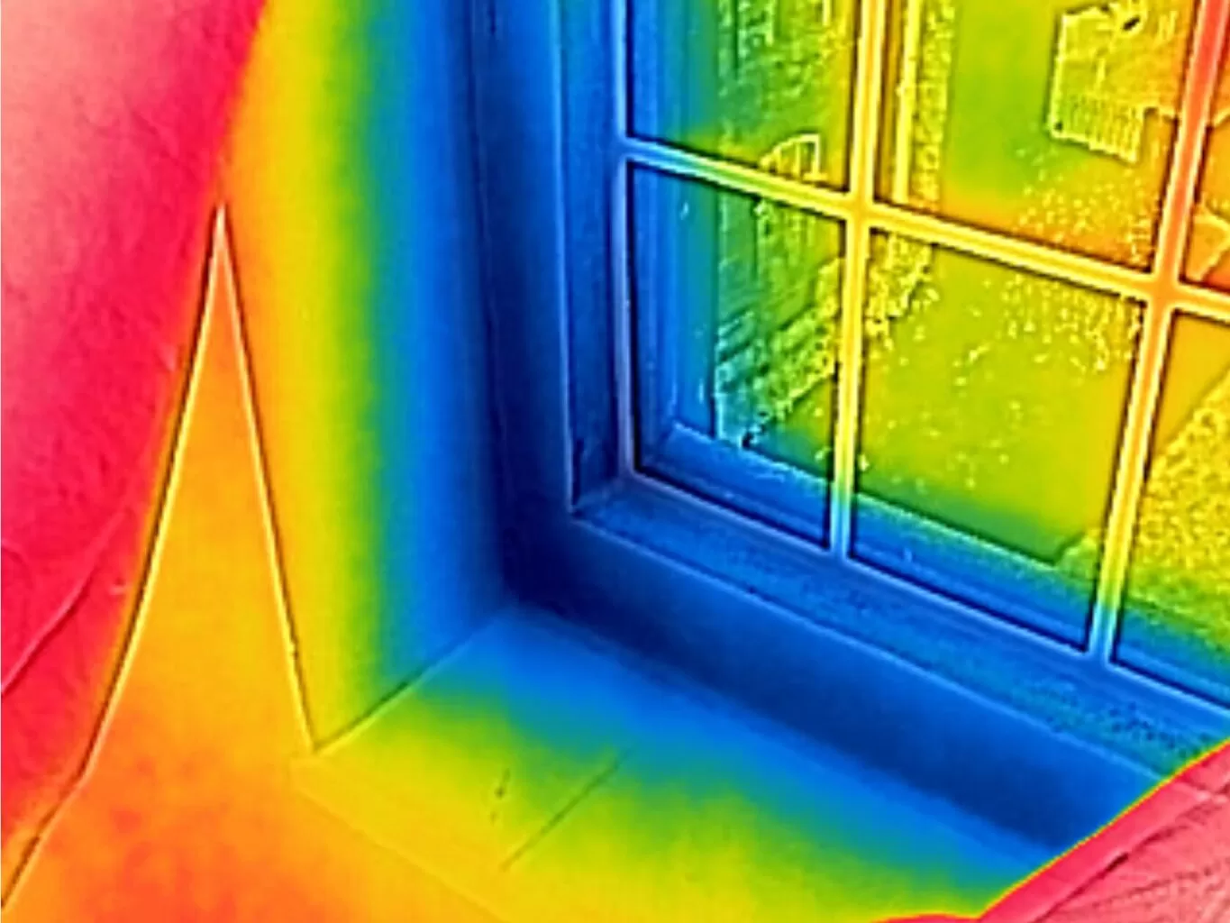
Thermography, a non-invasive technique using infrared imaging, has emerged as a powerful tool in the building industry. It is particularly useful for investigating building air pressure, air flow, and inefficient air leaks. This article explores the application of thermography in these areas, providing valuable insights and practical examples.
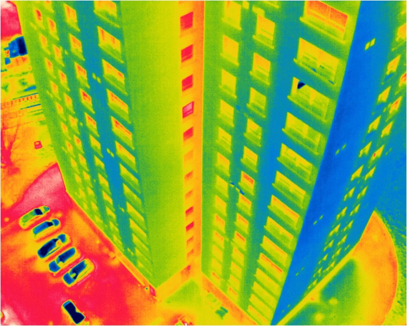
We supported a large thermal inspection project across three residential buildings by providing certified Level 3 thermographic reporting based on drone data collected by the client. Using a protocol we developed, they captured radiometric thermal images, which we analysed remotely to identify heat loss, glazing issues, and roof moisture indicators. This collaborative approach showcases how our clients can carry out surveys independently, while we deliver professional-grade thermographic interpretation and reporting — cost-effectively and without needing site access.