Aerial Thermal Image Applications
For many requirements, thermal imaging from the sky is far more preferable than from the ground. Aerial infrared thermography applications can be divided into two categories. Those where a straight-down view and/or large area view is needed, and those where long distances must be covered in a limited amount of time.
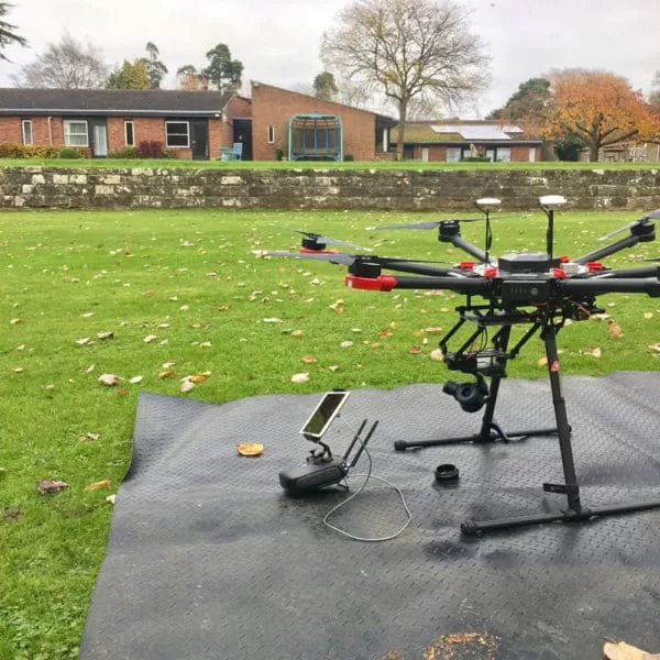
Most aerial infrared imaging is performed at night because daylight solar radiation usually adversely affects the imagery.Drone Media Imaging is qualified and certified by the CAA to fly at night.
“Thanks to the Zenmuse XT from DJI and FLIR, thermal imaging from the air has never been easier. By combining DJI’s unrivalled expertise in flight stability, gimbal technology, and image transmission with the industry-leading thermal imaging technology of FLIR, the Zenmuse XT is the ultimate solution for reliable, rapid-deployable aerial thermal imaging. Capture your thermal images faster, covering large areas, and save them for analysis and reporting.”
Available in 640×512 resolution, the Zenmuse XT has a lens option of 19mm which allows for fine detail and a great range and distance from the subject.
- Roof Moisture Surveys
- Environmental Surveys
- Animal Counts
- Area Thermal Mapping
- Landfill Site Examinations
- Underground Stream System Examinations
- Electrical Power Line Surveys
- Search and Rescue Operations

ENVIRONMENTAL IMPACT SURVEYS
When a liquid is introduced into a body of water (ocean, river, stream, lake) the former can be differentiated between through the use of high-resolution thermal imaging because the temperatures are almost always different. Often these liquids can be followed back to their source.
Some of the uses for this application are:
- Detecting illegal dumping/discharge.
- Tracking pollution such as waste spills or oil spills.
- Monitoring effluents from storm drains and sewage treatment plant discharge.
- Monitoring ground water seepage into rivers, streams and lakes.
- Managing heated water from power plant cooling towers.
- Measuring the amount of fresh water from ground sources that is introduced into an estuary.

Photogrammetry For Roof inspections, Solar Panels, and Hard-To-Reach Assets: A Technical Approach
Photogrammetry for roofs, solar panels, and complex vertical structures requires far more precision than standard terrain mapping. This post from explores why traditional workflows fall short and how operators can use tools such as terrain-following, custom camera profiles, circlegrammetry, and automated vertical scanning to achieve consistent results. Packed with real-world examples and scientific validation, it provides a practical technical guide to improving model accuracy, mission repeatability, and inspection efficiency across challenging commercial environments.Capturing quality photogrammetry data from vertical and elevated structures remains one of the trickier challenges in commercial drone operations. Traditional surveying workflows fail here. Kristaps Brass, Product Owner at UgCS, has spent years working with operators who tackle these missions daily. Solar farms, building facades, communication towers, dam inspections. The pattern is consistent: manual flying burns time and money, and processed models show gaps where critical details should be. This article covers what actually works, based on field-tested methods and real operator feedback.

IEC 62446 Solar String Testing Now Available
Drone Media Imaging now offers certified IEC 62446-compliant solar string testing, delivering complete electrical diagnostics for commercial PV systems. This new service verifies string integrity, insulation, voltage, current, and performance using advanced I-V curve tracing and Fill Factor analysis. Ideal for commissioning, troubleshooting, and maintenance, our testing supports safety, compliance, and ROI assurance. Combined with thermal imaging, we offer a powerful dual-inspection approach. Book today to ensure your solar array is operating safely, efficiently, and within international performance standards.
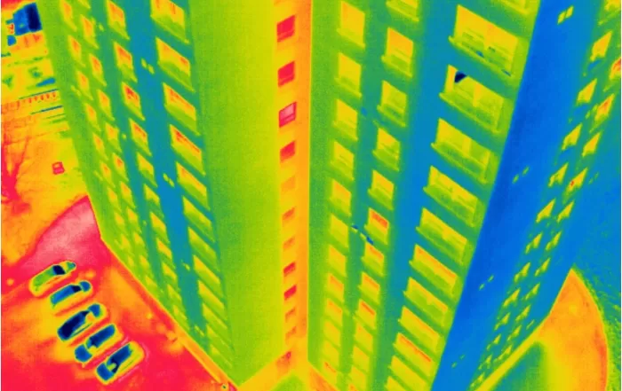
Level 3 Thermography Reporting Project – 3 Multi-Storey Residential Blocks
We supported a large thermal inspection project across three residential buildings by providing certified Level 3 thermographic reporting based on drone data collected by the client. Using a protocol we developed, they captured radiometric thermal images, which we analysed remotely to identify heat loss, glazing issues, and roof moisture indicators. This collaborative approach showcases how our clients can carry out surveys independently, while we deliver professional-grade thermographic interpretation and reporting — cost-effectively and without needing site access.
Drone Services Enquiry
Thermography | Inspections | Solar | Photogrammetry
Discover how drone technology can enhance your operations with a free quotation from our experts. Get a Free Quote or Make an Enquiry Today!