Aerial Photography as a Tool in Commercial Property Management


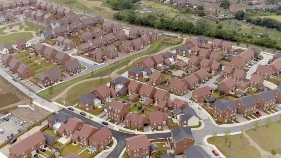
We have been working with this particular asset management company for some months now, providing them with updated photographs of their properties working across the UK. On this occasion, we grouped together these three properties in Nottingham, Coventry and Bury to create a small two day ‘Northern Tour’ to maximise their photography investment with us.
Not all locations are suitable for drone photography as there are strict legal requirements governing where we are able to fly. However all three of these locations met the necessary criteria to allow us to capture aerial photographs and combine these with our mast and ground level photography to provide the most complete picture possible of each of their assets.
Commercial photography can be used for…
Drone Services Enquiry
Thermography | Inspections | Solar | Photogrammetry
Discover how drone technology can enhance your operations with a free quotation from our experts. Get a Free Quote or Make an Enquiry Today!
related posts
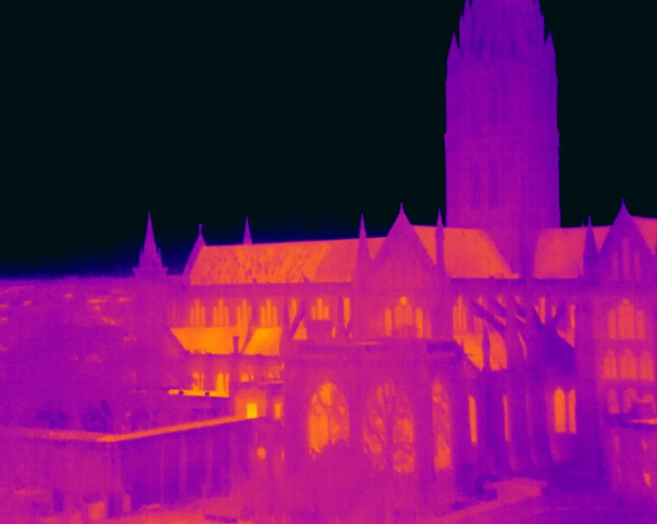
Pinpointing energy loss in buildings involves identifying hidden insulation defects, thermal bridges, and air leaks. A Level 3 Thermographer employs advanced thermal imaging to ensure precise diagnostics and compliance with energy standards, providing property owners with detailed reports for informed energy efficiency improvements and cost savings.
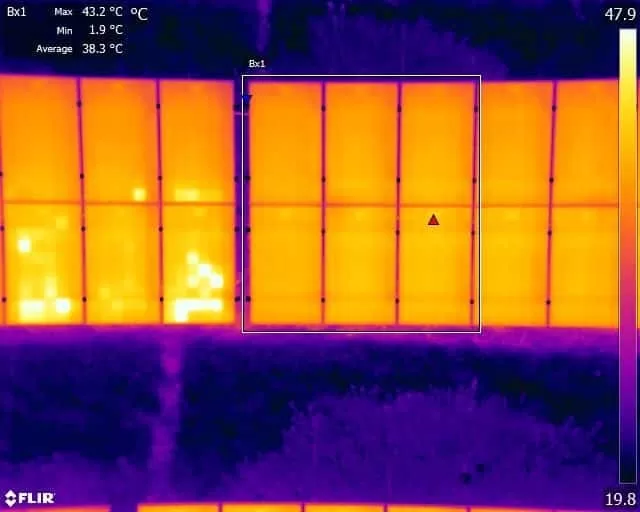
PID (Potential Induced Degradation) is a common phenomenon that affects the performance and lifespan of solar panels. It occurs when the voltage potential between the solar cells and the frame of the panel creates a current flow, causing the cells to degrade over time. Understanding PID and taking steps to prevent it is critical for maximizing the efficiency and longevity of your solar panels.