Specialists in aerial thermography, solar PV inspections, electrical string testing and precision 2D mapping. Certified, compliant, and trusted across the UK.


Drone Media Imaging
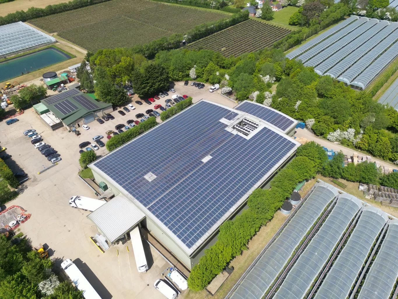
Drone Media Imaging is a specialist provider of certified drone thermography, solar PV inspections, electrical string-level testing, aerial condition surveys, and precision photogrammetry across the UK. We deliver high-accuracy data acquisition for commercial, industrial, engineering, and solar-energy clients who require reliable, standards-compliant aerial inspection services.
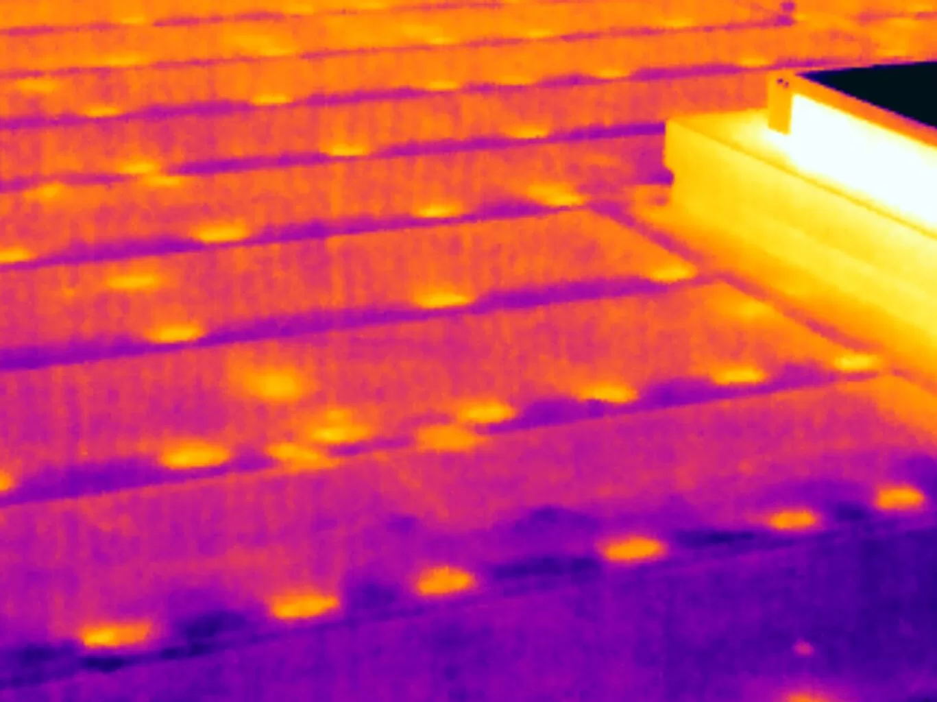
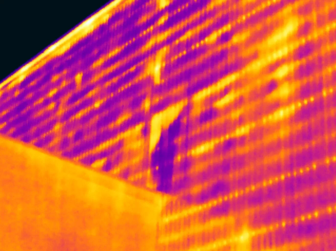
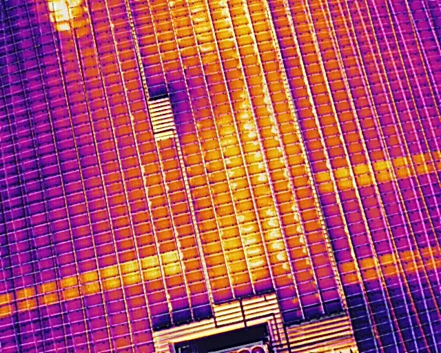
As a Certified Level 3 Master Thermographer and an IEC 62446-3 solar inspection specialist, we ensure every thermal and solar survey is captured to the highest professional standard. Our fieldwork is conducted using radiometric thermal drones, high-resolution RGB sensors, and CAA-approved aircraft, producing defensible datasets suitable for technical reporting, maintenance planning, and asset performance optimisation.
Our aerial inspection workflows provide a safer, faster, and more cost-effective alternative to manual access, eliminating the need for scaffolding, roof-walking, cherry pickers, or site shutdowns. With advanced thermal analysis, IEC-compliant electrical testing, and detailed orthomosaic mapping, we help commercial clients detect faults early, assess asset condition, and make confident decisions based on accurate, repeatable data.
Operating nationwide, we support solar farms, commercial rooftops, industrial facilities, property portfolios, engineering teams, insurers, O&M providers, and construction firms. With a commitment to quality, compliance, and technical excellence, Drone Media Imaging is your trusted partner for certified aerial thermography and precision drone inspections.
Flights
Total UK flight missions
Hours
Total flight hours
Level 3 Master Thermographer – Certified Aerial Thermal Surveys for Commercial & Industrial Clients ~ IEC 62446-3 Solar PV Inspections & IEC 62446-1 String-Level Electrical Testing ~ High-Accuracy Drone Mapping, Orthomosaics & Aerial Building Inspections Across the UKLevel 3 Master Thermographer – Certified Aerial Thermal Surveys for Commercial & Industrial Clients ~ IEC 62446-3 Solar PV Inspections & IEC 62446-1 String-Level Electrical Testing ~ High-Accuracy Drone Mapping, Orthomosaics & Aerial Building Inspections Across the UK
Why Choose Drone Media Imaging?
Expert Drone Thermography & Solar Inspection Specialists You Can Trust. Precision, Compliance & Industry-Leading Technology Across the UK.
1. Certified Level 3 Master Thermographer (Industry-Leading Expertise)
All thermographic work is supervised by a Certified Level 3 Master Thermographer, ensuring every inspection is conducted to the highest professional standards. Our surveys follow recognised frameworks including ISO 18436-7, ISO 9712, EN 13187, and IEC 62446-3 for solar PV thermography.
2. IEC 62446-3 & 62446-1 Compliant Solar Diagnostics
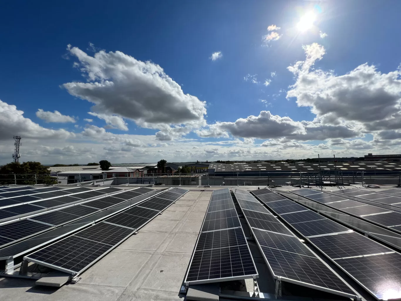
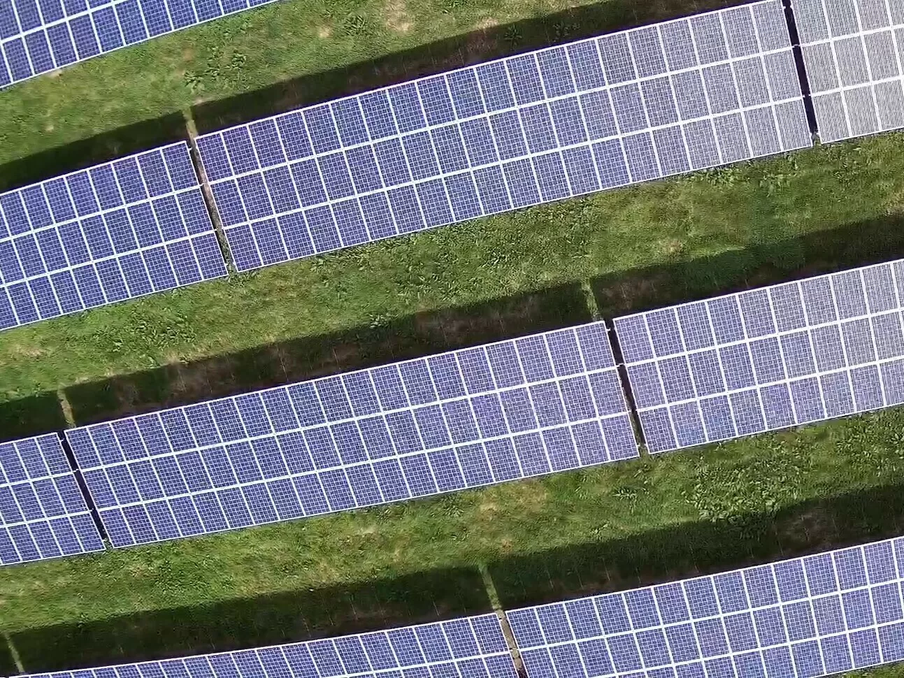
We specialise in solar PV inspection and diagnostics, combining radiometric thermal imaging with string-level electrical testing for complete system evaluation. From module-level hotspot detection to I-V curve tracing, our workflow supports asset owners, EPCs, and O&M teams with reliable, actionable data.
3. CAA Certified Drone Operators (Operational Authority)
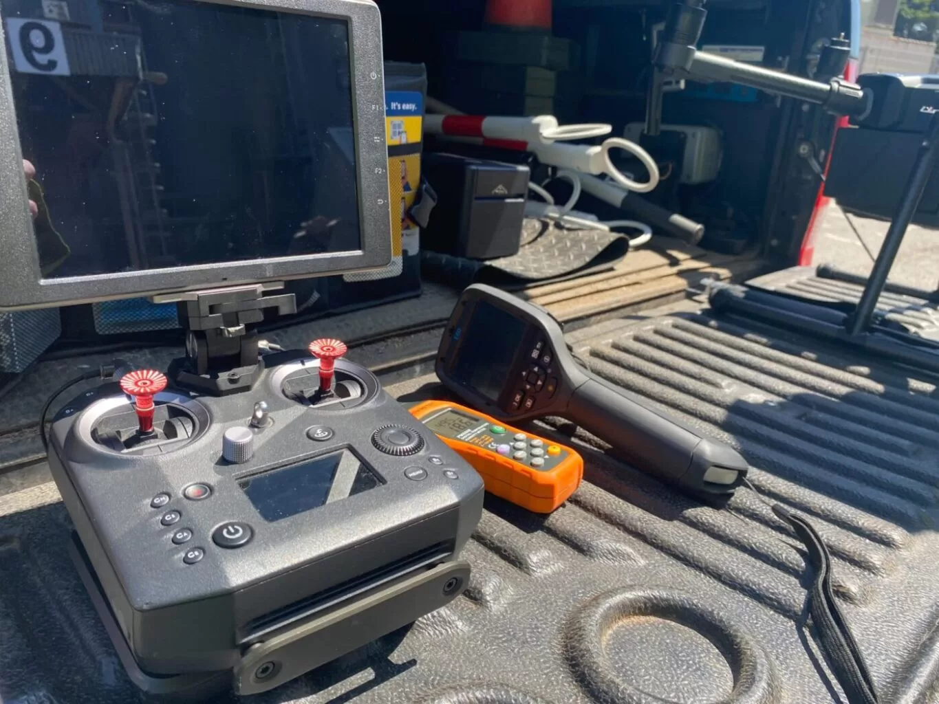
With a CAA Operational Authorisation, GVC, and A2 CofC, we operate safely and legally across commercial, industrial, and restricted environments. Our flight procedures ensure compliance, risk mitigation, and professional execution on every mission.
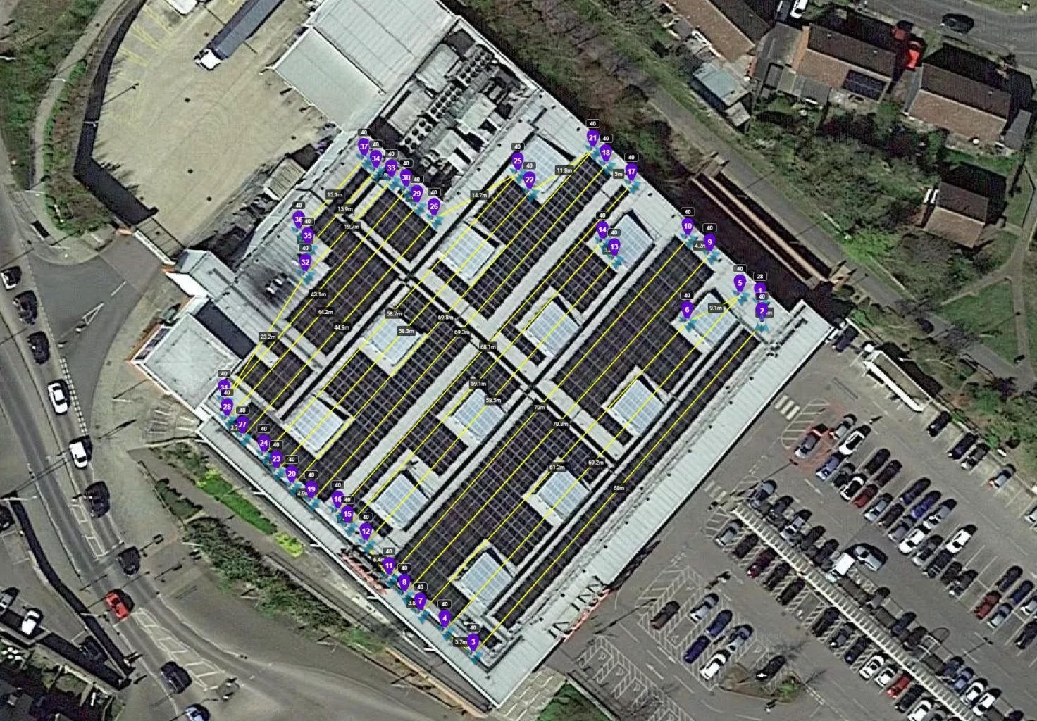
4. Precision Mapping & Aerial Inspections
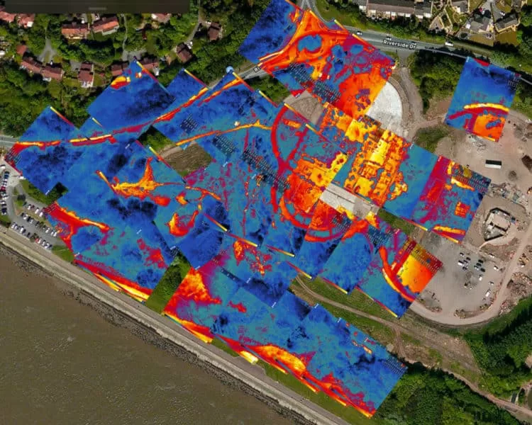
Using advanced photogrammetry and high-resolution visual sensors, we deliver accurate orthomosaics, DSM/DTM models, and building condition surveys. Our data supports construction managers, engineers, surveyors, insurers, and commercial property teams.
5. Technical Accuracy, Repeatability & Defensible Results
We capture radiometric thermal data and geospatially accurate visual imagery designed for engineering-grade analysis.
Our workflows emphasise repeatability, consistency, and defensible reporting — essential for long-term asset management and performance tracking.
6. UK-Wide Coverage for Commercial Clients
Based near Gatwick, we support clients across the South East and throughout the UK, delivering specialist aerial inspections, mapping, and solar diagnostics with rapid mobilisation and flexible scheduling.
7. Integrated Workflow with Thermography Services UK
Where full analytical reporting is required, your aerial data can be escalated seamlessly to Thermography Services (UK) Ltd for Level 3 certified thermographic reporting, ensuring complete and compliant documentation when needed.


At Drone Media Imaging, we pride ourselves on delivering high-quality drone services that drive real results for our clients. From solar panel inspections and aerial thermography to mapping, and precision surveying, our projects showcase the accuracy, efficiency, and value we bring to businesses across the UK. Explore our latest projects to see how Drone Media Imaging can support your industry with professional, reliable, and expert drone services.
Book a Certified Drone Thermography or Solar PV Inspection
Get accurate, standards-compliant aerial data for your solar, building or industrial assets. We deliver IEC-compliant solar inspections, Level 3 aerial thermography, string-level electrical testing, and precision mapping across the UK.
Quotes and consultations are free, with no obligation.
Our Work is Delivered Under Recognised Industry Standards
& Certified Competence
Trusted Partner for Certified Drone Thermography, Solar PV Inspections & Aerial Mapping Across the UK
Drone Media Imaging delivers specialist aerial thermography, IEC-compliant solar inspections, string-level electrical testing, and precision photogrammetry for commercial and industrial clients across the UK. Our work is supervised by a Certified Level 3 Master Thermographer, ensuring accurate, standards-driven data capture suitable for engineering analysis, asset management, safety assessments, and long-term maintenance planning.
Using CAA-approved UAV systems with radiometric thermal sensors, high-resolution RGB cameras, and advanced mapping workflows, we produce consistent, defensible datasets for solar operators, engineering teams, facility managers, insurers, and O&M providers. Our approach eliminates the need for manual access, reduces operational disruption, and supports evidence-based decision-making across a wide range of commercial assets.
With UK-wide operational capability and a strong technical foundation in IEC 62446-3 thermography, IEC 62446-1 electrical testing, BS 7671 competence, and ISO-based thermographic practice, Drone Media Imaging provides reliable, compliant, and high-accuracy aerial inspection services. Whether you require solar diagnostics, building thermography, aerial inspections, or orthomosaic mapping, we deliver precise and actionable insights tailored to commercial requirements.
Precision, Expertise, and Innovation
Delivering High-Quality and Certified Aerial Solutions for Your Business Across the UK
Expertise
Certified Master Thermographer Level 3
IEC 62446-3 & IEC 62446-1 Compliant
Compliant
CAA Operational Authorisation
GVC & A2 CofC Certified Commercial

Aerial Drone News and Blogs.
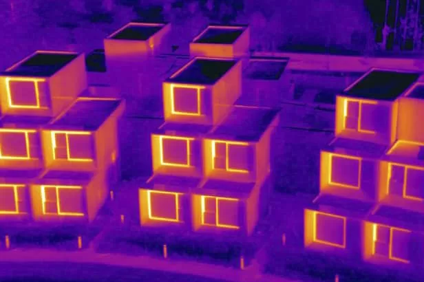
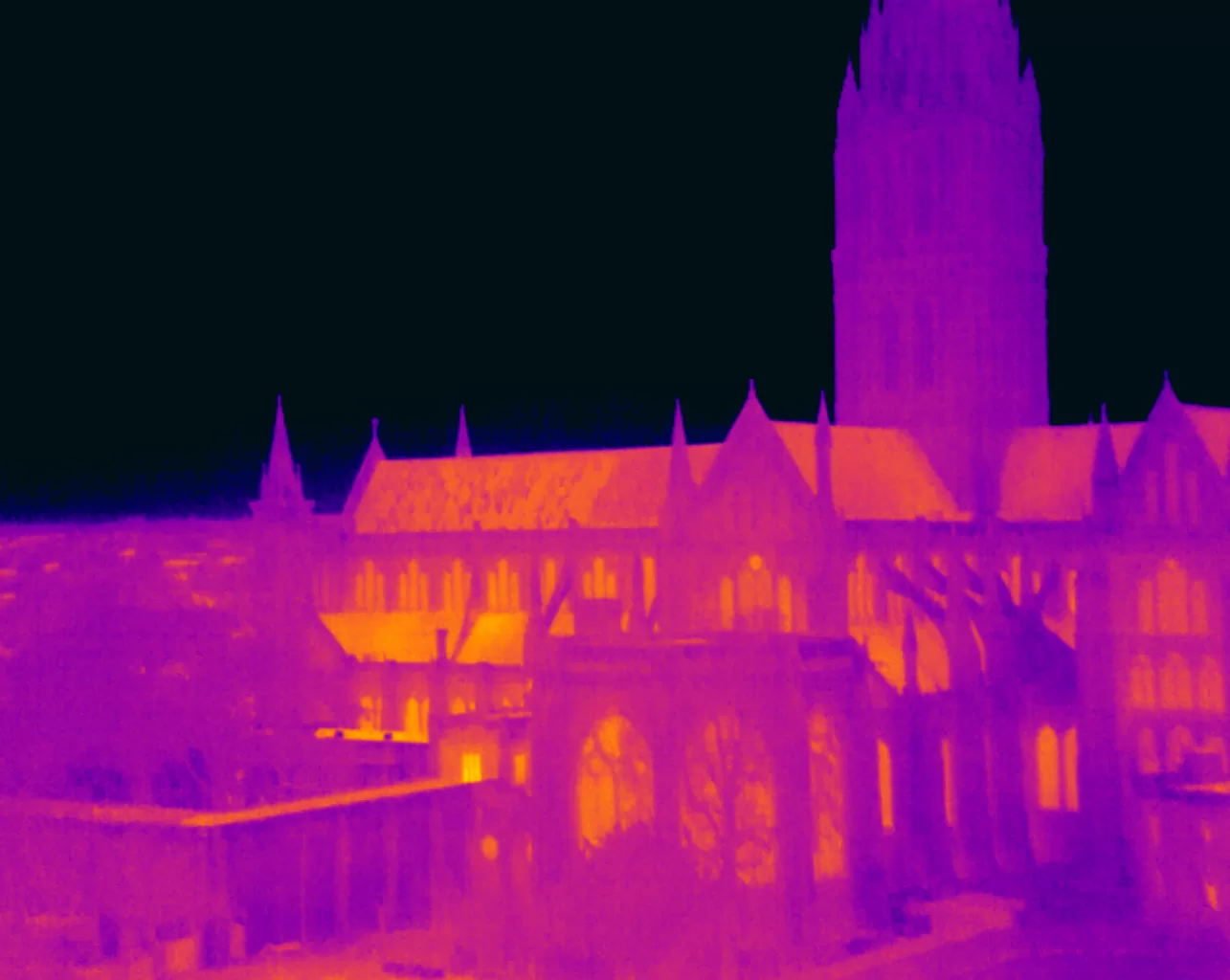
Trained and Certified in Aerial Thermography
Drone Media Imaging use trained and certified thermographers to deliver thermographic services and inspections across many domestic, industrial and commercial sectors throughout the UK. Whether it is solar photovoltaic panel inspection in accordance with IEC 62446-3:2017 and BS EN ISO 62446-1:2016 or fire detection and management in disasters zones or underground landfill fires, Drone Media Imaging can deploy across the UK quickly, efficiently and with the right experience.
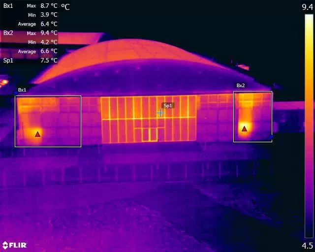
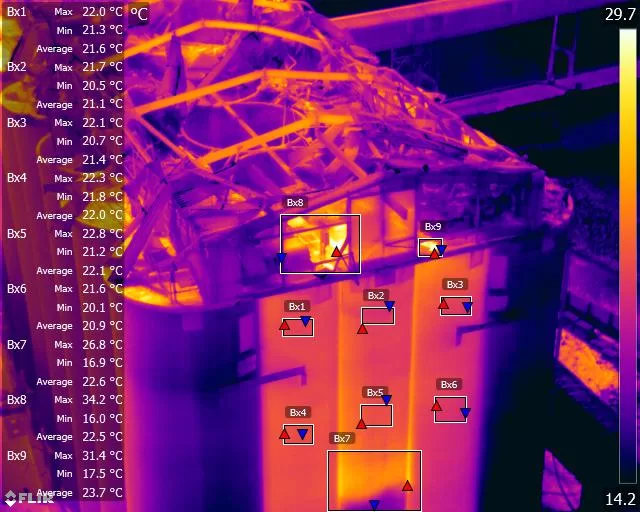
Aerial Thermography Category 2 Thermography certification to category level 2 focuses on radiometric temperature measurement analysis and the benefits of obtaining precise temperature data from challenging environments for diagnosing and reporting purposes. Whether for qualitative evaluation or quantitative evaluation our report and diagnosis analysis provide you with answers following a non-destructive inspection format from the air via UAV drones equipped with the latest technology. Drone Media Imaging is a small but unique drone operations company specialising in airborne thermal imaging across the UK. Our certification and experience when paired with our CAA enhanced OSC permissions, means we are more than capable of performing any aerial thermal imaging job however challenging. As level 2 thermographers we dive into the fundamental principles of surface emissivity, reflected temperature correction, spatial and measurement resolutions, and as a result providing clients with accurate data reporting that can be trusted.
Aerial Thermal Imaging Infrared Cameras Thermal Imaging cameras capture the reflected radiation from a surface or heat source and convert the recorded temperatures to an image map for analysis. This unique worldview provides numerous advantageous and cost-effective non-destructive options for commercial and residential needs. Aerial thermal cameras of the highest quality provide non-contact temperature measurements in difficult to reach locations that cannot be observe from the ground. As is the case with all drone inspections, the hazards connected with operating at a height are minimised as is the potential of inflicting damage to the structure during the inspection procedure.
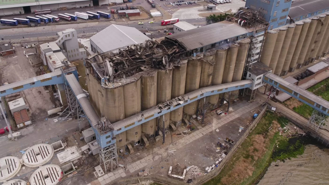
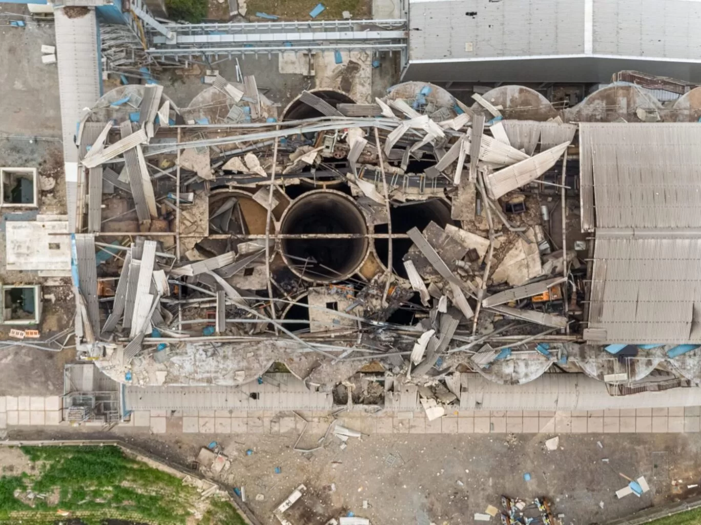
Case Study – Explosion at a Grain Store Port of Tilbury London Following an explosion at the Port of Tilbury London grain store in July 2020, Drone Media Imaging were hired to provide aerial thermal data support to emergency service gold commanders and the senior management for the grain store. Flying thermographic data collection missions, hourly, daily, and weekly for over 13 months from the initial explosion and subsequent silo fires, we provided important thermal data reports as the fire developed, enabling the fire management strategy to be accurately measured over time. Comprehensive reports, thermal imaging, RGB photography, and video pictures were used to provide the information essential to effectively manage the problem until the building was destroyed in 2020.
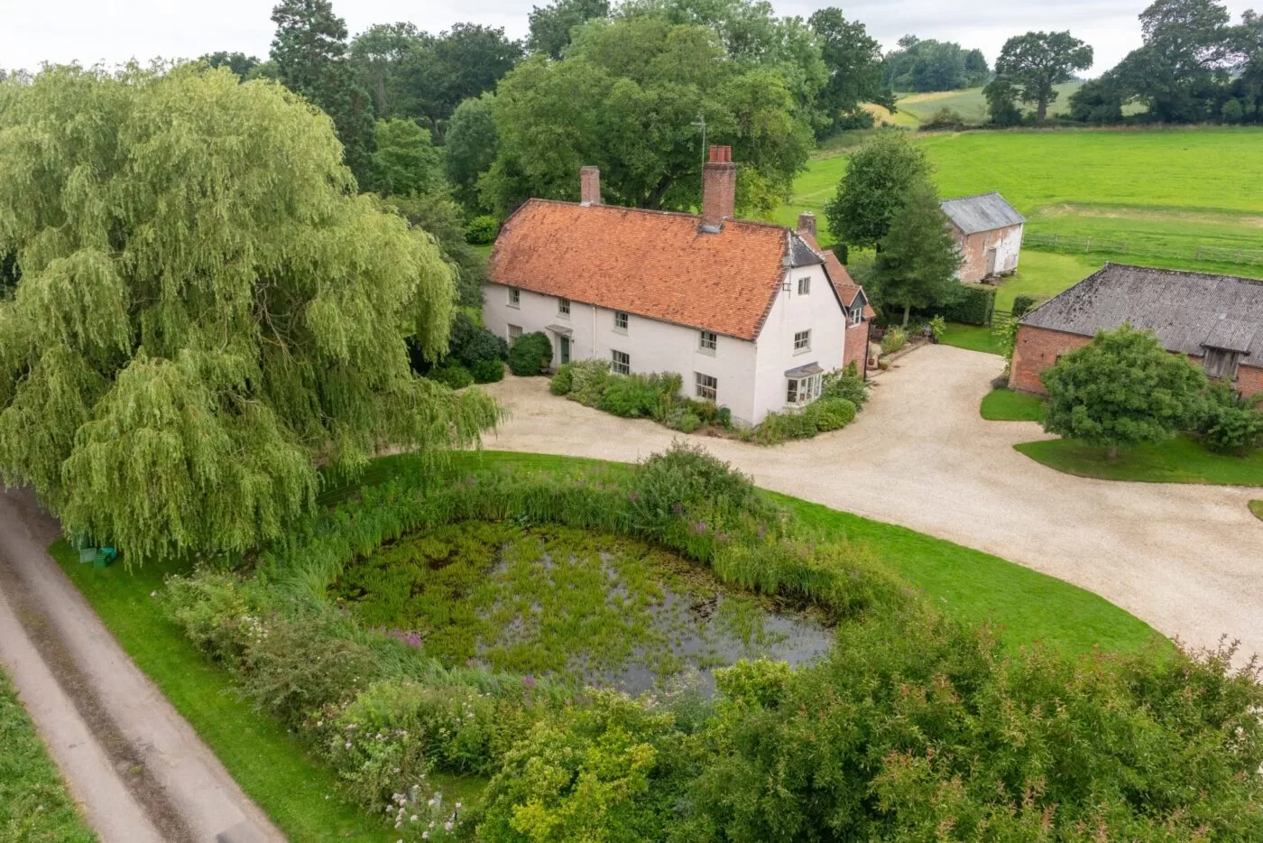
House portraits make great gift ideas!
It can be hard to think of the perfect gift for people sometimes, especially when you’re looking for something really special and unique to them. A house portrait can fit the bill exactly.
These photos come from a client who wanted the perfect way to express her thanks to her parents for hosting her wedding at their property and I can’t think of a better way to put it than by commissioning such a special portrait of their home.
Using a drone captures a property from a unique angle and is the perfect way to showcase all the beautiful home and garden features. In ‘olden days’ these portraits used to be captured via an aircraft flying at a much greater height and on a fixed flight path but a UAV or Drone can fly lower and capture much more detail as well as choose the perfect angle to show off the property at it’s very best. Not to mention that it can do all this at a fraction of the cost.
Commissioning an aerial home portrait is simple to do – just get in touch with us to talk over your requirements, and provide us with the property details. We can then schedule a time to come and visit and capture your images – in this case, we did it when her parents were away so it could be a surprise.