

Specialists in aerial thermography, solar PV inspections, electrical string testing and precision 2D mapping. Certified, compliant, and trusted across the UK.


Drone Media Imaging
Drone Media Imaging is a specialist provider of certified drone thermography, solar PV inspections, electrical string-level testing, aerial condition surveys, and precision photogrammetry across the UK. We deliver high-accuracy data acquisition for commercial, industrial, engineering, and solar-energy clients who require reliable, standards-compliant aerial inspection services.
As a Certified Level 3 Master Thermographer and an IEC 62446-3 solar inspection specialist, we ensure every thermal and solar survey is captured to the highest professional standard. Our fieldwork is conducted using radiometric thermal drones, high-resolution RGB sensors, and CAA-approved aircraft, producing defensible datasets suitable for technical reporting, maintenance planning, and asset performance optimisation.
Our aerial inspection workflows provide a safer, faster, and more cost-effective alternative to manual access, eliminating the need for scaffolding, roof-walking, cherry pickers, or site shutdowns. With advanced thermal analysis, IEC-compliant electrical testing, and detailed orthomosaic mapping, we help commercial clients detect faults early, assess asset condition, and make confident decisions based on accurate, repeatable data.
Operating nationwide, we support solar farms, commercial rooftops, industrial facilities, property portfolios, engineering teams, insurers, O&M providers, and construction firms. With a commitment to quality, compliance, and technical excellence, Drone Media Imaging is your trusted partner for certified aerial thermography and precision drone inspections.
Flights
Total UK flight missions
Hours
Total flight hours
Level 3 Master Thermographer – Certified Aerial Thermal Surveys for Commercial & Industrial Clients ~ IEC 62446-3 Solar PV Inspections & IEC 62446-1 String-Level Electrical Testing ~ High-Accuracy Drone Mapping, Orthomosaics & Aerial Building Inspections Across the UKLevel 3 Master Thermographer – Certified Aerial Thermal Surveys for Commercial & Industrial Clients ~ IEC 62446-3 Solar PV Inspections & IEC 62446-1 String-Level Electrical Testing ~ High-Accuracy Drone Mapping, Orthomosaics & Aerial Building Inspections Across the UK
Why Choose Drone Media Imaging?
Expert Drone Thermography & Solar Inspection Specialists You Can Trust. Precision, Compliance & Industry-Leading Technology Across the UK.
1. Certified Level 3 Master Thermographer (Industry-Leading Expertise)
All thermographic work is supervised by a Certified Level 3 Master Thermographer, ensuring every inspection is conducted to the highest professional standards. Our surveys follow recognised frameworks including ISO 18436-7, ISO 9712, EN 13187, and IEC 62446-3 for solar PV thermography.
2. IEC 62446-3 & 62446-1 Compliant Solar Diagnostics
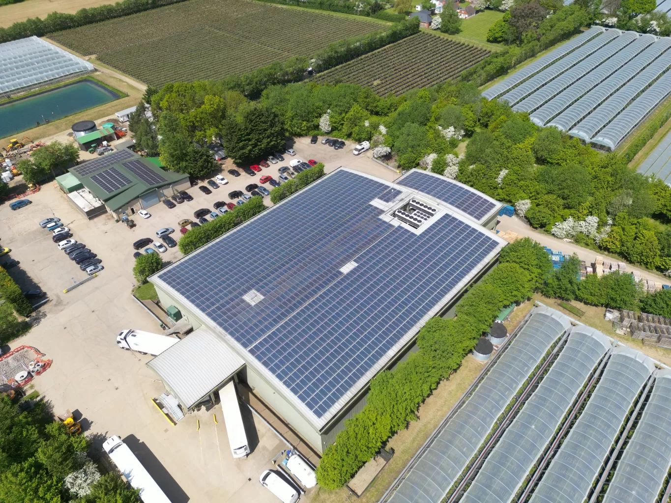
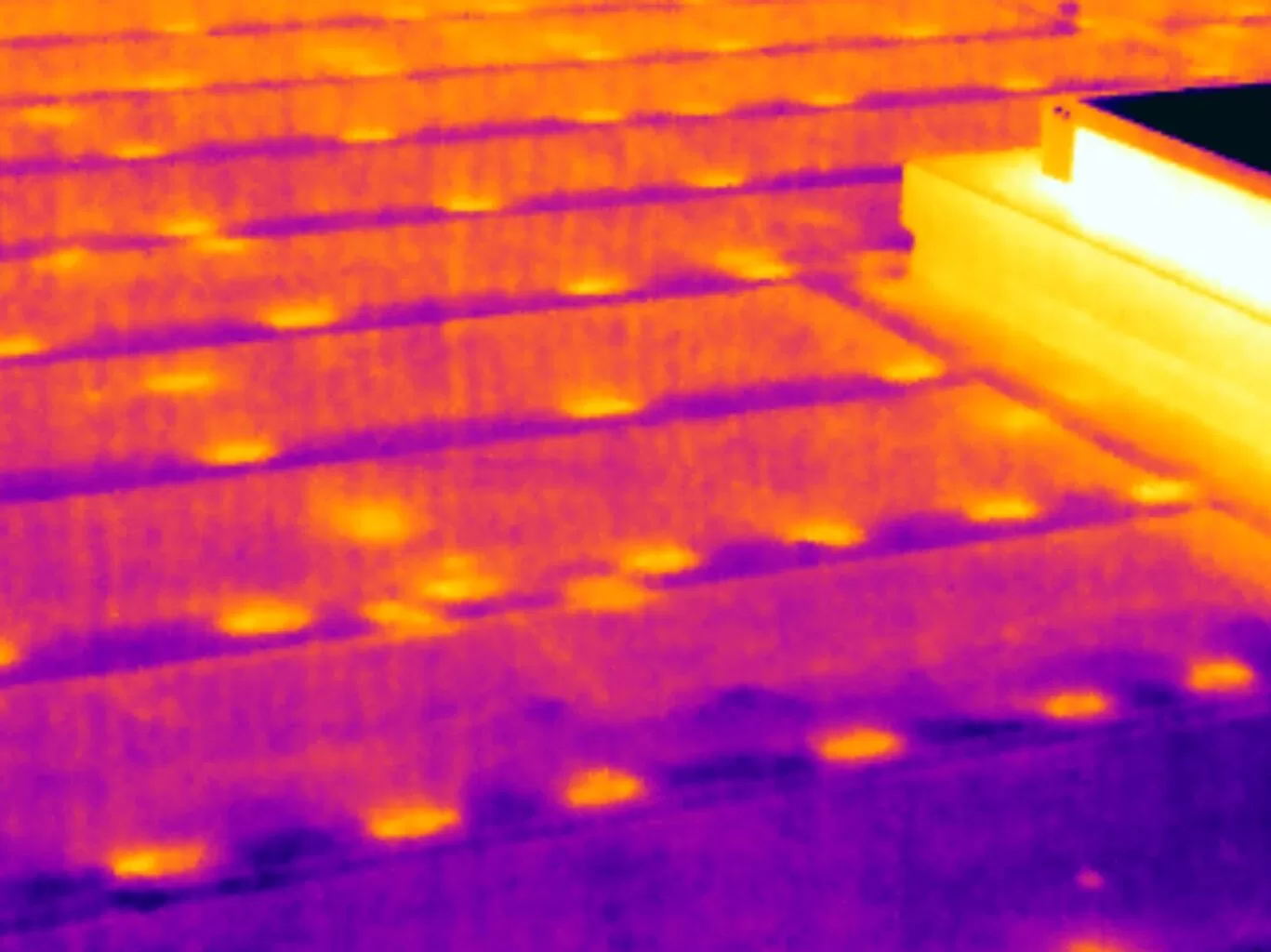
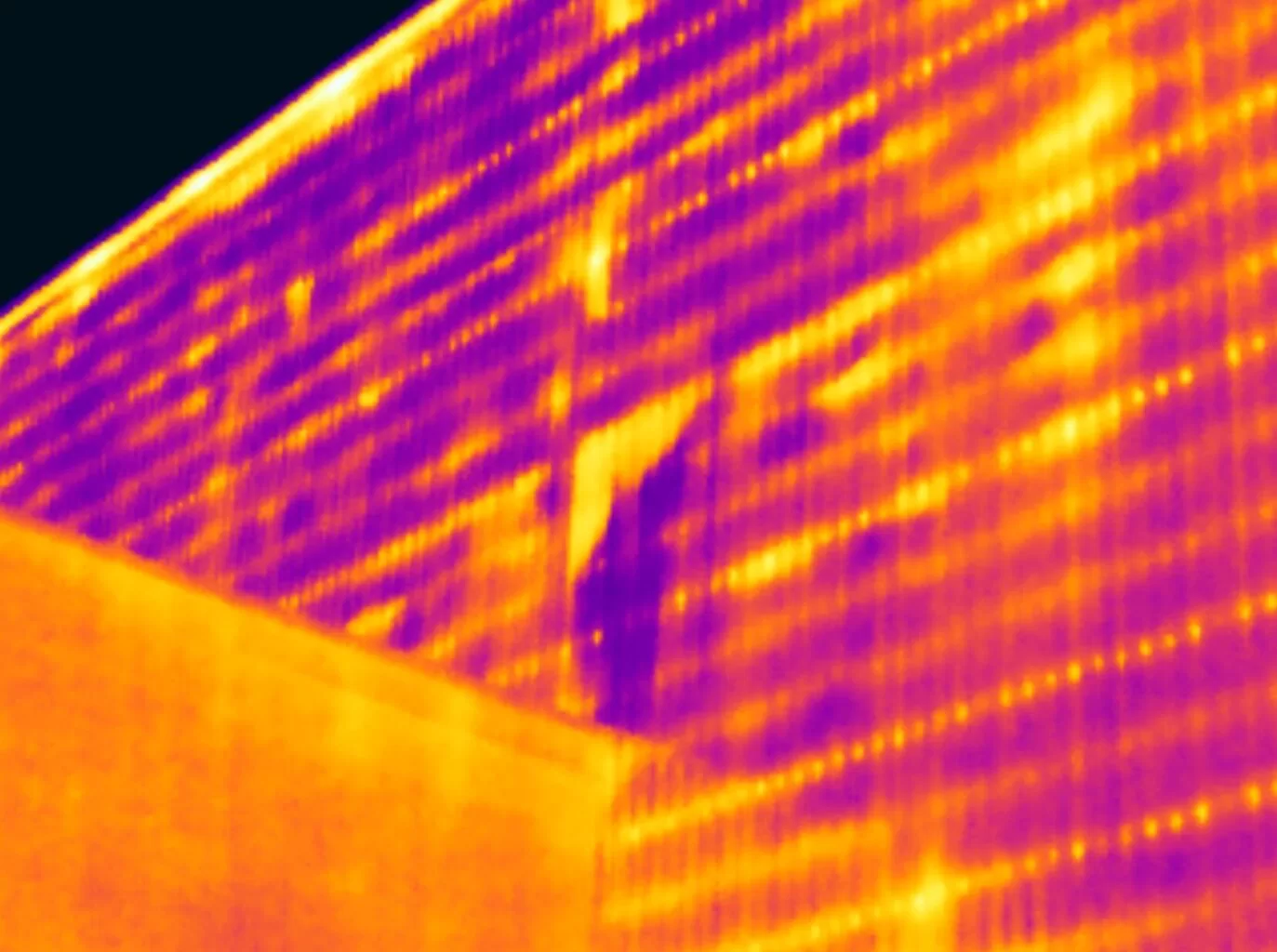
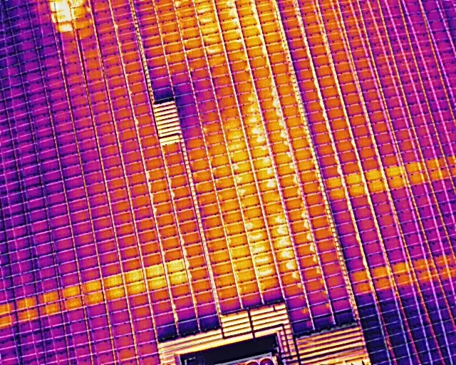
We specialise in solar PV inspection and diagnostics, combining radiometric thermal imaging with string-level electrical testing for complete system evaluation. From module-level hotspot detection to I-V curve tracing, our workflow supports asset owners, EPCs, and O&M teams with reliable, actionable data.
3. CAA Certified Drone Operators (Operational Authority)
With a CAA Operational Authorisation, GVC, and A2 CofC, we operate safely and legally across commercial, industrial, and restricted environments. Our flight procedures ensure compliance, risk mitigation, and professional execution on every mission.
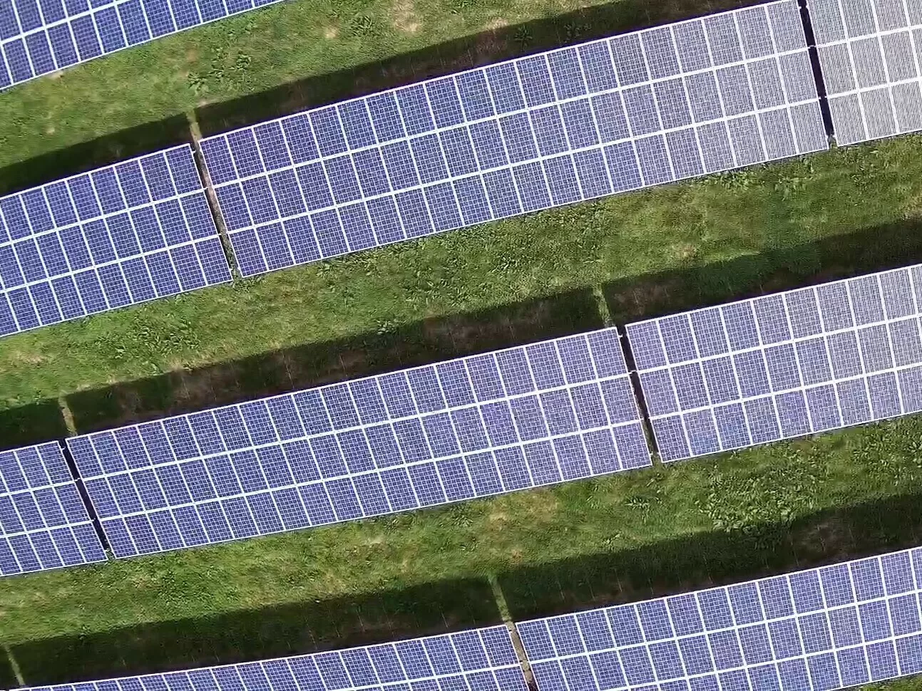
4. Precision Mapping & Aerial Inspections
Using advanced photogrammetry and high-resolution visual sensors, we deliver accurate orthomosaics, DSM/DTM models, and building condition surveys. Our data supports construction managers, engineers, surveyors, insurers, and commercial property teams.
5. Technical Accuracy, Repeatability & Defensible Results
We capture radiometric thermal data and geospatially accurate visual imagery designed for engineering-grade analysis.
Our workflows emphasise repeatability, consistency, and defensible reporting — essential for long-term asset management and performance tracking.
6. UK-Wide Coverage for Commercial Clients
Based near Gatwick, we support clients across the South East and throughout the UK, delivering specialist aerial inspections, mapping, and solar diagnostics with rapid mobilisation and flexible scheduling.
7. Integrated Workflow with Thermography Services UK
Where full analytical reporting is required, your aerial data can be escalated seamlessly to Thermography Services (UK) Ltd for Level 3 certified thermographic reporting, ensuring complete and compliant documentation when needed.


At Drone Media Imaging, we pride ourselves on delivering high-quality drone services that drive real results for our clients. From solar panel inspections and aerial thermography to mapping, and precision surveying, our projects showcase the accuracy, efficiency, and value we bring to businesses across the UK. Explore our latest projects to see how Drone Media Imaging can support your industry with professional, reliable, and expert drone services.
Book a Certified Drone Thermography or Solar PV Inspection
Get accurate, standards-compliant aerial data for your solar, building or industrial assets. We deliver IEC-compliant solar inspections, Level 3 aerial thermography, string-level electrical testing, and precision mapping across the UK.
Quotes and consultations are free, with no obligation.
Our Work is Delivered Under Recognised Industry Standards
& Certified Competence
Trusted Partner for Certified Drone Thermography, Solar PV Inspections & Aerial Mapping Across the UK
Drone Media Imaging delivers specialist aerial thermography, IEC-compliant solar inspections, string-level electrical testing, and precision photogrammetry for commercial and industrial clients across the UK. Our work is supervised by a Certified Level 3 Master Thermographer, ensuring accurate, standards-driven data capture suitable for engineering analysis, asset management, safety assessments, and long-term maintenance planning.
Using CAA-approved UAV systems with radiometric thermal sensors, high-resolution RGB cameras, and advanced mapping workflows, we produce consistent, defensible datasets for solar operators, engineering teams, facility managers, insurers, and O&M providers. Our approach eliminates the need for manual access, reduces operational disruption, and supports evidence-based decision-making across a wide range of commercial assets.
With UK-wide operational capability and a strong technical foundation in IEC 62446-3 thermography, IEC 62446-1 electrical testing, BS 7671 competence, and ISO-based thermographic practice, Drone Media Imaging provides reliable, compliant, and high-accuracy aerial inspection services. Whether you require solar diagnostics, building thermography, aerial inspections, or orthomosaic mapping, we deliver precise and actionable insights tailored to commercial requirements.
Precision, Expertise, and Innovation
Delivering High-Quality and Certified Aerial Solutions for Your Business Across the UK
Expertise
Certified Master Thermographer Level 3
IEC 62446-3 & IEC 62446-1 Compliant
Compliant
CAA Operational Authorisation
GVC & A2 CofC Certified Commercial

Aerial Drone News and Blogs.
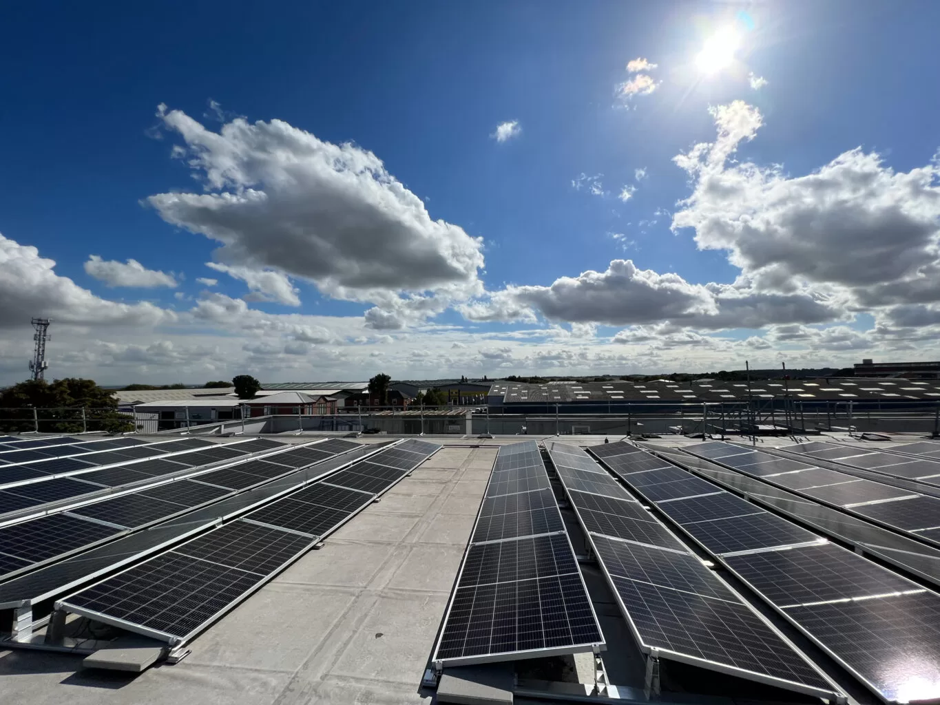
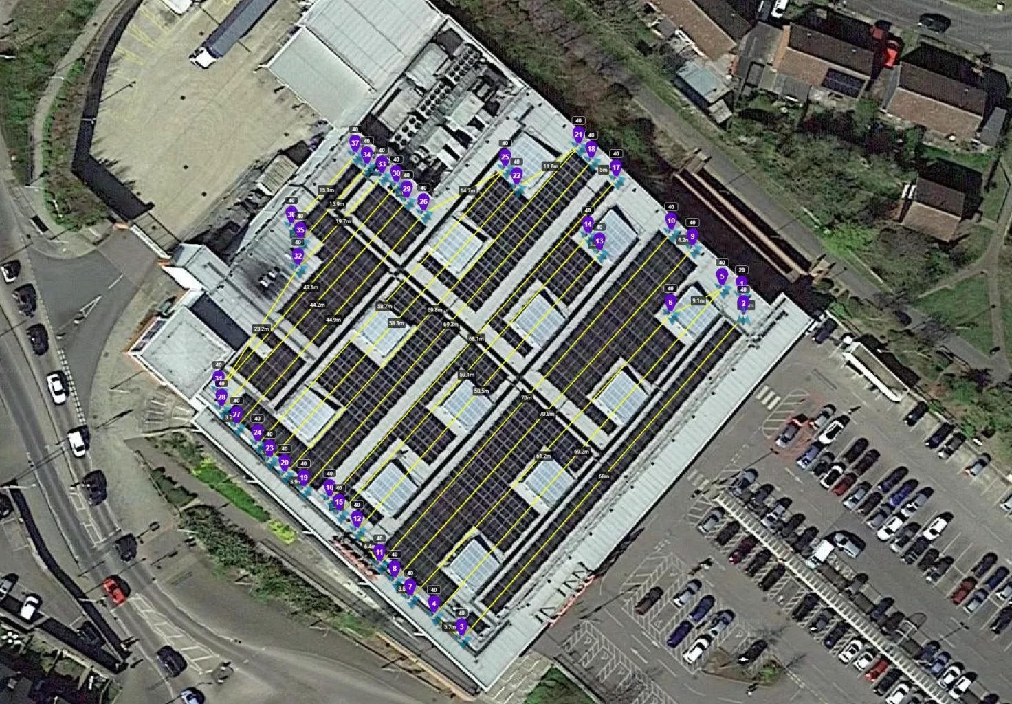
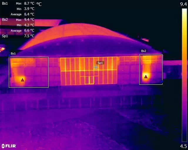
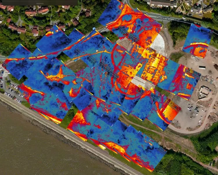
In an unusually sunny September, we completed 20 solar panel inspections across the UK, including 17 at Tesco stores. Typically, inspections occur in summer due to optimal solar irradiation. This year’s record-breaking sunshine allowed us to extend operations safely into autumn.
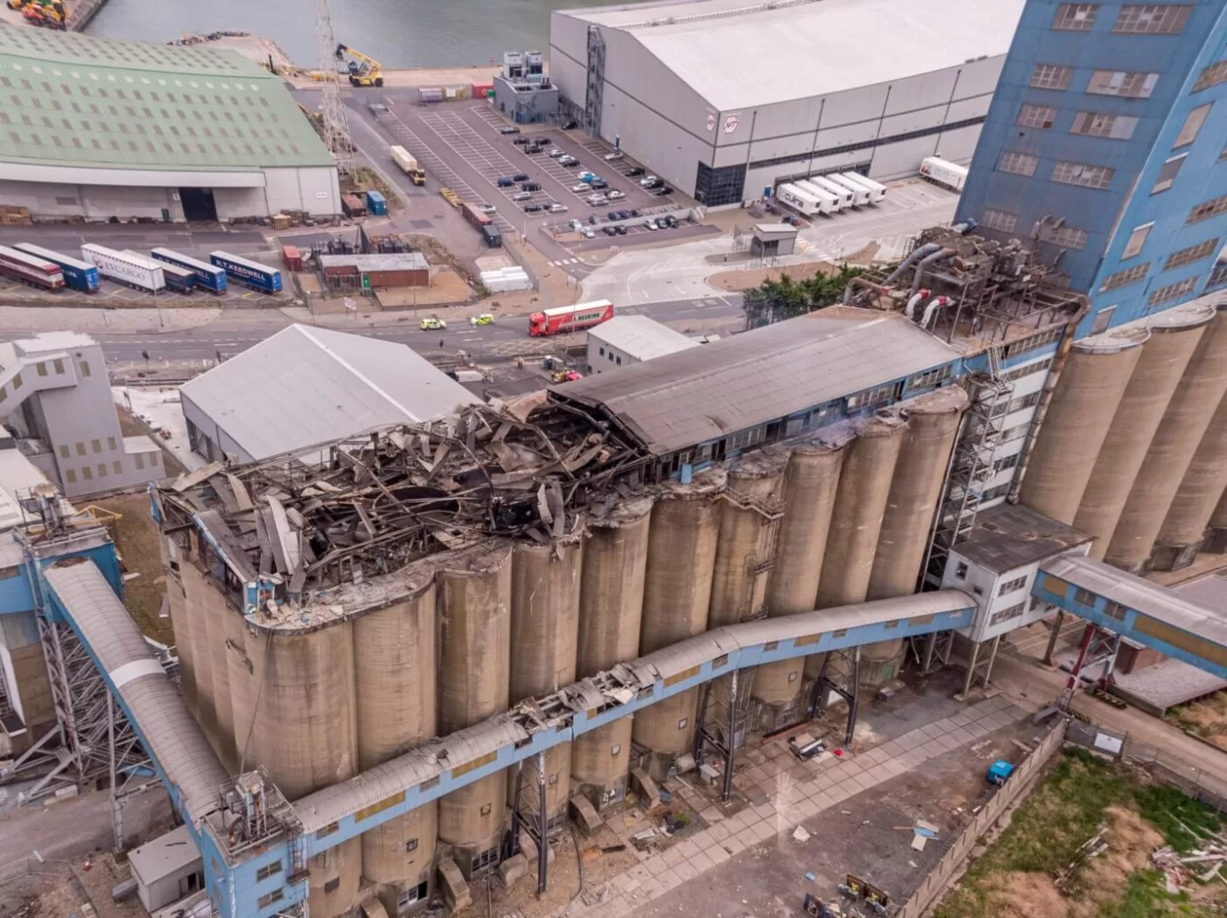
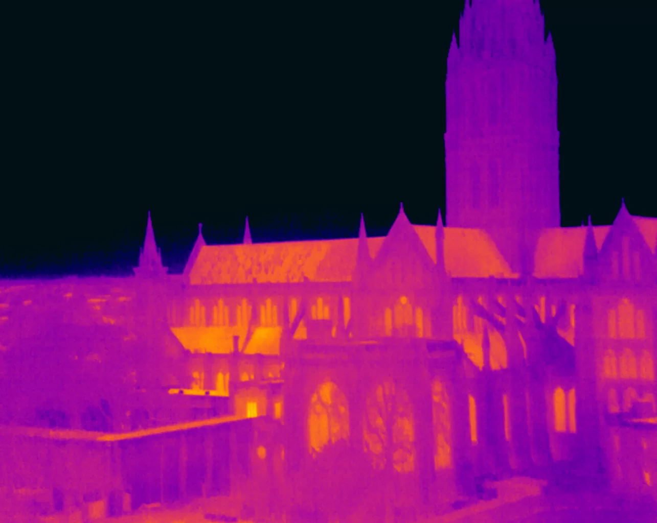
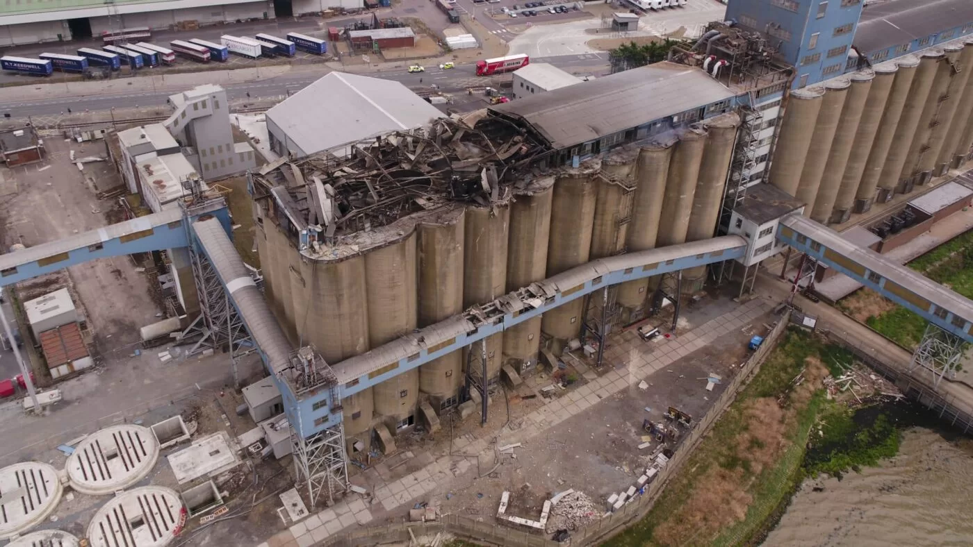
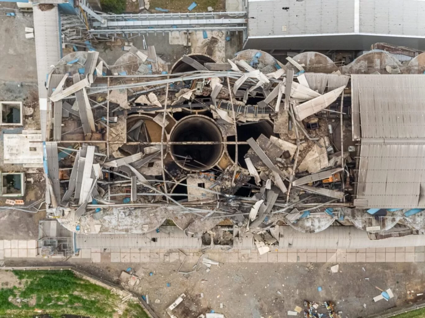
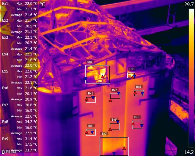
Thermal Fire Monitoring Following a Grain Store Terminal Explosion
Grain Store Explosion and Year-Long Fire – July 5, 2020 – Tilbury Port, London On July 5, 2020, a series of events (possibly by a spark) triggered a large dust explosion and a subsequent fire at the Grain Store Terminal at the Port of Tilbury in London. This was a serious event that required the attention of a large-scale emergency response to get the subsequent grain fire under control and avoid additional explosions. No one was seriously hurt, which is nothing short of a miracle given the number of people on the scene and the amount of reinforced concrete and debris thrown high into the sky before raining down on the surrounding buildings.
Traditional firefighting methods and techniques are ineffective in the case of grain storage fires. Using water to extinguish the inferno is ineffective with grain and dust fires, and the added weight might have caused a catastrophic structural collapse, exacerbating an already challenging situation. As a result, London fire teams were on the scene for days while a proper fire strategy and plan was developed and implemented, with staff always remaining on-site to monitor the situation over the following weeks.
Throughout this early period, there was always the possibility of more explosions and the fire spreading since the grain stored in the linked silos generates dust that may ignite if the temperature is high enough. Drone Media Imaging was contracted to fly thermal imaging flights to collect temperature data to estimate fire spread and track fire management efforts over time. For instance, were the temperatures rising, falling, or remaining constant?
We began operations on July 7, 2020, flying three flights each day, seven days a week initially, to compare temperatures and report back to crisis management teams and emergency service gold commanders. We eventually completed our thermal imaging missions one year and a month after the initial Grain Store explosion in late August 2021! While not all of the silos were full with grain, many were, and several were burning at temperatures far beyond 800°C. Before the fire could be quenched, the building had to be entirely demolished. Temperatures more than 80°C were still being recorded in the grain that remained on the ground after demolition 13 months later.
Gaining safe access to the terminal to fly was not without difficulty, as emergency services had imposed a 50m exclusion zone surrounding the terminal due to the possibility of additional explosions. As a result, our risk assessments and method statements had to be developed specifically for this circumstance and rigorously tested to assure both safe drone flights and the most accurate thermal data gathering at this vital juncture.
We continued to provide the Port of Tilbury London and the accompanying emergency services with daily and weekly calibrated temperature measurements that documented the progress of the grain store fire over 13 months. As thermal infrared aerial specialists, we provided data in the form of detailed reports, thermal imaging, RGB photographic and video footage.