

Country House Roof Inspection
Country House Roof Inspection

Our client asked us to survey a roof that was leaking, and with our Zenmuse z30 high powered zoom along with thermal cameras, we were able to help identify the problem. The work took a couple of hours and a handful of flights, on a showery day.
Using the software from Scopito we were able to complete a full report with detailed images showing the problems for the roof maintenance company to act upon.
The DJI Zenmuse z30 high powered zoom drone camera offers very stabilised long lens telephoto shooting to show closeup detail from the air with a drone – for more information here is a link to the DJI Zenmuse z30


Get your Property Roof Inspection Today!
We are certified and approved drone pilots and work throughout the UK and Ireland to provide both aerial and ground based property photography
Drone Services Enquiry
Thermography | Inspections | Solar | Photogrammetry
Discover how drone technology can enhance your operations with a free quotation from our experts. Get a Free Quote or Make an Enquiry Today!
related posts
"Mastering the RECCE" is the ultimate guide for BBC filmmakers seeking the perfect filming locations. Packed with insider tips and techniques, this comprehensive handbook will equip you with the skills to scout and secure the most captivating spots. From historic landmarks to hidden gems, unlock the secrets to creating visually stunning productions with this essential resource.
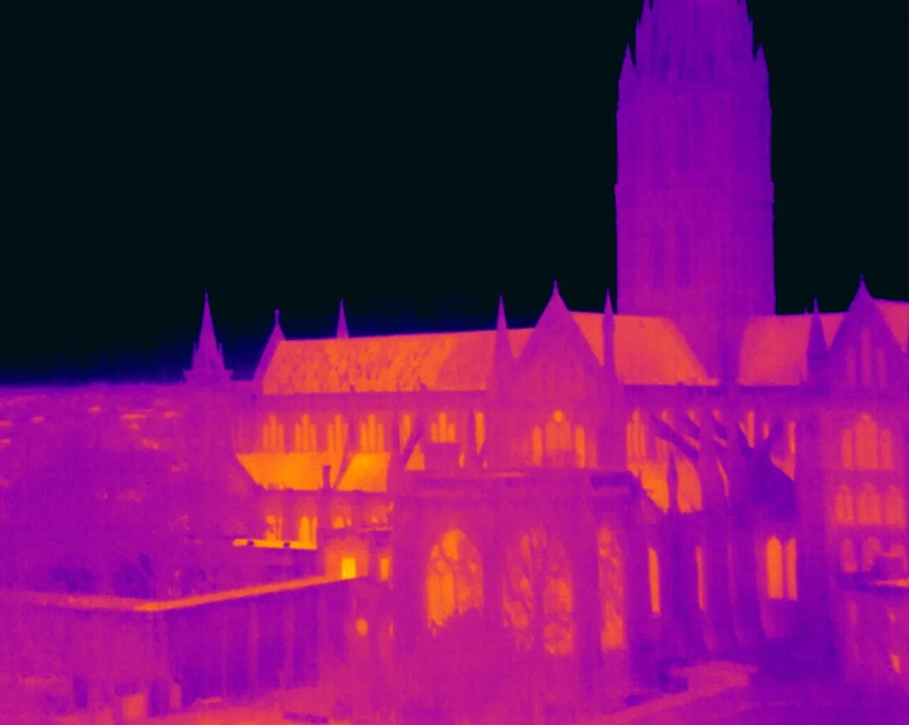
Pinpointing energy loss in buildings involves identifying hidden insulation defects, thermal bridges, and air leaks. A Level 3 Thermographer employs advanced thermal imaging to ensure precise diagnostics and compliance with energy standards, providing property owners with detailed reports for informed energy efficiency improvements and cost savings.
