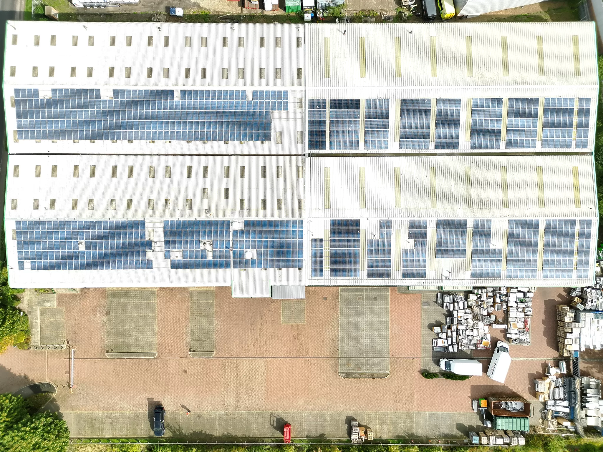
Drone Media Imaging completed a programme of construction progress mapping surveys for a major redevelopment site in Crawley. Because the location is positioned close to Gatwick Airport, each mission required detailed airspace planning, operating-risk assessment and full compliance with CAA commercial-flight procedures. Working alongside the site management team, we delivered regular photogrammetry datasets that captured accurate, measurement-ready orthomosaics showing changes in excavation, building footprints, plant movement and site logistics.
Our structured mapping approach ensured that each survey maintained identical altitude, overlap and imaging parameters, giving the client a consistent baseline for progress tracking. These orthomosaics were used by project managers, consultants and contractors to coordinate work phases, confirm progress, identify potential access issues and maintain clear communication across the construction team. Operating safely within the constraints of controlled airspace, Drone Media Imaging provided high-accuracy geospatial insight that supported better planning, improved safety and long-term project documentation.

Project Overview
Subject
construction drone mapping, progress orthomosaic survey, airport proximity drone operations, commercial site inspection, land development mapping
Skills Used
Aerial Photogrammetry, Geo-referenced Mapping, Construction Progress Monitoring, Controlled Airspace Operations, CAA Compliance
Portfolio Tags
photogrammetry, construction, mapping, airport operations, progress survey, orthomosaic, inspection, redevelopment
Construction Progress Mapping for a Major Redevelopment Project in Crawley
High-accuracy mapping to support site monitoring, progress tracking and safety planning within controlled airspace near Gatwick Airport.

Aerial Progress Mapping for Construction Sites
Aerial Mapping for a Large Redevelopment Site in Crawley
Drone Media Imaging was commissioned to deliver a series of construction progress mapping surveys at a large commercial redevelopment site in Crawley. The project involved transforming a former industrial facility into a new multi-building technology complex, requiring frequent, accurate, and up-to-date geospatial data to support project management. Working within close proximity to Gatwick Airport, the site demanded a high level of planning, airspace awareness and compliance with aviation and construction-site requirements.
The client required detailed orthomosaic maps at regular intervals to track progress, document changes, plan logistics and support communication between contractors, engineering consultants and project managers. By using advanced photogrammetry workflows, we produced precise site-wide imagery that offered a reliable visual and measurement-ready record of each construction phase.


Flying Drones Flying Drones near Gatwick Airport
Technical Mapping Workflow and Operating Within Controlled Airspace
The site sits less than two miles from the boundary of Gatwick’s controlled airspace, meaning drone operations required enhanced planning, airspace risk assessment and strict adherence to CAA requirements. Drone Media Imaging prepared a full flight-operations plan addressing CTR considerations, construction-site briefings, on-site RAMS documentation and pre-flight liaison with the project’s site-safety teams. Weather, visibility and NOTAM checks were conducted before every mission to ensure safe and compliant flight conditions.
Photogrammetry acquisition was completed using a tightly structured grid pattern, maintaining consistent altitude, overlap and camera geometry across each survey date. This ensured every progress map was directly comparable, with the same ground sample distance and measurement accuracy. The resulting orthomosaics captured structural changes, earthworks development, new building footprints and on-site logistics in high resolution. These datasets were delivered in formats suitable for planning reviews, contractor coordination and long-term documentation.

Safe, Compliant and High-Accuracy Mapping
Results, Progress Insights and Value Delivered
The recurring surveys provided the construction team with a clear visual reference for tracking earthworks, monitoring materials storage, reviewing contractor access routes and verifying progress against plans. The orthomosaics supported communication between stakeholders, helping teams quickly identify emerging issues and confirm that project milestones were being met. Working in controlled airspace demonstrated Drone Media Imaging’s capability to deliver safe, compliant and high-accuracy mapping in complex environments.
By comparing datasets from multiple dates, the project team gained an actionable sequence of development stages — from initial clearance through early foundation works to the rise of the new structures. The mapping supported improved logistical decision-making, enhanced site safety planning, and reduced the need for ad-hoc ground-based inspections.