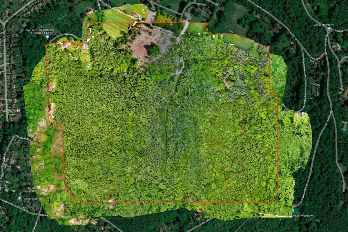
Drone Media Imaging delivered a specialist aerial thermography investigation on a former landfill site following concerns about underground heating and possible early-stage fire activity. Legacy waste deposits can generate significant heat during decomposition, and if not detected early, subsurface smouldering fires can develop unnoticed beneath soil caps or vegetation layers. Using radiometric drone thermography under Level 3 best practice, we surveyed the entire site safely and efficiently, capturing high-resolution thermal data that highlighted temperature gradients and hotspot clusters. The radiometric images were analysed to assess whether anomalies were consistent with normal biological heating or potentially indicative of developing smouldering zones. The results helped the client pinpoint areas requiring further ground inspection, improving both risk management and operational safety. Aerial thermography proved far more efficient than ground-based techniques, offering comprehensive coverage, improved visibility of temperature trends and a faster route to early hazard identification. This portfolio case demonstrates the value of combining specialist thermal imaging expertise with drone technology to support environmental safety, waste-site monitoring and proactive fire-risk mitigation.

Project Overview
Subject
landfill thermal inspection, underground fire detection, environmental thermography survey, drone heat anomaly mapping, waste site thermal monitoring
Skills Used
Aerial Thermography (Level 3), Radiometric Analysis, Environmental Surveying, Hotspot Identification, Industrial Risk Assessment
Portfolio Tags
thermography, landfill, fire investigation, environmental survey, hotspot detection, industrial monitoring, drone inspections, subsurface anomalies
Aerial Thermal Investigation of Suspected Underground Fire Activity at a Former Landfill Site
Using radiometric drone thermography to assess heat anomalies and identify early-stage fire risks within legacy waste deposits.

Drone Thermography for Landfill Fire Detection
Investigating Heat Anomalies and Fire Risk at a Former Landfill Site
Drone Media Imaging was commissioned by Client to carry out an environmental thermography survey at a former landfill site following concerns about possible underground heating and early-stage subsurface fire activity. Legacy landfill sites are particularly vulnerable to smouldering fires, where decomposing waste layers produce sustained heat that can go undetected until it becomes a significant risk. Traditional ground-based inspections often struggle to cover large footprints or identify buried hotspots, especially in unstable or inaccessible terrain.
Using professional radiometric thermal imaging deployed from a drone platform, we were able to scan the full site quickly and safely, identifying temperature variations, surface heat signatures and any anomalies requiring further investigation. This approach provided the client with an accurate, non-contact method of assessing potential fire behaviour while maintaining safe distancing from unstable ground.
Aerial Hotspot Investigation at Waste Sites
Thermographic Methodology and Environmental Assessment
The survey required a carefully controlled set of parameters to produce meaningful thermal data. As landfill fire investigation relies heavily on surface temperature gradients and environmental stability, the flight was conducted during appropriate ambient conditions to minimise false readings caused by solar loading, wind effects or thermal crossover. Under Level 3 thermography practice, all measurements were taken with radiometric accuracy and correctly documented emissivity assumptions for the site’s mixed waste materials, soil coverings and vegetated areas.
The drone system was flown using structured passes at a consistent altitude to ensure full coverage of the site footprint. Radiometric images were then analysed within FLIR reporting software to map out thermal variations, compare relative temperatures, and identify clusters or patterns indicative of self-heating or potential subsurface combustion. This enabled early detection of problematic areas, guiding the client on where more targeted ground investigation or temperature probing may be required.

Thermal Imaging for Subsurface Heat Anomalies
Findings, Interpretation and Value to the Client
The thermal analysis revealed several elevated-temperature regions that showed patterns consistent with natural decomposition heating. A smaller subset of anomalies presented characteristics potentially associated with early-stage subsurface smouldering, where heat is trapped beneath compacted waste layers. Because landfill thermography is qualitative in nature, the results were expressed using cautious and non-assertive terminology appropriate for environmental risk assessment.
The survey provided the client with a clear plan for where to deploy ground crews, temperature probes or gas monitoring equipment for verification. Importantly, the drone thermography approach significantly reduced the time and risk involved when navigating uneven landfill surfaces. The final report mapped each anomaly, provided supporting radiometric frames, and outlined possible contributory factors such as settlement, buried materials, or decomposition stages.
This investigation demonstrated how aerial thermography can offer a fast, safe and highly effective tool for environmental monitoring on legacy waste sites, helping operators maintain regulatory compliance, manage risk and mitigate potential fire events before they escalate.