
Photogrammetry & Aerial Mapping – High-Accuracy Drone Surveys & Orthomosaics UK
Advanced Drone-Based Surveying for Infrastructure, Agriculture, Engineering, Mining & Environmental Monitoring
Industry-Leading Drone Mapping | High-Resolution Models | Accurate Terrain & Volume Analysis
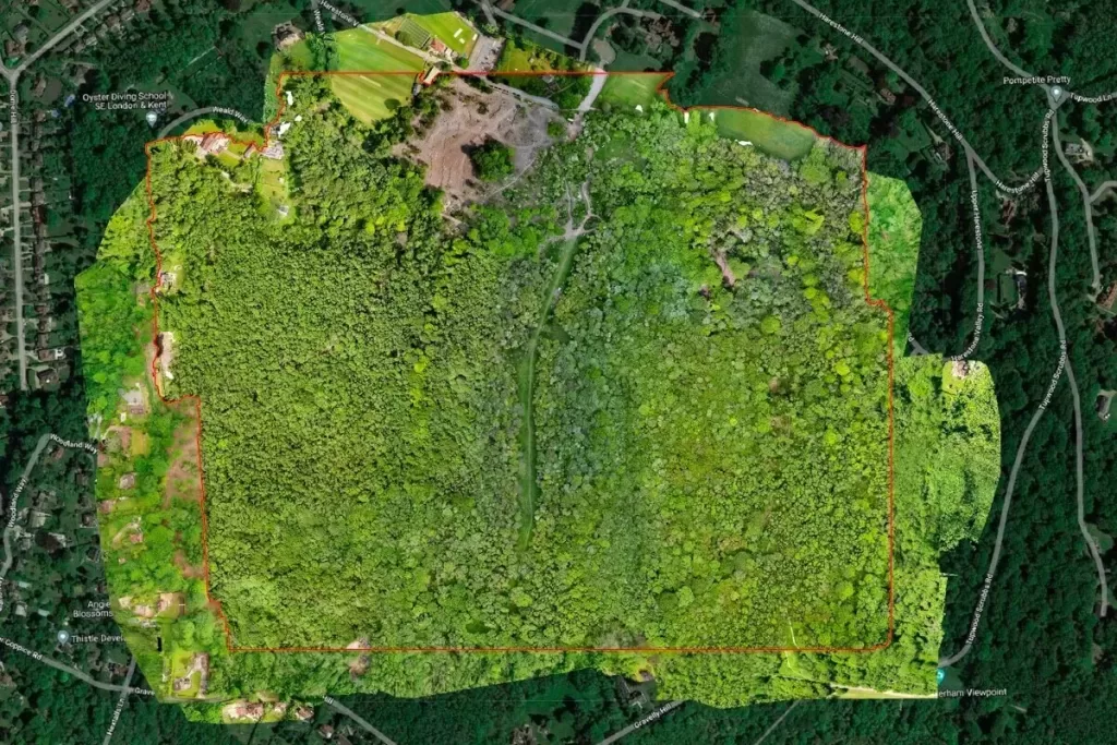
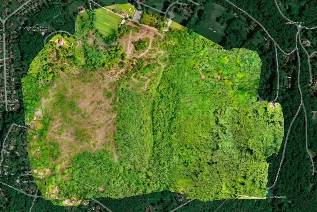
Drone Media Imaging provides high-accuracy photogrammetry and aerial mapping for commercial, engineering, construction, and land-management clients across the UK. Using structured flight planning and professional-grade UAV imaging systems, we deliver geo-referenced orthomosaics, elevation models, DSM/DTMs, and mapping datasets suitable for design, planning, auditing, and technical assessment.

Our photogrammetry service generates precise 2D mapping products and 3D elevation models using high-resolution aerial imagery captured under controlled mapping workflows. These datasets include orthomosaics, digital surface models, digital terrain models, elevation maps, and measurement-ready survey outputs, providing a reliable representation of your site for planning, monitoring, or engineering use.
Photogrammetry enables rapid assessment of land features, structures, progress changes, volumes, and terrain conditions without the need for manual surveying or site disruption. This makes it ideal for construction progress monitoring, land-planning, site auditing, agricultural oversight, and environmental management.
Whether mapping large commercial sites, industrial estates, infrastructure assets, or agricultural land, our deliverables integrate seamlessly into GIS, CAD, and BIM workflows, supporting informed, accurate and data-driven decision-making.
Unlock accurate, high-resolution aerial mapping with professional drone photogrammetry. Our 2D orthomosaics and 3D elevation models support construction, engineering, land management, and environmental assessment, delivering reliable geospatial data for informed planning and smarter operational decisions.

What is Photogrammetry & How Does it Work?
State-of the-Art UAV equipment dedicated to commercial scale mapping
Our aerial mapping projects follow tightly controlled flight plans designed to maintain consistent overlap, altitude, ground sample distance (GSD) and flight geometry. This structured approach ensures each pass captures uniform, distortion-minimised imagery that stitches cleanly into accurate mapping outputs. Where higher positional accuracy is required, we incorporate ground-control points (GCPs) or apply optimised camera-alignment workflows to enhance both horizontal and vertical precision.
All captured imagery is processed using professional photogrammetry software to produce high-quality orthomosaics and 3D elevation datasets. Each model undergoes rigorous quality checks, including alignment validation, seam and edge inspection, distortion checks and correlation against ground references. This ensures that every mapping output meets the technical expectations of engineers, surveyors, planners and design teams who depend on reliable, defensible data.
Our deliverables support a wide spectrum of commercial applications, including volumetric analysis, cut-and-fill calculations, area and distance measurement, design verification, drainage pattern assessment, access-route planning and long-term asset documentation. The result is a clear and comprehensive geospatial view of site conditions that enhances planning accuracy, reduces risk, and supports confident decision-making.

How We Deliver Photogrammetry – Technical Methodology
Our mapping missions follow structured flight plans designed to maintain optimal overlap, altitude, GSD, and flight geometry. This ensures consistency across all capture passes and creates predictable, stable datasets with minimal distortion. Where required, ground-control points (GCPs) or optimised alignment workflows are applied to enhance horizontal and vertical accuracy.
Captured imagery is processed using advanced photogrammetry software to create accurate orthomosaics and 3D datasets. These outputs undergo quality checks for alignment, distortion, seam consistency, and ground-truth correlation, ensuring that every dataset meets the accuracy expectations required by engineers, designers, surveyors, and planning teams.
Our typical mapping deliverables support volumetric analysis (e.g., stockpiles), area/length measurements, design verification, drainage assessment, access planning, and long-term documentation, providing a comprehensive geospatial view of site conditions.
Who is Our Photogrammetry and Mapping Services For?
Our photogrammetry and aerial mapping services are designed for organisations that require accurate, repeatable and up-to-date geospatial information to support planning, development, engineering and site-management decisions. By delivering high-resolution orthomosaics, elevation models and GIS-ready datasets, we provide the clarity and precision needed for technical teams to analyse site conditions, monitor progress, assess risk and manage assets confidently. This service is ideally suited to sectors where accurate mapping underpins operational efficiency and long-term project success.

Why Choose Drone Media Imaging
Drone Media Imaging delivers a level of technical accuracy and professional competency that goes far beyond standard drone mapping services. Our workflows are built around structured flight planning, calibrated imaging systems, and repeatable capture geometry to ensure every dataset meets the reliability expected by commercial and engineering teams. Combining disciplined field methodology with professional photogrammetry processing, we produce orthomosaics and elevation models that offer clarity, consistency and data integrity — essential when mapping forms part of planning, design, verification or auditing work.
As a CAA-certified operator with extensive experience in thermography, solar diagnostics and inspection workflows, we understand the environmental, operational and safety controls needed to acquire high-quality geospatial data. Our approach avoids shortcuts — we assess site conditions, verify mapping parameters, and apply accuracy-enhancing methods such as ground control points or optimised alignment where required. This results in deliverables that engineers, planners, surveyors and project managers can depend on, without the uncertainty often seen in lower-grade mapping.
We also offer a unique advantage through our ability to integrate mapping with thermal, solar and inspection datasets, delivering multi-layered intelligence that supports deeper analysis and more informed decision-making. From construction progress to asset management and land-use planning, our mapping outputs are delivered in practical, GIS/CAD-ready formats that slot directly into your existing workflows. With a focus on precision, professionalism and commercial relevance, Drone Media Imaging provides the specialist expertise you need to make confident, data-driven decisions across your projects.
Who Our Photogrammetry & Mapping Services Are Designed For?
Our photogrammetry and aerial mapping services are built for organisations that rely on accurate, up-to-date geospatial data to support planning, engineering, construction and asset-management decisions. Whether you need to analyse site conditions, verify design stages, monitor project progress or document changes over time, our mapping outputs provide the clarity and precision required for dependable decision-making. This service is ideally suited to technical teams who need reliable, repeatable, measurement-ready datasets that integrate seamlessly with GIS, CAD and BIM workflows.
FAQs – Photogrammetry Surveys & Orthomosaic Mapping
Industries such as construction, agriculture, mining, forestry, civil engineering, and environmental monitoring rely on photogrammetry for accurate land assessments and planning.
We provide precision agriculture surveys, analysing soil quality, crop health, and plant density to improve yield optimisation and land management.
Yes, we capture shoreline changes over time, helping environmental agencies track coastal erosion, flooding risks, and land movement.
Our drone photogrammetry achieves centimetre-level accuracy, providing highly detailed 2D and 3D models for precise measurements and analysis.
We generate digital surface models (DSM), terrain models (DTM), volume calculations, contour maps, and orthomosaic imagery for detailed site assessments.
Yes, drone-based photogrammetry can be combined with multi-spectral and thermal imaging to assess water clarity, surface temperature variations, and hydrological patterns. This is particularly useful for environmental monitoring, flood risk assessments, and aquatic ecosystem health studies.
Yes, drone photogrammetry is widely used in civil engineering projects, road planning, and bridge surveys. By capturing high-resolution topographic data, engineers can assess terrain, measure gradients, and identify potential obstacles, ensuring accurate design and construction planning.
Drone photogrammetry provides accurate volumetric calculations for stockpile management, excavation tracking, and site planning. Mining companies use this data to monitor extraction rates, optimise material transportation, and improve safety compliance without the need for manual surveying in hazardous areas.
While it doesn’t replace all manual surveying techniques, it offers greater efficiency, speed, and accuracy for large-scale mapping and terrain modelling.
Survey duration depends on site size, but most aerial mapping projects are completed within a day, with data processing typically delivered in 24-48 hours.