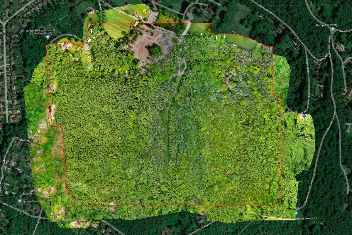
Drone Media Imaging completed a comprehensive photogrammetry survey of a 100-acre woodland belonging to Client, following the discovery of widespread tree disease that required a significant felling operation. The objective was to produce high-accuracy before-and-after mapping outputs to support safety planning, environmental assessment and long-term land-use management. Using structured flight planning and controlled imaging conditions, we captured thousands of high-resolution images to generate a precise orthomosaic, digital surface model and canopy analysis dataset.
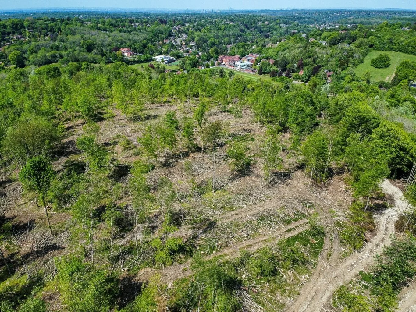
The pre-clearance map revealed clear patterns of canopy decline and areas requiring urgent attention, allowing the Client to plan extraction routes and contractor access more efficiently. Once the diseased trees had been safely removed, Drone Media Imaging repeated the mapping process to create a post-clearance orthomosaic that documented every area of felling activity and provided an accurate representation of the new terrain profile.
These mapping outputs now serve as an invaluable record for environmental consultants, school estate planners and arboricultural teams, supporting replanting strategy, habitat recovery and future on-site development decisions. This project demonstrates how professional photogrammetry enables organisations to manage large woodland areas with confidence, clarity and long-term sustainability in mind.
Project Overview
Subject
forest photogrammetry mapping, canopy loss assessment, large-area drone survey, forestry disease monitoring, before and after mapping
Skills Used
Aerial Photogrammetry, Orthomosaic Production, GIS-Ready Mapping, Structured Flight Planning, Environmental Survey Techniques
Portfolio Tags
photogrammetry, mapping, forestry survey, orthomosaic, environmental assessment, aerial mapping, land management, before and after survey
Large-Scale Woodland Mapping for Disease Identification and Planned Tree Removal
High-accuracy aerial mapping providing a complete visual record of forest decline, disease impact and post-clearance recovery.

Drone Mapping for Forest Disease Assessment
Large-Scale Woodland Mapping for Disease Identification and Planned Tree Removal
Drone Media Imaging was commissioned by Client, a large educational organisation responsible for a 100-acre school woodland, to complete a full photogrammetry mapping survey before and after major tree-removal works. The forest had been affected by a rapidly spreading tree disease, resulting in canopy loss, weakened structure and significant health and safety concerns. To plan safe access routes, quantify affected areas, and record conditions prior to clearance, the Client required a precise, geo-referenced mapping dataset.
Using professional drone platforms and a structured flight plan, we captured complete high-resolution imagery of the forest canopy. The objective was to create two definitive datasets:
A pre-clearance baseline map showing disease extent, canopy density and access constraints.
A post-clearance orthomosaic to document the removal works, updated terrain visibility and long-term land-use planning opportunities.
The project provided the Client with a before-and-after visual audit containing accurate spatial measurements and a clear record of environmental change.
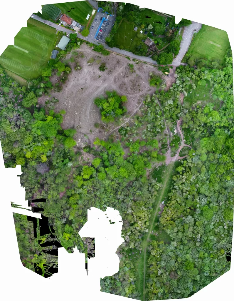
Aerial Survey of Woodland Decline
Technical Workflow: Photogrammetry Standards, Flight Planning and Mapping Output
The forest’s dense canopy and varying elevations required a carefully structured flight plan to maintain consistent Ground Sample Distance (GSD), overlap and image geometry. A combination of nadir and slight-angled imaging was used to ensure edge clarity, enabling accurate reconstruction of the full woodland footprint. All flights were conducted under stable light conditions to minimise shadow distortion and maintain consistent colour data.
Captured imagery was processed using advanced photogrammetry software to generate a high-accuracy orthomosaic, digital surface model (DSM) and canopy structure output. These products allowed the Client to assess canopy density, disease spread and overall structural variation within the woodland prior to the clearing operation.
Once the felling works were completed, we repeated the entire process to create an updated orthomosaic showing exposed ground levels, root-plate positions, equipment access paths and remaining vegetation.
The combined before-and-after mapping dataset is now used by the Client for health and safety auditing, new land-use planning, future replanting strategy and ongoing environmental monitoring.

Photogrammetry for Environmental Management
Findings, Results and Long-Term Environmental Value
The pre-clearance mapping clearly highlighted significant areas of canopy thinning, early structural decline and pockets of complete die-off. These insights helped the Client prioritise urgent areas, plan safe extraction routes and maintain control over the larger tree-removal schedule. The post-clearance dataset provided an accurate visual record of all works completed, with detailed evidence of site conditions necessary for planning approval, future regeneration and risk assessments.
Together, the two orthomosaics provided a powerful before-and-after comparison for environmental consultants and land managers. The Client now has a complete geospatial record of the forest’s condition, giving them a reliable baseline for future re-planting, habitat restoration and regeneration strategy. This project demonstrates the value of precise photogrammetry when managing large woodland environments affected by disease, decay or commercial forestry operations.

