Professional Property Photography – on the Ground and in the Air
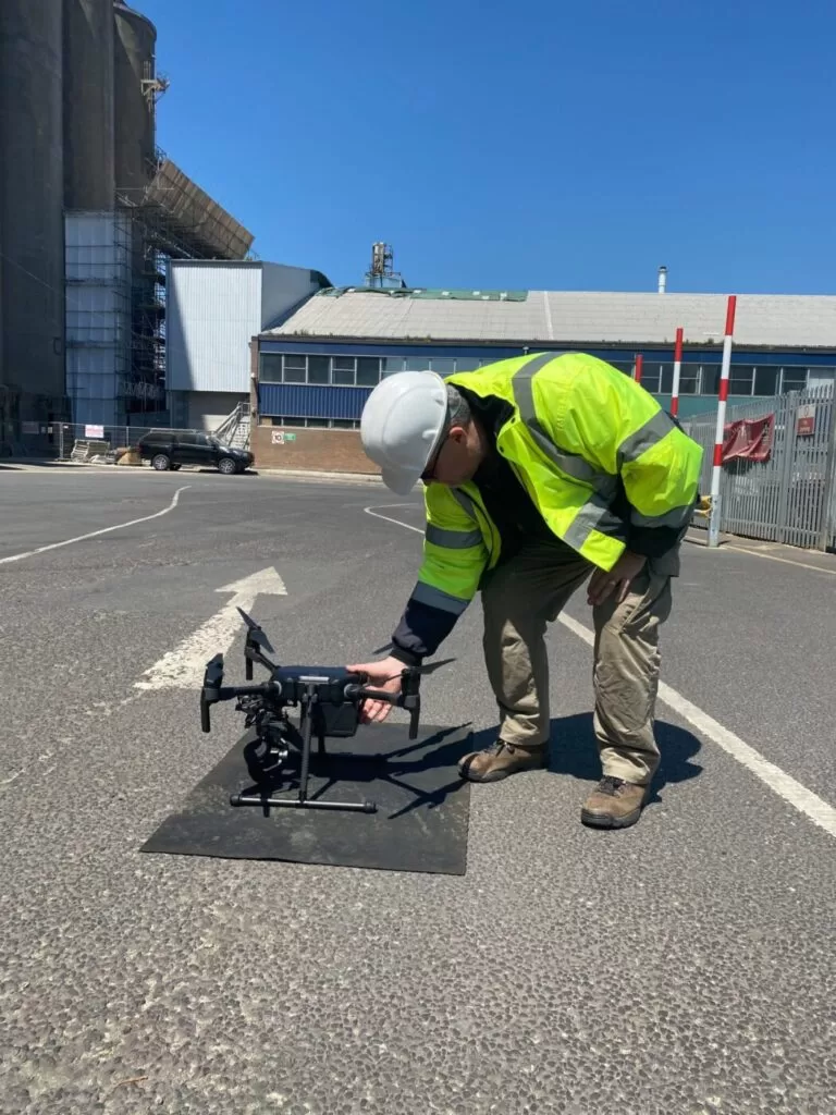
This morning’s trip to the ‘office’ was short which was lovely. Working locally in Sussex, we needed to complete the aerial component of the property photography (we were also carrying out ground level photography) before the store in question was open for business. So it was a bright and early start for us – that’s not unusual actually. Quite a lot of drone photography even takes place at night when you’re talking about thermal imaging – so we’re used to working around the clock.
So we arrived at the location, set up our secure area, completed our preflight checklists and prepared for the flight. The flight preparations are quite lengthy to ensure that we are fully checked, double checked and prepared, have assessed any risk and able to fly safely and securely. The flight time itself can seem quite short in comparison. Everything went perfectly and once all the necessary images were captured, we landed packed away and commenced with our ground level photography. A beautiful little assignment that had us home in time for breakfast with professional property photography images for our clients.
Drone Services Enquiry
Thermography | Inspections | Solar | Photogrammetry
Discover how drone technology can enhance your operations with a free quotation from our experts. Get a Free Quote or Make an Enquiry Today!
related posts
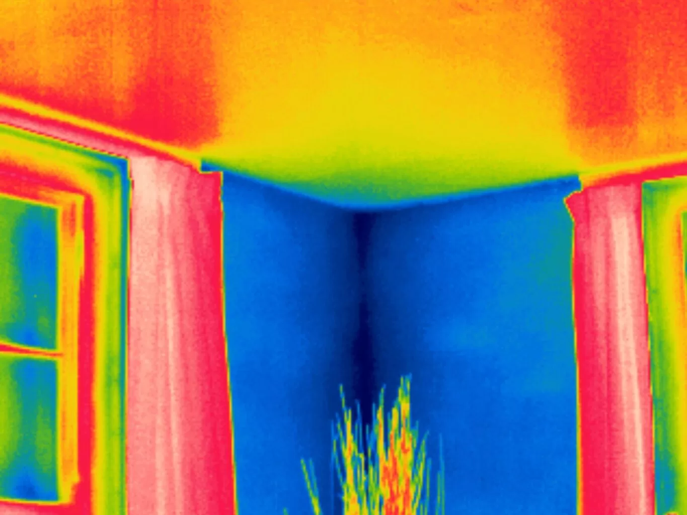
Discover the effects of thermal convection on building room corners with insights from thermal imaging. Uncover hidden insights.
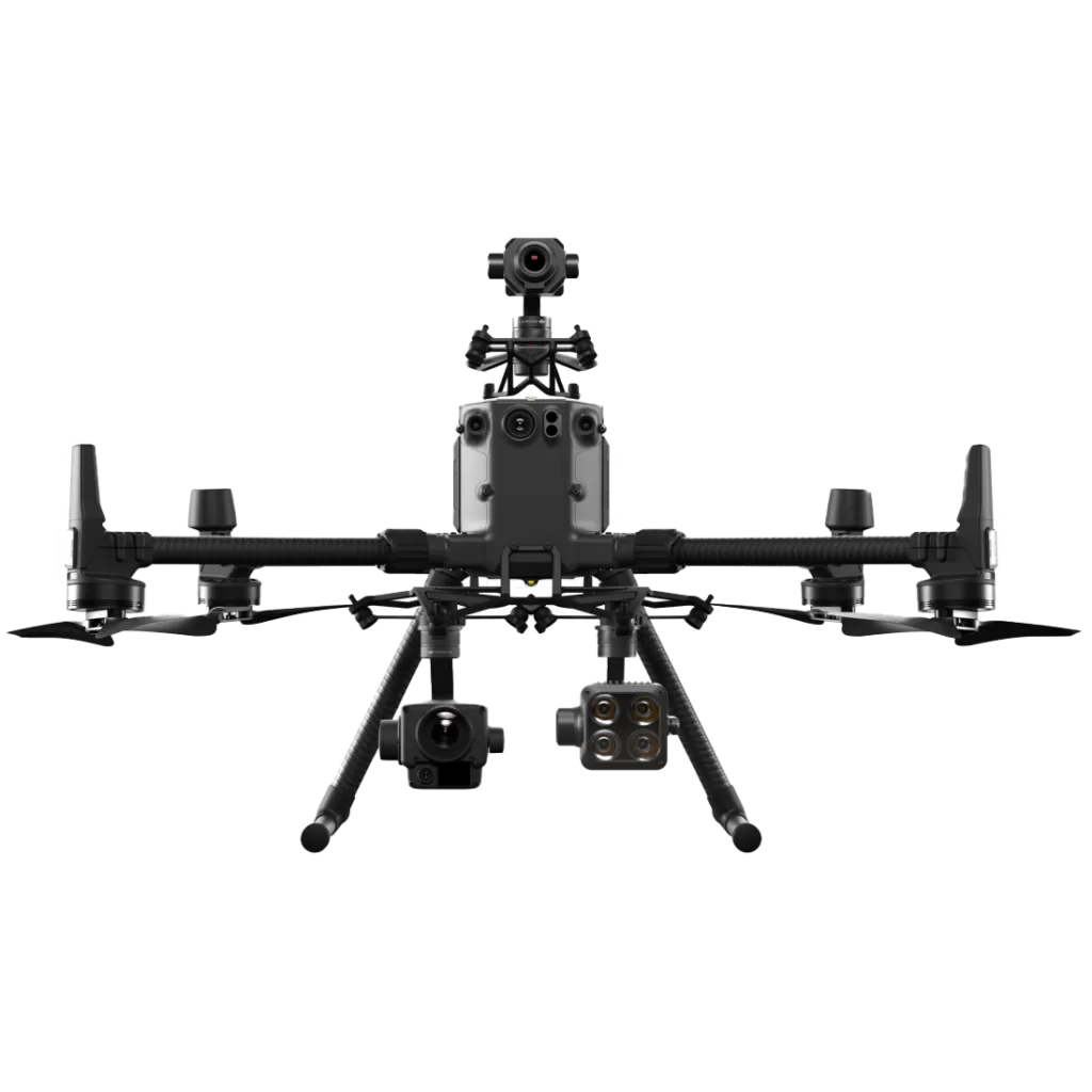
The DJI M300RTK with DJI P1 is a powerful combination that has revolutionized the way professionals conduct aerial surveys and mapping. With advanced features such as precision positioning, enhanced safety, and extended range, the M300RTK sets a new standard in performance and reliability. Paired with the high-resolution imaging capabilities of the DJI P1, professionals can capture detailed and accurate data for a wide range of applications. From construction and agriculture to land surveying and mapping, this groundbreaking combination is transforming industries and unlocking new possibilities.