Using Aerial Thermal Cameras in Property Inspections
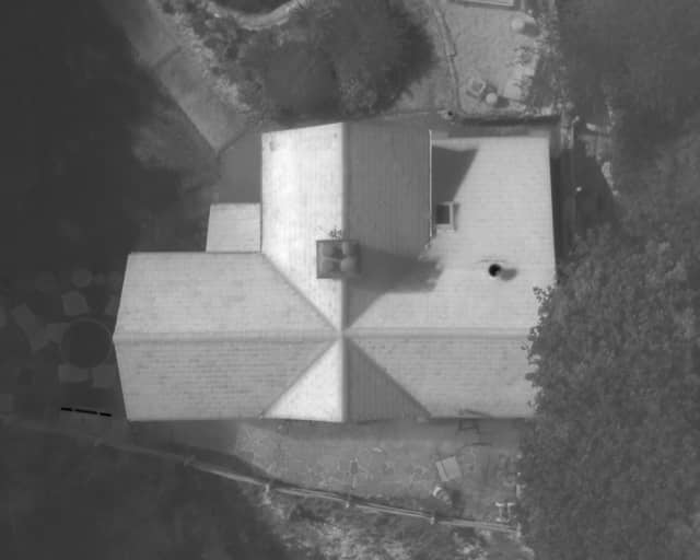
Water Ingress Detection
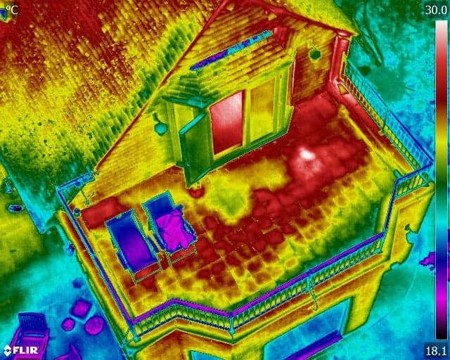
This is another type of inspection that is conducted in the summer months when the sun will heat the area such as a flat roof. Water holds its thermal energy much longer than other materials used in roofing and therefore this type of inspection is completed in the summer months when the solar energy from the sun is at its most intense.
The water inside the structure (if there are water ingress signs and membrane failure) will retain heat for much longer than the surrounding roof structure itself so when inspected as the exterior temperature has cooled at the end of the day at dusk, water ingress will show as an area of increased temperature.
This can be detected and corrected before interior damage occurs.
Photovoltaic Surveys
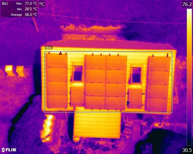
Drones can be used to inspect the functioning of solar panels during the summer months – either those that form part of a commercial installation or solar farm or those on private property. Two issues that are commonly found on solar PV cells are defective cells and defective converter boxes. Defective cells may be found individually or as a group whereas a defective converter will appear as a single ‘hot spot’ that does not fit the cell layout pattern.
Malfunctioning solar cells can create further damage such as melted solder connections, cracking of the protective glass cover, and degradation of the adjacent cells. Therefore, early identification can help to minimise repair bills as well as to keep the solar panels functioning at maximum capacity.
Problems are immediately apparent when looking at the thermal images gathered from a drone flight so target repair teams can be deployed to address the issues.
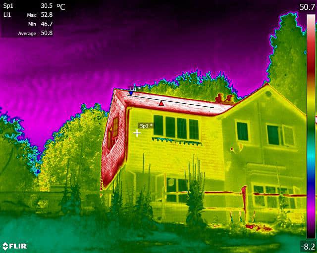
Heat Loss & Insulation Inspection
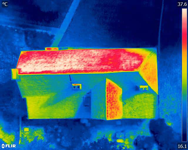
Insulation continuity may have been compromised during the design or construction stage of a building’s life cycle. Alternatively, damage may have been caused later in its existence, particularly when older materials have been used. Insulation surveys are usually conducted in the cooler months of autumn and winter where it is easier to obtain the difference between internal and external temperatures that are required to make clear areas of heat loss and thermal bridging.
In all cases, a simple non-invasive drone flight using a thermal imaging camera under the right conditions can be all that is needed to identify hidden problem areas. Early identification can mean cheaper repair bills, less downtime and inconvenience, and more peace of mind.
When a Drone is not the right tool for the job
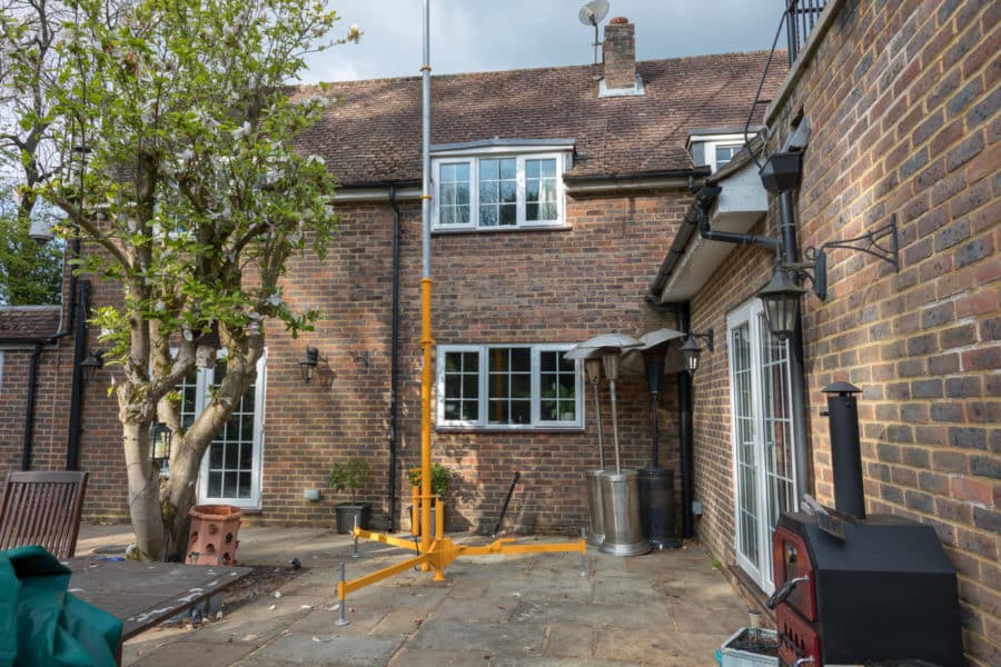
Drones are not always permitted in certain situations. Sometimes the appropriate permissions from neighbours are not forthcoming, or the property is in restricted airspace, perhaps by an airport. Even the weather may not play ball. In such cases, Drone Media Imaging will use a professional industry grade telescopic mast which will utilise the same camera payloads as our fleet of drones will carry, to a height of 15m (50ft) which is around 3 stories (pitched roof) or 4 stories (flat roof).
The use of a photographic mast is not restricted by the same legislation that a Drone is, such as distances of 30m to people, property, vessels or vehicles that are not under the control of the Drone Pilot when taking-off and 50m when executing a flight plan.

Where else can Thermal Imaging cameras be used?
State of the art thermal cameras offer a non-contact non-destructive temperature measurement across areas that are hard to access or view from a ground-based perspective.
As with all drone inspections, the health and safety risks associated with working at height are minimised, as are the risks of causing damage to the structure through the inspection process itself. With UAV thermal imaging cameras, real-time temperatures are recorded both quickly and accurately with the resulting images being able to provide temperature measurement at any given spot. Image analysis and reporting can identify potential problem areas that would have remained hidden to the naked eye until serious damage had occurred.
