Harnessing the Power of Drones in Construction
One key area where drones can offer real benefit is working within the construction industry. While some firms are already leveraging the considerable powers of the UAV at all stages of development, this is potential that is still largely untapped in the UK.
Drones can become involved at the earliest stages of development at the land survey stage. A drone pilot can complete a series of short flights to create a topographical map or even a 3D model that can be provided digitally in a format compatible with the design team’s modelling software. Obstacles can be identified, opportunities can be maximised from a realistic digital landscape. Better data in the early stages of the construction cycle helps a more accurate roadmap to be prepared and the immediacy of the data means that you can keep a tighter rein on project costs.
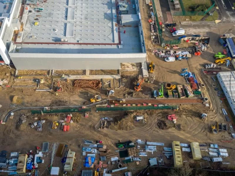
Drone deployment at regular intervals during the construction process can provide both a visual and accurate record of infrastructure placement. It can also offer opportunity for monitoring the various phases of construction and adherence to the standards you have set out. Videos and photos taken during the construction phase can also be created into an effective time lapse of the project which is an excellent marketing tool for your potential clients.
In addition to this, regular monitoring of health and safety standards such as proper shoring of excavations, use of barriers and wearing of PPE can help to reduce your site insurance costs.
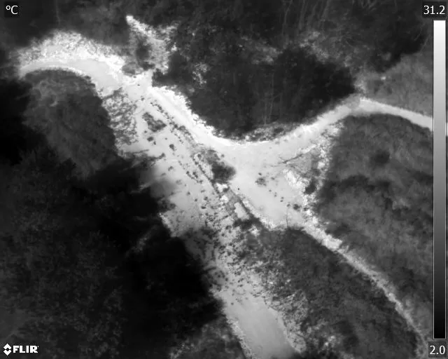
The addition of thermal imaging can add a whole new dimension to monitoring and inspection – allowing the project manager to verify the integrity of the insulation and spot water ingress before damage is caused. Solar panels, if these are fitted, can also be assessed to ensure that they are safe and in perfect working order.
Regular inspection flights can help pinpoint areas of concern before they can become expensive problems. Investors and interested parties can also make use of the footage and photos to keep in touch with progression from wherever they are based without losing time to site visits.
After the project has been completed, a drone flight can not only provide amazing marketing material from a bird’s eye view. It can assist with communicating the quality and completion of the project to assist in invoicing. Maintenance inspections moving forward can keep repair budgets to a minimum by allowing targeted deployment of repair teams to keep the building in an as new condition.


Drone deployment at regular intervals during the construction process can provide both a visual and accurate record of infrastructure placement. It can also offer opportunity for monitoring the various phases of construction and adherence to the standards you have set out. Videos and photos taken during the construction phase can also be created into an effective time lapse of the project which is an excellent marketing tool for your potential clients.
In addition to this, regular monitoring of health and safety standards such as proper shoring of excavations, use of barriers and wearing of PPE can help to reduce your site insurance costs.
The addition of thermal imaging can add a whole new dimension to monitoring and inspection – allowing the project manager to verify the integrity of the insulation and spot water ingress before damage is caused. Solar panels, if these are fitted, can also be assessed to ensure that they are safe and in perfect working order.
Regular inspection flights can help pinpoint areas of concern before they can become expensive problems. Investors and interested parties can also make use of the footage and photos to keep in touch with progression from wherever they are based without losing time to site visits.
After the project has been completed, a drone flight can not only provide amazing marketing material from a bird’s eye view. It can assist with communicating the quality and completion of the project to assist in invoicing. Maintenance inspections moving forward can keep repair budgets to a minimum by allowing targeted deployment of repair teams to keep the building in an as new condition.
Drone Services Enquiry
Thermography | Inspections | Solar | Photogrammetry
Discover how drone technology can enhance your operations with a free quotation from our experts. Get a Free Quote or Make an Enquiry Today!
related posts
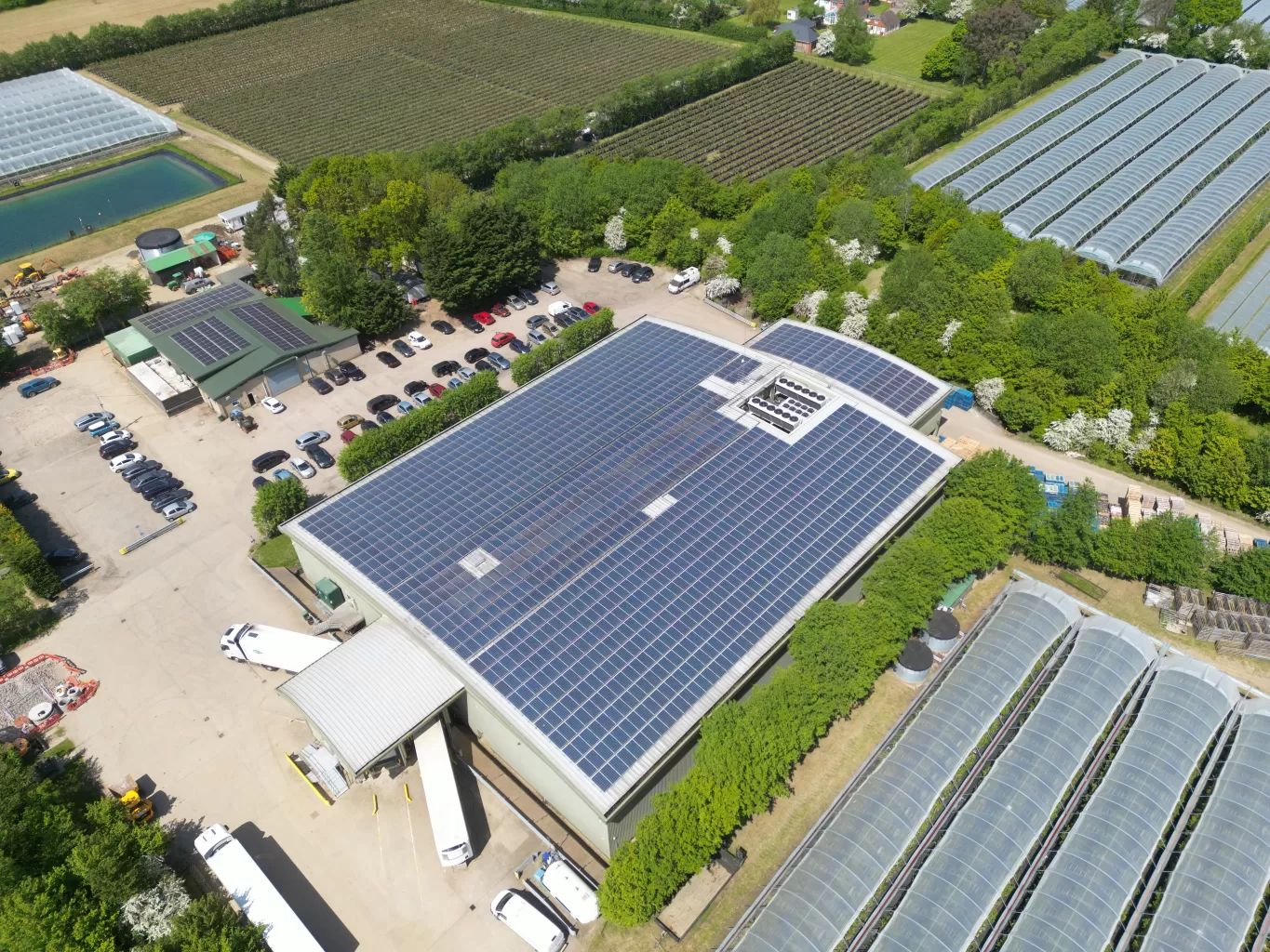
Winterwood Farms in Maidstone can rely on IEC's thermal expert solar panel inspection services to ensure optimal performance during the winter months. Our team of professionals will thoroughly assess the panels, identifying any issues that may affect efficiency. With our comprehensive inspection, Winterwood Farms can maximise energy production and minimise potential downtime.